One of B.C.'s best steep creeks. Classic whitewater; continuous, clean, few portages and a handful of bigger rapids. Not much is "must run", but be prepared to run a good amount of class 5 if you put on as either too much portaging or hiking out would be a lot of work and probably end in the dark. If the upper is too high the middle is a good back up option.
Class
V
Scouting / Portaging
Scout whenever you think you should. Everything has been run except one short canyon that is portaged on the right.
Time
4-8 hours depending on group size and familiarity.
When to Go
Late June to mid to late July. Usually run as things are coming down from peak runoff.
Gauge
0.36cms↓ (Feb 28 22:00)
Skip to the end to read a perfect and concise write up of all 3 Pingston sections by the true master of the Pingston, the late, great Adrian Kiernan.
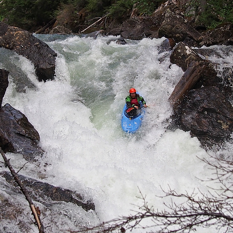
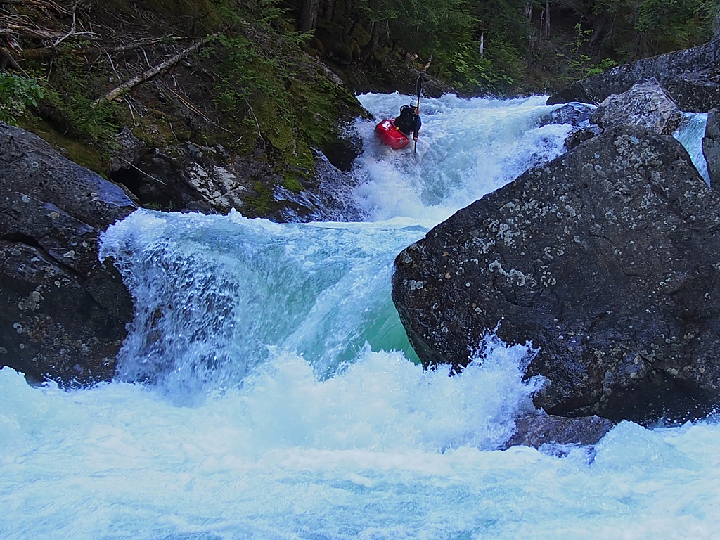
The run starts out with really nice class 4/4+ to warm up on. Keep a sharp eye out for wood, especially on this section (summer 2019 had 3-4 pieces that required portaging). The run will start to ramp up and contains a couple of the bigger rapids (a slide with a narrow exit and highway to hell) before the middle 3rd (ish) which is the steepest section of run. The middle third is the kilometer before and the kilometer after the portage and is the most continuous part of the run, containing an amazing array of ledges with big boofs over meaty holes. Although much of this run has been aptly described as class 5 boogie, scouting is possible and highly recommended if showing yourself down for the first time. The portage canyon comes up very quickly with easier eddies on river left, but the portage itself on river right. The character of this run seems to be more forgiving than it looks, and following the water generally results in good lines.
Flow: Best between 5.75 and 6 on the gauge at the dam. Find it on the river left side of the reservoir. This roughly correlates to 8-15cms on the Cranberry Creek gauge.
This page now shows flow information directly from Pingston dam at the top, but we are still working to understand the correlation between that gauge and runnability.
Can be run as low as 5.7, but becomes bony with more pin and sieve potential. 6 on the dam is, in the words of Garrett Quinn, "The Super Bowl. The Stanley Cup finals. As good as it gets."
Highway to Hell (photo by Erik Shore)
Stairway to Heaven (photo by Garrett Quinn)
Put in: Alternate routes to the put in exist. The shortest is to use the Mt. Odin road. This extremely overgrown road was brushed in the summer of 2019 making it usable, however there are few spur roads and staying on the right road may require doing some research (using google earth or similar) before you go. The longer but less confusing route to the put in involves taking the turn close to where the penstock, or pipe of water diverted from the Pingston, crosses the road. If you are coming from the main road it is a right turn just before the gated private access road to the Trans Alta powerhouse (if you are coming from the takeout it is a left turn). I would strongly recommend a B.C. Backroads Mapbook or using Google maps in satellite mode, and downloading the directions/maps before you go in order to avoid frustration and faff. It is easy to see the put in, take out and the roads that lead there in satellite mode.
Travelling from Revelstoke. Head towards Arrow Lakes ferry on Highway 23, Turn right onto Shelter Bay FSR (go for~ 16.5km), Turn right onto Limekiln rd and follow it (~ 6.5km) until you cross the bridge over the Pingston which serves as the upper takeout or middle put in. Google Maps Directions
Adrian's write up: My Pingston schooling is finally complete! Paddled the middle and lower section of Pingston creek today finishing in Arrow lake.
MIDDLE - There were a couple of pieces of wood in the middle, they are in the steeper "class 5"(not really) section right towards the end at the bridge. when you see the floating boys hanging in the trees on river right (cant miss them) your getting close so keep a look out. (this section would go way higher (class 4+/5) and lower (3/4)
LOWER - good to go at these flows but a little burly for the 60ft combo. needs to be a bit lower but not much. portage right from the pool on the lip and include the major rapid downstream. UGLY
I guess flows would have been around .70 -.75 at the upper dam gauge.
A todo at these flows is definitely possible. It took us 2 hours from middle put in to lake our first time. we barely scouted anything till the "class 5" bit before the bridge. but we did virtually every corner from there to the lake.
UPPER - Good to go from .7(boney as hell but fun) to (best guess) 1m (very scary) Best flows between .75 and .9 to show yourself down. Time: anywhere between 6 hours to 45 mins if you know the lines!
Portage right!!!
For more information check out Mikkel's series of 5 blog posts