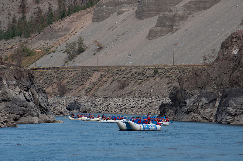
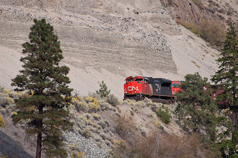
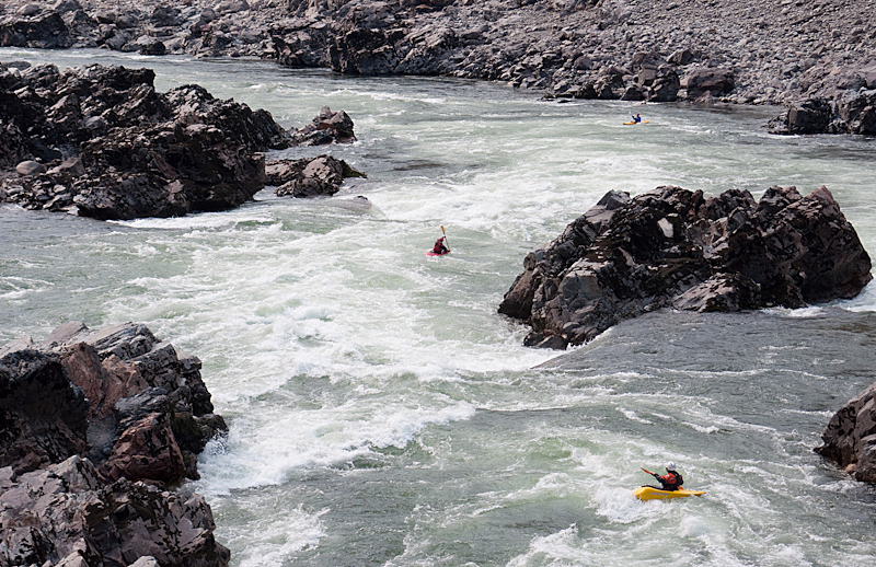
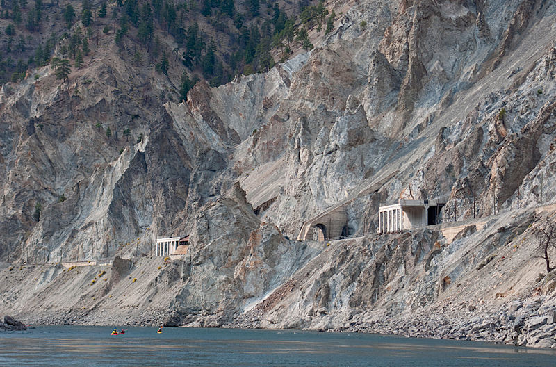
The Thompson is a huge river that drains a large portion of the southern interior of BC, flowing in to the Fraser at the town of Lytton. From a kayaking perspective it is a fun big volume grade III run that is most popular in the late summer and early fall (relatively low water), with several nice play features. The rapids are a great place to challenge intermediates with a good roll, and it's a relaxing trip for stronger boaters. The scenery is very impressive but not exactly natural. The river corridor is home to the main cross-country rail lines for both Canadian National and Canadian Pacific, as well as the Trans Canada Highway. Expect to see many trains!
Getting to the Thompson couldn't be easier. All roads around the river are paved highways. Lytton (the take out town) is about 3.5 hours from Vancouver. Access to the river is at a public boat launch just above a large rail bridge on the Fraser (river left) a few hundred meters below the confluence. The road to the boat lauch is next to the Visitor Information Center in town. The put in is about 15 km east on highway 1. Look for an obvious ravine and a boat lauch used for raft access. There is ample parking just west of the boat launch.
There is an accurate online gauge for the Thompson. While the river is runnable at any level, it is most popular for kayakers at relatively low water in the late summer and early fall. At this time of year the river is big volume grade III appropriate for intermediates with a strong roll. It can be run at any level earlier in the summer, just expect the boily nature of such a big river (2000+ cms at high water) to increase the difficulty and consequence accordingly. There are probably many play waves that come and go due to the huge fluctuations in flow over the course of a season.
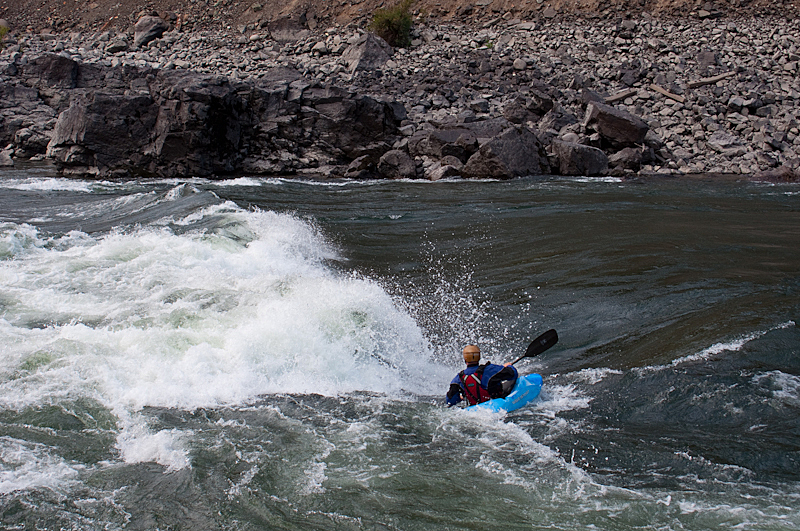
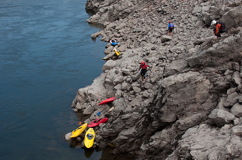
Things are relatively calm at the put in. Just a few hundred meters below the start is the Frog Wave. This is a decent play feature that is best around 450 cms. It is possible to park and play here. The biggest rapids are in the first few kilometers, including Witch's Cauldron, Cutting Board (go left at the island) and Jaws. Jaws is located where the highway starts to go far away from the river, and it's possible to put in here to miss the biggest rapids. Below Jaws the river mellows noticably, and there are some sections of flat water. Keep an eye out for some good on the fly surfing. You'll know you've reached the take out when one last grade III wavetrain appears just above the bridges in Lytton.
View Thompson in a larger map