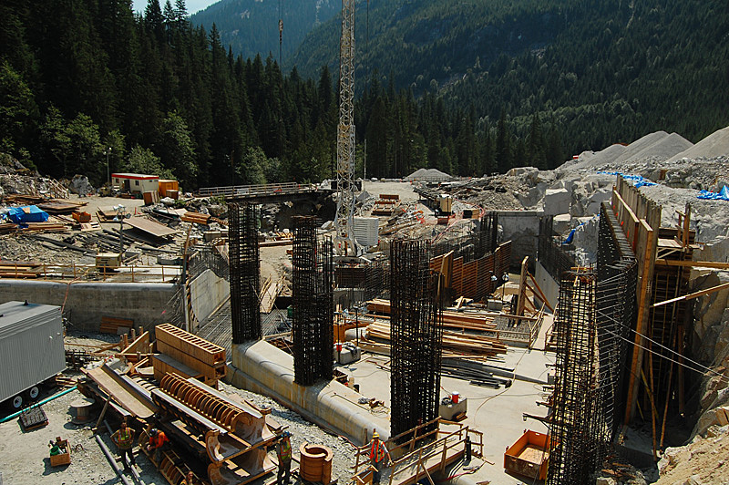
The Stave River, one of the truly wild rivers of the South Coast area, is a challenging multiday kayak trip not without some significant difficulties that will probably never see a lot of traffic. The construction of 2 hydro projects on the lower river below Garibaldi Park in 2009 and 2013 have dewatered almost 1/3 of the good whitewater, drastically reducing the whitewater value and detracting from the overall wilderness experience. Although there are a few release days per year provided by Innergex, they are unlikely to be used because there are no public roads accessing the area. Furthermore, the releases are in May, which is useless for running the multiday option as the upper river will still be snowed in.
Looking at a map of southwest BC the Stave River drainage stands out like a sore thumb. Obviously a large river system, it drains Coast Mountain snowmelt from Garibaldi Park directly south to the Fraser River - it's surrounded by the rivers that flow west into Howe Sound or the Squamish River, and on all other sides by the extensive Lillooet River/Harrison Lake drainage. This is rugged mountain country and there is little record of travel down the Stave River corridor - it's a tough three day trip with excellent whitewater, hard portaging and a lot of potential left to go in and run some serious stuff that hasn't seen a paddle blade. If you're interested, keep reading to find out what you have to do.
Planning a trip in to a river that is impossible to scout beforehand and that has little to no information available about prior descents is always a gamble. This report is based on a trip that happened on a low snow year, and wanting to be careful of high flows but also not wanting to get stuck on a low water bash-fest we decided that early August would be a good time to go figure out this run. Space scouting using Google Earth showed a lot of potential for good whitewater, especially in the upper reaches of the river. We had flows (based on the gauge at Stave Lake) between 20 and 30 cms. If you are to repeat this trip with the intention of running the big canyons I would go in there with a maximum of 15 cms - maybe even less. The river can be done in a three day push, but taking four days might be a little more reasonable, especially if you want to consider some of the must-scout-before-running canyons.
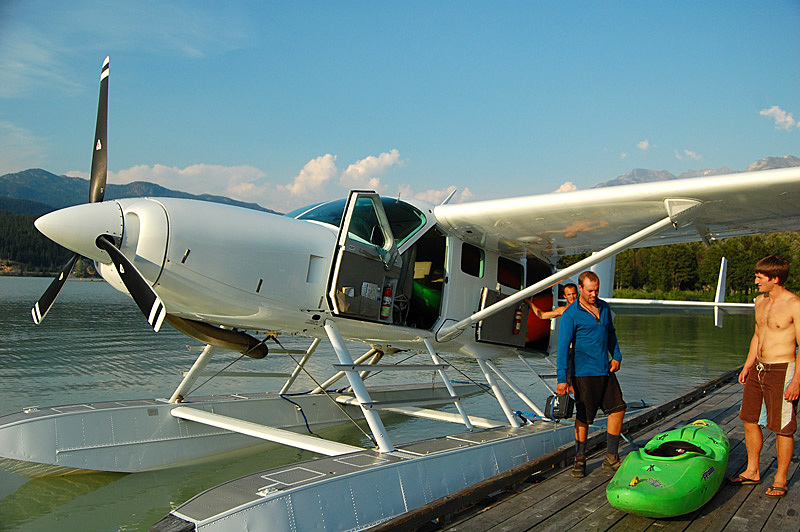
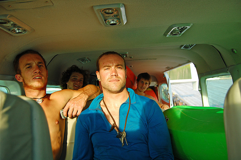
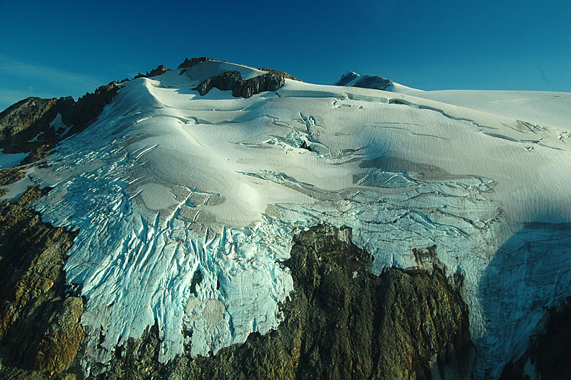
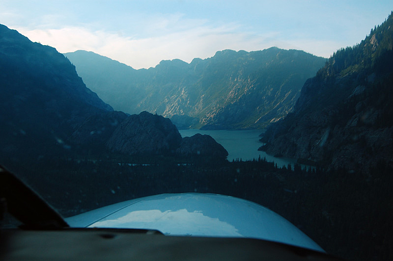
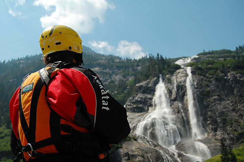
Access to the Stave put in is by float plane only - the country here is wild and rough with no road access in the upper valley - the fact that no roads have penetrated the upper watershed is most likely because the river lies in Garibaldi Park. The instant you cross the park boundary there is a road along the river and the valley is heavily clear cut. We flew out of Whistler with Whistler Air to the small lake below the Stave Glacier. The flight is nothing short of spectacular. Whether or not Whistler Air (now Harbor Air, new ownership) will still fly here is unknown.
There are a few more options when it comes to taking off the river. We opted for the float plane pick up from Stave Lake, flying back to Whistler. This was in the interest of time and convenience. Although there is a road paralleling the lower river, you can only get to this road by taking a boat across Stave Lake. The south end of Stave Lake is near the town of Mission, so if you're motivated to paddle out or are industrious enough to arrange a boat to pick you up at the north end of the lake when you finish the river it will save some money on the flight, but it won't save any time. Note that if you do opt to fly out you'll have to paddle a few kilometres down the lake - there are a lot of dead trees poking out of the water (the lake was dammed to raise the level) in the north end making landing a plane impossible.
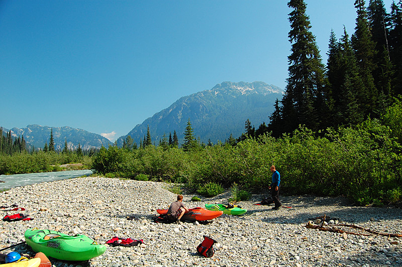
The first few kilometers of the river (down to the trifluence of the Stave with a big river left and a small river right tributary) is splashy, easy whitewater. If you choose the three day option it might be a good idea to fly in around supper time and paddle through this stuff, camping just below the side creeks and above the first canyon. The first canyon is obvious and it has a gravel bar just upstream that's a nice camp site - it'll give you a chance to scout out the first rapids as well. Incidentally, the first two creeks you just passed are the only major tributaries that enter the river, and from your first paddle strokes you'll probably have 80 % of the volume that you'll have at the lake, 45 km downstream.
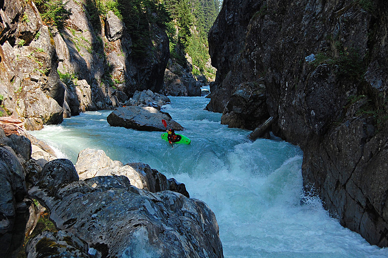
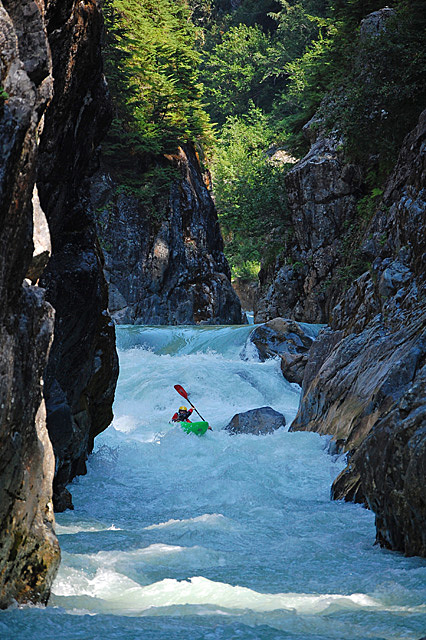
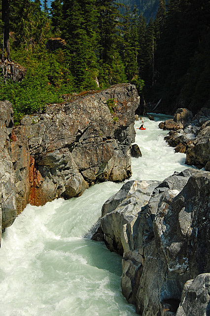
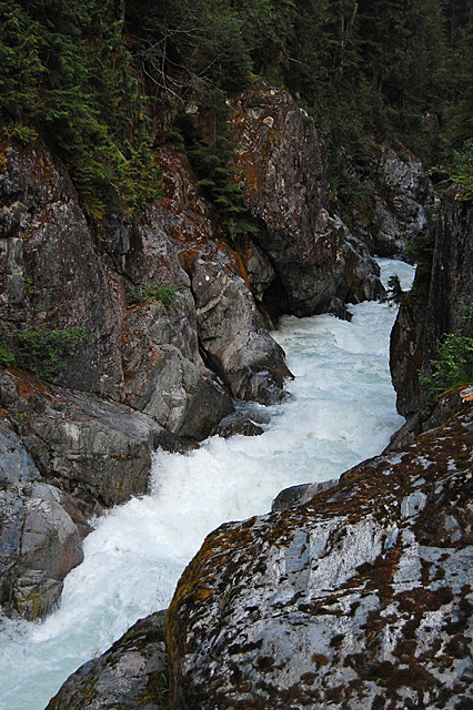
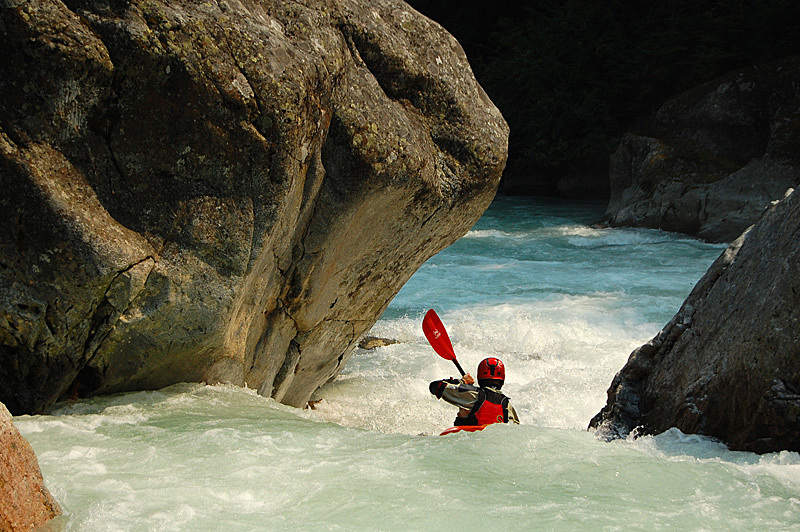
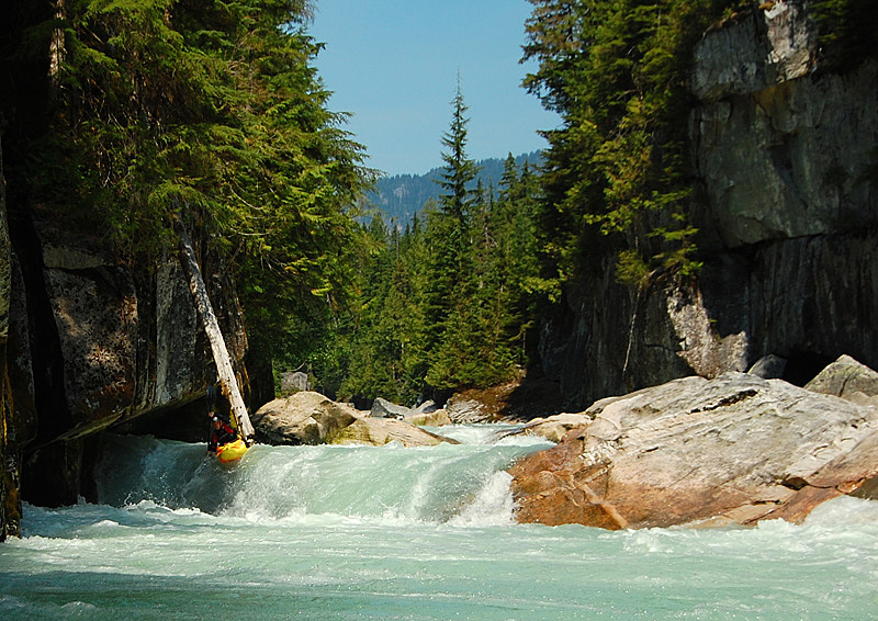
Day one was the best day of our trip. Immediately from camp we dropped into an ultra classic canyon that was all runnable. It's scoutable with some climbing up the walls, but portaging wouldn't be easy. Everyone was fired up and spirits were high after we paddled out from this one, hoping the rest of the river would be the same. Next up was a huge one-off rapid that saw one descent by our crew, followed by many miles of open valley with good scenery and awesome class IV-V boating, again all runnable. A good ending for day one is at the start of the second canyon - be careful here, you don't want to drop in! A quick scout will let you know you're reached it - it starts with a gnarly waterfall leading into a vertical walled canyon.
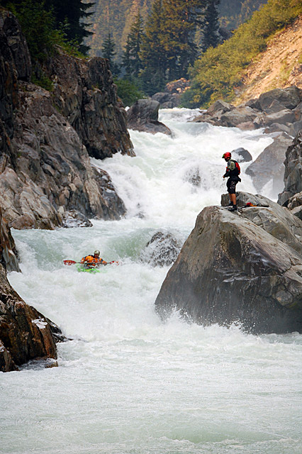
The first half of our second day was all portaging. The initial portion of the second canyon at our levels was class V+ to VI. If this section is runnable at low flows it will be extremely high consequence. The canyon briefly opens before plunging over a series of huge waterfalls. The whole river thunders over two smaller falls and then over a 70 footer that pounds onto rock. This directly goes over another waterfall into a black crack in the earth that you can't see the bottom of. There's good camping on river right at the falls.
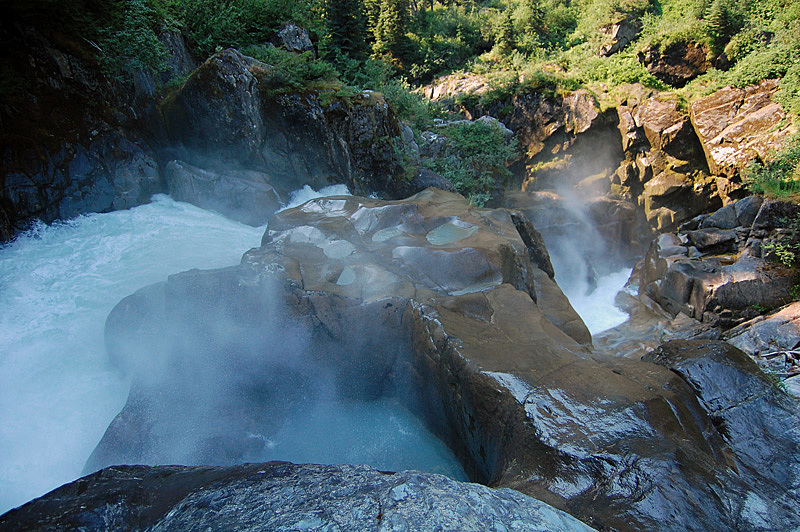
The portage is on the right, and down to the falls is flat walking through semi thick forest. You'll have to walk around the falls and on downstream where the dark chasm opens again into a wider but still huge canyon. At the falls a creek comes in on the right that can be crossed by walking upstream to a decent pool. Past the creek is some thick bushwhacking through a winter avalanche path followed by walking across a steep talus slope. It's hard going, but there is little elevation change on the walk. The canyon continues and it may be possible to go to the edge and find a way in - it will need to be scouted and will likely need some rope work to get down to the water. We opted to continue to the bottom of this canyon - continue along the talus and into the forest where it is an easy, if a little steep walk through old growth down to the water. There's a 40 foot slide at the exit of the canyon that you can get to the top of. This whole portage took us about 4 hours.
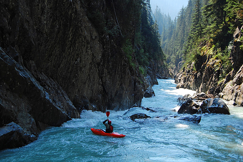
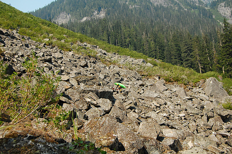
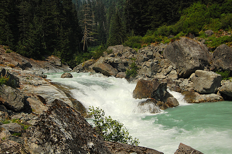
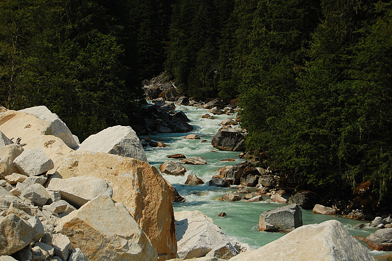
The Stave undergoes a dramatic transformation at the end of the second canyon. The valley opens up with good downstream vistas and the whitewater changes from bedrock canyon to steep boulder rapids formed by massive landslides. This section is furiously steep, and while we were able to pick away at it, it would come in to prime at much lower water. There is nice camping after the last big rapid in this section.
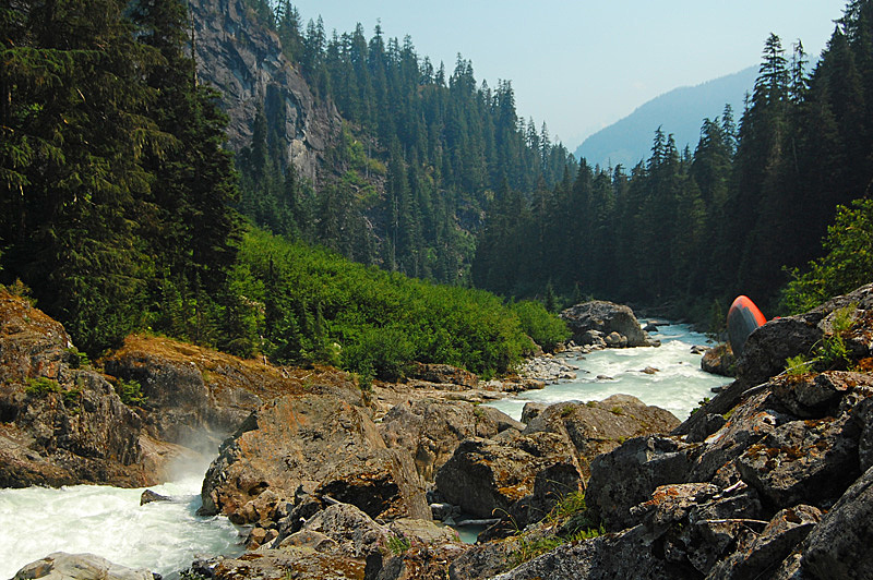
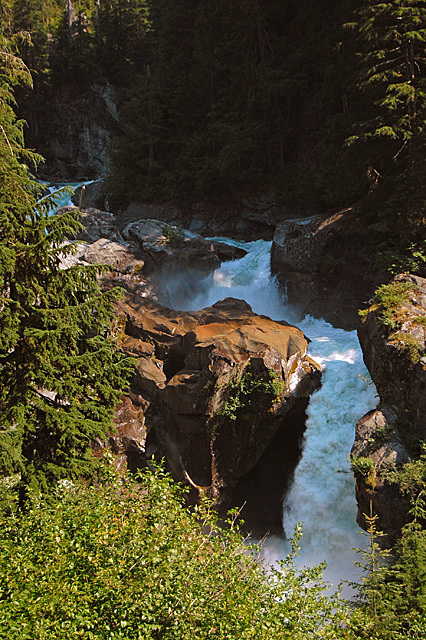
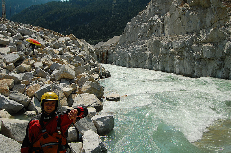
After the boulders the river eases to flat water - in the distance you can see clear cutting, meaning the road is close. The whitewater however is far from over - soon comes the final canyon of the Stave that starts with a perfect 30 foot waterfall. We portaged right (1.5 hours) because it was blown out too high - this canyon has a huge rapid in the middle that might make the canyon unrunnable - if you get in there, scout the whole thing first as there is little option to escape after the first waterfall. This canyon is now dewatered for hydro power.
After this canyon there is still some good stuff left - the lower section can loosely be described as class IV-IV+ with a few waterfalls thrown in for good measure. The road parallels the river in this lower stretch (the lower 25 km) so scouting and portaging is quite easy, especially when compared to the upper stretches of the river. Unfortunately the best portion of the lower river has been dewatered for a run-of-river hydro project and when the upper river is runnable the diversion reach will be dry. You read correctly - there are 2 hydro projects on the Stave. There is potential for recreational whitewater flow release here - the project is currently owned by Innergex.
After the powerhouse there is almost no whitewater left on the river, and the occasional small rapids fade to current and finally flat water. The scenery is epic with tall granite walls on all sides as you approach Stave Lake. Once you get to the lake, do whatever you have to do to get yourself back to the civilized world.
Any trip down the Stave should still be considered exploratory. I feel the trip would be worthwhile even with the dams in operation, but the third day would have little whitewater once the second project is finished. The first day of the trip was as classic as anything around - the real test of this river will be when someone goes in at lower flows and assesses the runnability of the big canyons on day 2 and figures out the rest of the big avalanche rapids that follow. If it's all runnable, the Stave has the potential to become a world-class class V multi day kayaking trip.
Stave River Trivia
- The first known descent on the Stave happened some time in the 90's. A short account of their run disappeared with the defunct Fraser Valley Whitewater web page.
- We found the remains of a raft in the woods near the start of the first canyon. A good story I'm sure.