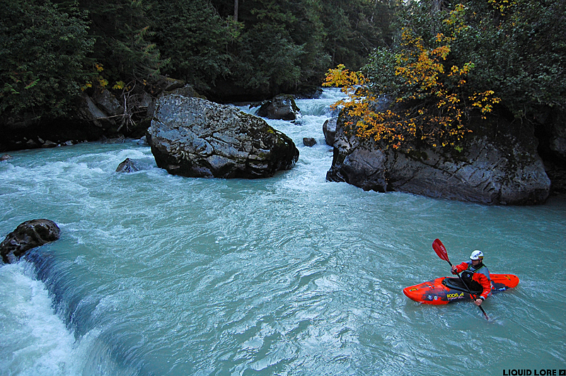
The Ryan River is a major tributary of the Lillooet River just north of Pemberton - despite its proximity to the ever popular destination of Whistler, this run rarely gets boated. The upper stretch of this run flows well into the fall; for much of the summer it is far too high to consider. As it's glacier fed and needs relatively low flow, look to come here when the nights start to get cold and the leaves begin to turn - expect a hike in to a stout section of very steep boulder rapids that are good, but a little bit junky.
Getting to the Ryan is not obvious - the BC Backroads Mapbook and this map should clarify things. From Pemberton, head north out of town on the Pemberton Valley Road. You'll shortly cross over the Ryan, which meanders through the lowlands of the Lillooet Valley and is largely unimpressive here. In the distance to the west you'll see the Ryan valley. There is a forest service road up the Ryan valley, however it is currently not passable to the put in due to several washed out bridges from the floods of 2003. The obvious road in the Backroads map book (the one that heads directly west from the highway into the valley) is marked as private. If you continue another 100 meters there is a second turn that heads down an old overgrown road that will bring you to the FSR, and it is not signed as private.
If you've taken the overgrown road, turn left when you get to the end then turn right at the 4-way intersection and start driving up the valley. If you came along the private drive keep straight. Continue along the FSR until you reach the end of the road - this is the location of the washed out bridge whose remains are in the clearing, and the take out. Ferry to the other side of the river and hike to the top.
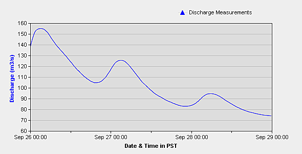
Flows on the Ryan are visual and unless you've been there before it will be difficult to gauge. Flows should correlate to those on the Lillooet which has an online gauge. Late summer and early fall are the best betting times. Flows of about 100 cms on the Lillooet gauge gave a medium to medium-high level on the Ryan.
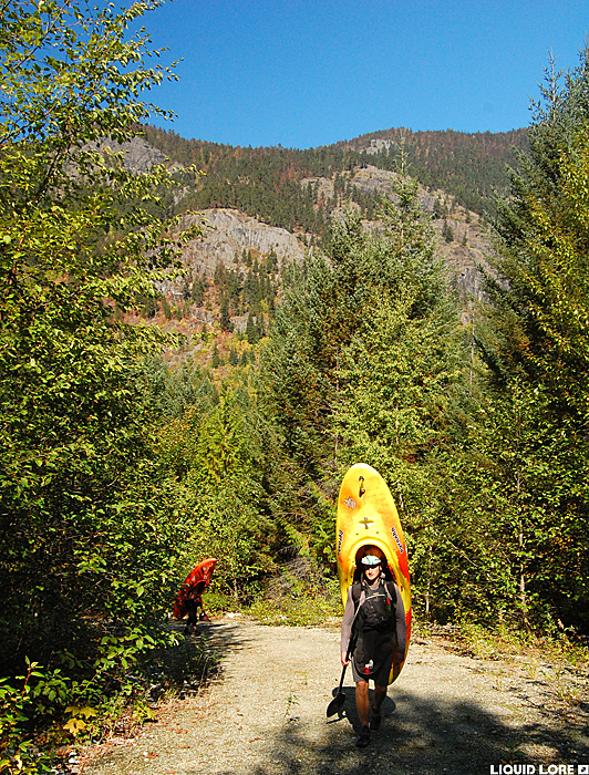
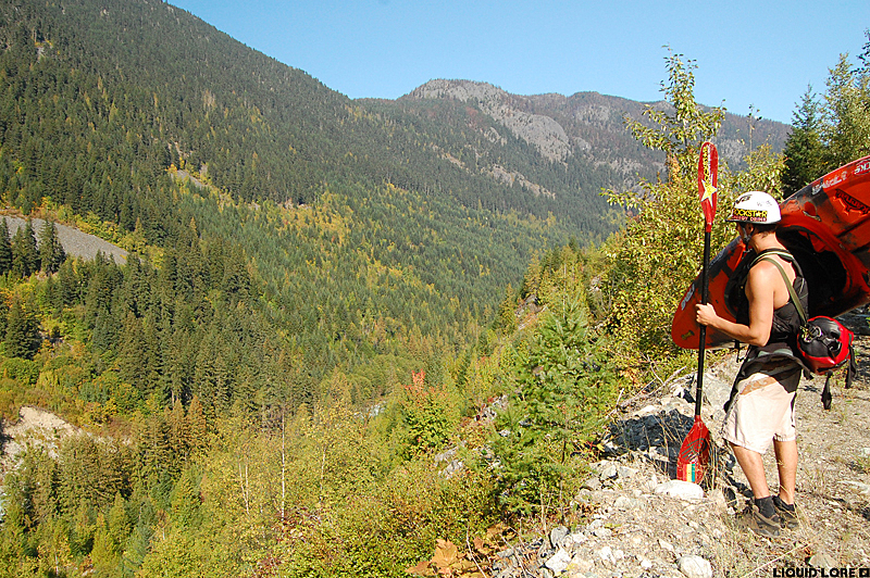
From the take out it doesn't look like a road continues on the other side. If you go straight across to where it looks like the old bridge footing used to be the road is indeed there but it's very overgrown. Unless industry again set their sights on the Ryan valley the road is probably not going to be rebuilt. To reach the put in you have to hike up the old road - it is overgrown to the point of being difficult to follow in places. Don't freak out when the road goes downstream at the start - it quickly swings back around. Plan on walking for 2-3 hours. You can start wherever you see fit - the river eventually gets flat as you head up the valley - start at the second major creek crossing/massive washout if you want to get all of the whitewater.
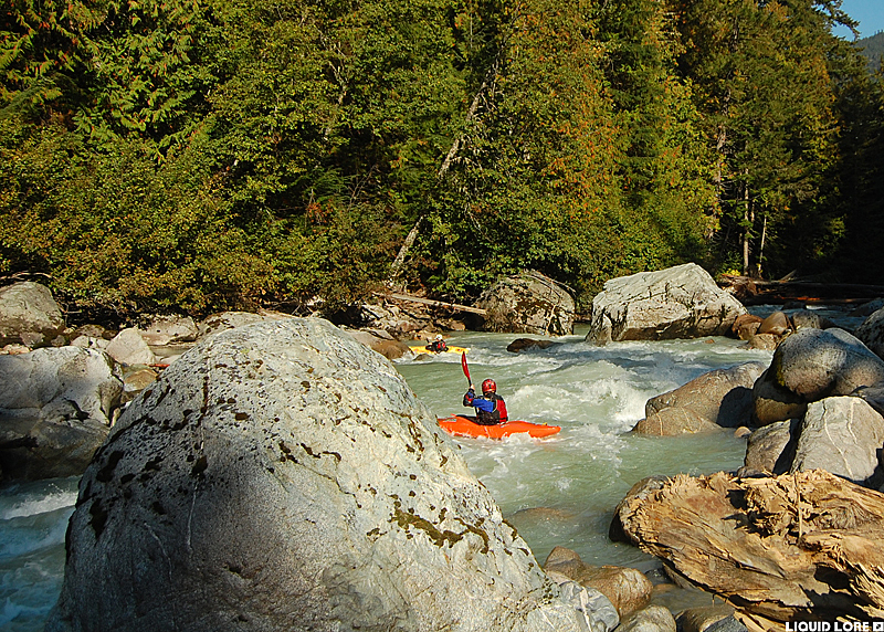
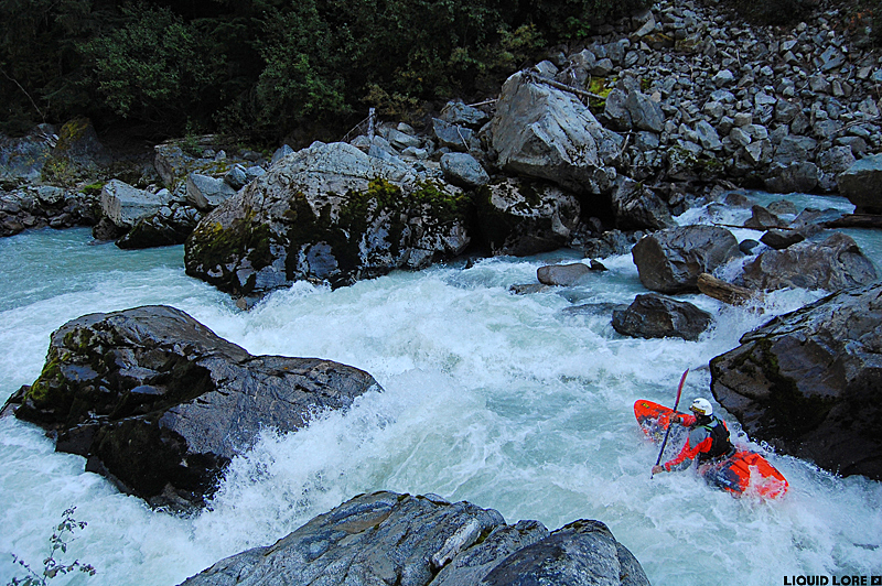
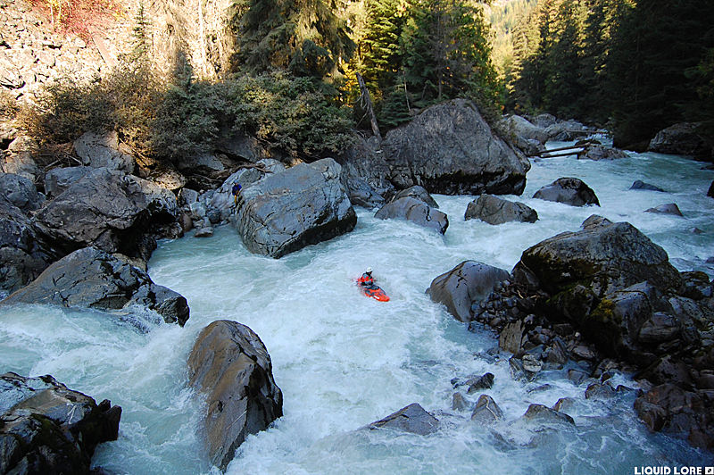
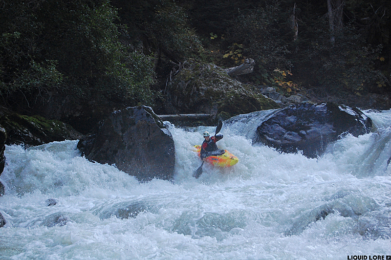
There is not a lot of point in trying to describe the river. The first half of the trip is very steep, continuous whitewater where everything has to be scouted. There are some huge boulder rapids in this section - luckily river level scouting and portaging is possible along the whole length of the run. All the nasty stuff is in play on this section - wood, sieves, holes and bad rocks. Expect some great whitewater and a few spots with some solid mank. For reference, I feel this section is steeper and harder than the Bottom Mile of the Ashlu.
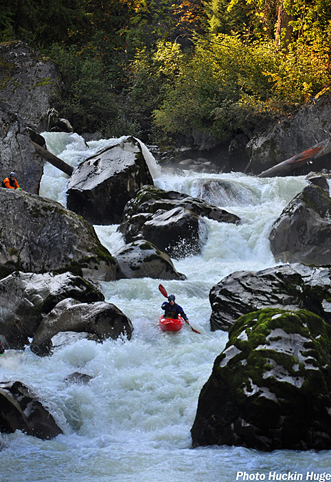
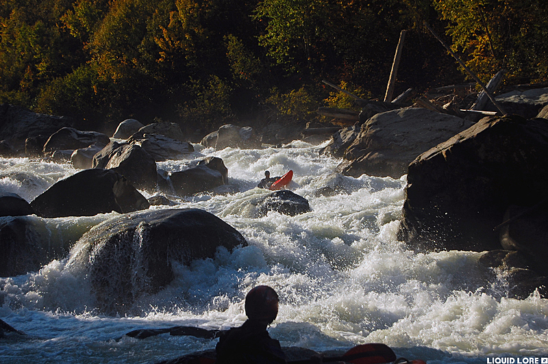
About half way down the run the whitewater begins to relent. You can start to boat scout some things, and you'll eventually be able to bomb long sections of fun class IV. Once this boogie begins it will stay that way until the end, which comes all too quickly. You can't miss the take out - you'll see your cars and the remains of the old bridge. There is a lower run on the Ryan starting from the take out for the upper but it's recommended to run this section when the river is higher.