Rogers Creek is under direct threat for run-of-river hydro development by Innergex and the In-SHUCK-ch First Nation. With the local First Nation on board, it is only the kayaking community that can preserve the recreational value of this creek if the project moves forward.
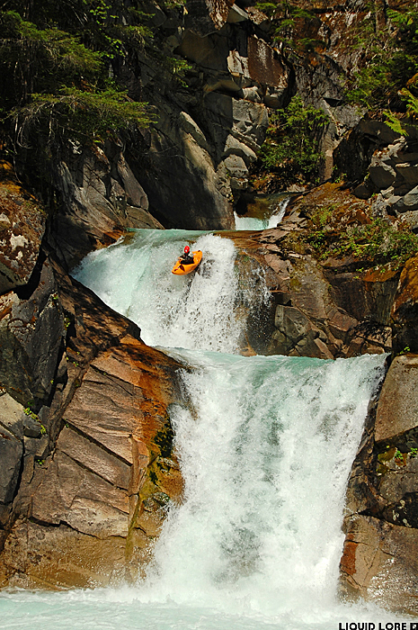
There's not a lot to say about Rogers Creek that hasn't already been said. It's one of the iconic river reaches in the South Coast area of BC, largely due to the incredibly clean and visually pleasing triple falls in its gorge. You know the one. It's as good as you think it is. The rest of the creek is a fun paddle through a deep granite canyon with several great rapids above and below the falls. The whole package is rounded off by a pleasant bushwhack from the access road to the creek - it wouldn't be BC without a bushwhack now would it?
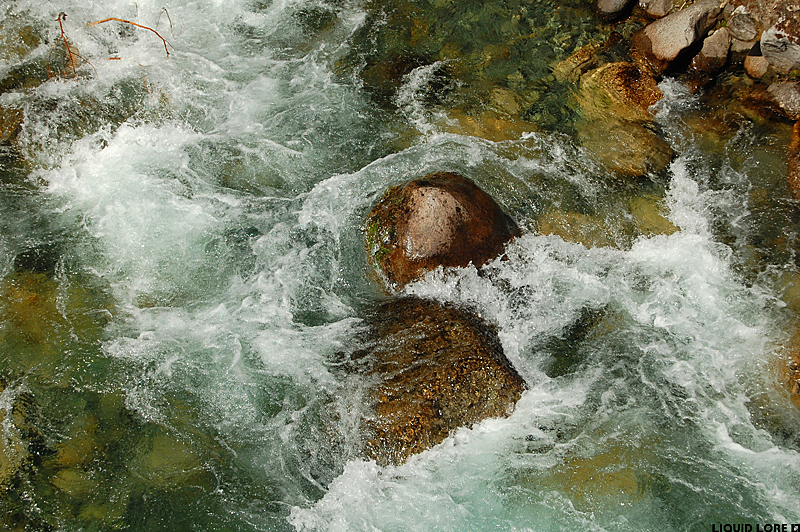
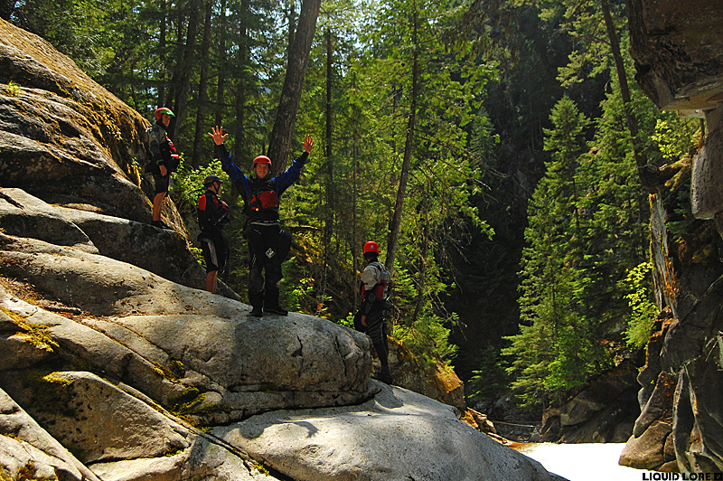
The flow on Rogers is visual only. July or August will be the best betting time to hit it at a good flow, with both the weather of the week and that season's snowpack playing a role in exactly when it will be good. It isn't glacier fed, so it will dry up eventually. At the take out, the river will look quite low but navigable - check out the photo below to reference a medium level. If you're really concerned about the level you can head up the river right logging road to the 1 km marker where you can see down to the triple falls. This is the make-or-break point in terms of water level - the limiting factor is your ability to paddle over the boil in the pool between drops one and two to run the second one on the left.
Rogers Creek is found about 1 hour / 45 km south on the east side FSR of Lillooet Lake/Lillooet River, leaving from highway 99. It's dusty but scenic. The take out is where the road crosses the creek. It isn't signed, but it is the first major river you cross on the drive south. Alternatively you can paddle out on to the Lillooet River and float a few kilometers downstream to the Skookumchuck/St. Agnes Well hot spring, which is a great place to camp out. There are roads up both sides of Rogers - the best access to the normal run is up the river right FSR (which is signed), several hundred meters north of the bridge. Get up here however you can - without 4x4 you might have to park at the bottom of the hill and walk - at the first clear cut (now heavily grown in) after the switchbacks you'll want to bushwhack in along the downstream side. There is more whitewater further upstream, including another triple drop.
There have been access issues here in the past. Frankly, the native land owners in the area are aggressively unfriendly. If you want to avoid conflict, don't screw around at the take out and don't leave a shuttle vehicle parked right at the bridge. The lands surrounding Rogers are unsettled treaty lands, which the In-SHUCK-ch Nation will eventually own. You do, however have the right to use the creek, the details of which are described in this document. Specifically, roads remain Crown property, reasonable access for recreation is allowed (Ch. 5, clause 1) and the public right to navigation is unaffected (Ch. 5, clause 9).
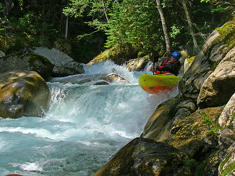
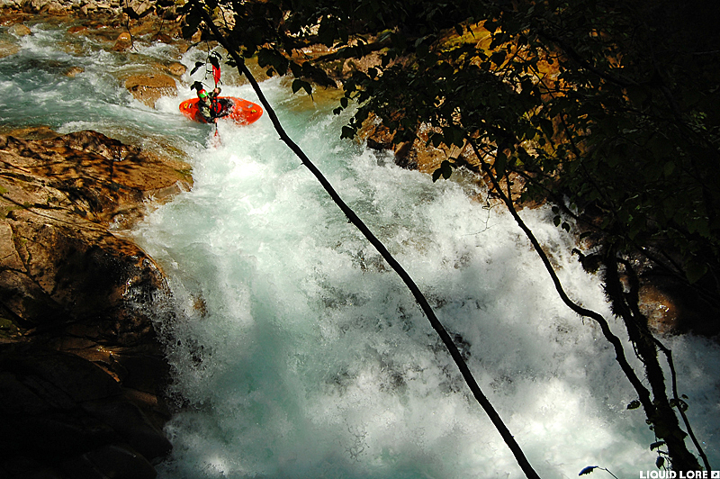
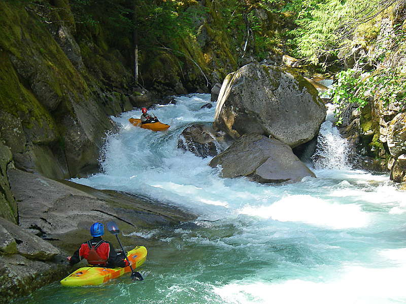
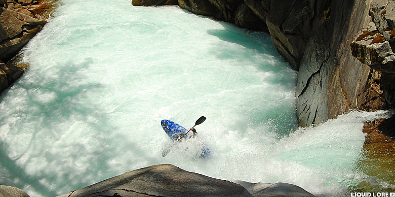
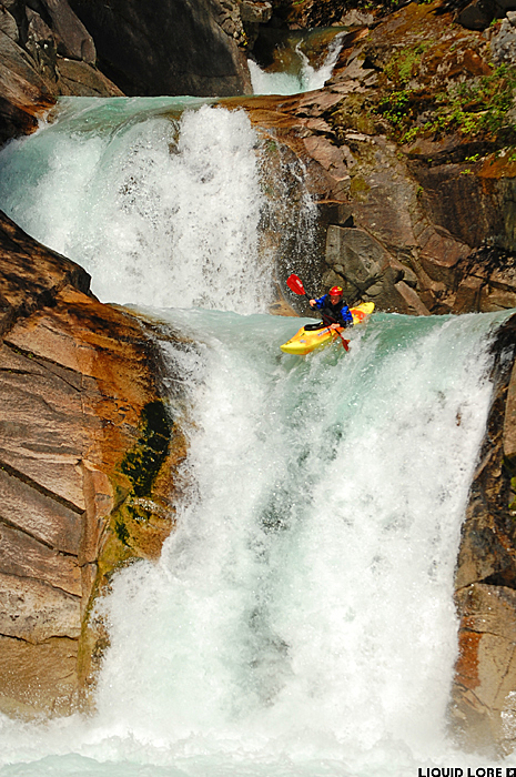
The creek after you whack down the clear cut will be wide. The first section is rocky but all good to go. You'll quickly come to a 6-8 foot ledge with a twisty lead in that marks the entrance to the gorge. Some great boulder pile rapids ensue - after you run a drop that pinches up against the right canyon wall eddy out below on the left to check out the falls.
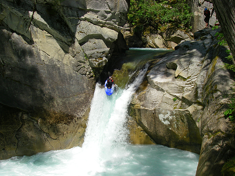
The line at the triple is apparent. Go left on the second one as the hole on the right is a nasty place to swim. Take a while and soak in the splendor here. If you have to, the falls can be portaged (or you can hike back up to run them again) on river left. After the falls there is one more rapid - perhaps the best one on the creek - and then some fun boogie (if it isn't low) down to the take out bridge. Quietly paddle past the cabin on river right - if you make it down in one piece, might as well go for a second lap...