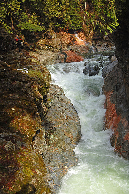
Norrish Creek is a great creek found little more than an hour east of Vancouver in the Fraser Valley near the town of Mission. Keeping with the theme of southwest BC, the Norrish contains a selection of clean-ish boulder rapids and some fine bedrock often squeezed between eerily tight vertical canyon walls. It's amazing how many cool zones are so close to such a big urban area.
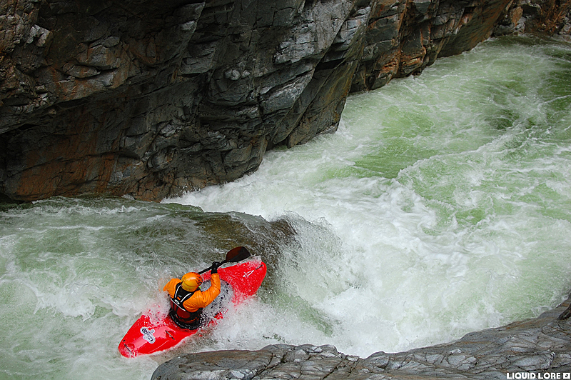
The Norrish is generally of the class III-IV variety, at least at low to medium flows. However, the fact that two of the more notable rapids on this section are solidly class IV, and they are difficult if not impossible to portage can raise the stress level a little bit if class IV-IV+ is your max. Like all streams, this one packs more of a punch at higher levels and it isn't often run higher than 'medium' for the section because of a dangerously sticky river-wide hole in the unportageable rapid. Expect some fun boulder gardens with esthetically pleasing smooth rock and a handful of good bedrock rapids - while the road is never far away from the river, the canyon gets quite intimate in a few spots and the scenery here (with the exception of some rather unfortunately placed abandoned cars in the river) is top notch, making the trip worthwhile for more than just the rapids.
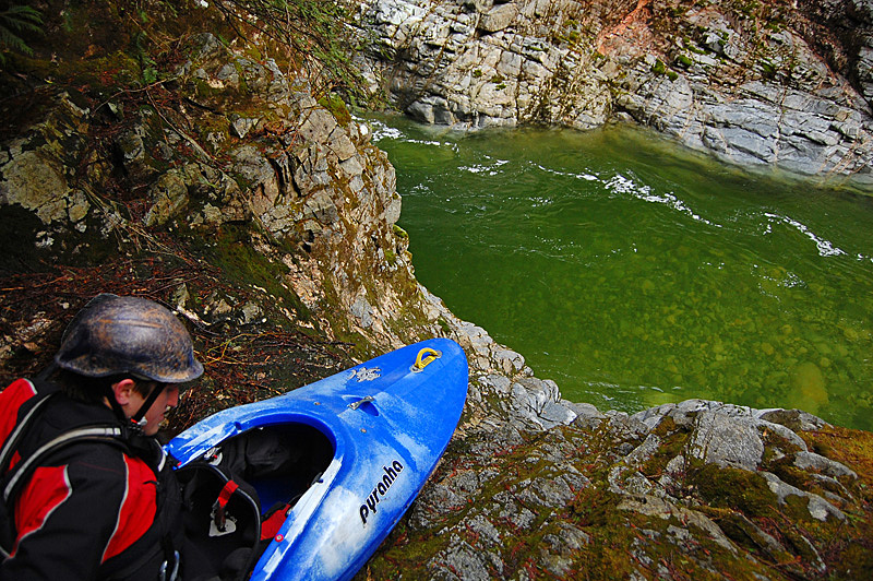
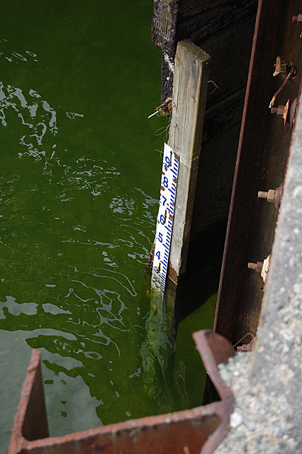
Finding good flows on the Norrish may present some issues - there is no reliable internet gauge. The best bet is to head to this one after a good rain happens in the lower mainland and hope for the best. There is a gauge at the takeout - it changes from time to time so try and get local beta on what currently represents high and low. Currently, 1.40m is medium (note that the locals refer to this as 4.0). Below 3.0 is low.
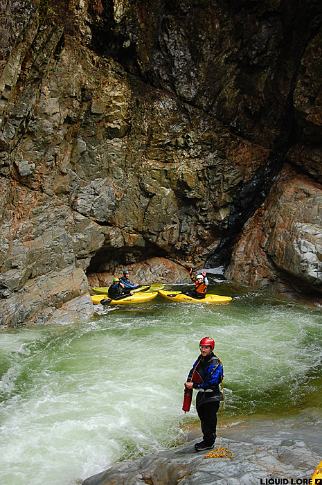
Follow the map link to get to the river - the takeout is located about 15 minutes east of Mission. The road to the takeout is gated, so park a few hundred meters west of the bridge. The gauge is found on the downstream river left side of the road bridge. Put in about 7 km up the Norrish Creek FSR - look for an old road dropping towards the river that is not passable for normal vehicles. An upper put in is possible, but most accounts say the short section above the normal put in isn't really worth the effort.
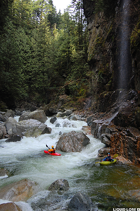
From the start you're treated with several nice bedrock ledges that give way to fun boulder garden rapids - for the most part this early section is not walled out like the lower reaches. As you get into a good grove you'll eventually notice a tilting of the river bed and the appearance of some more bedrock ledges and steeper boulder rapids that indicate the coming of the first unportageable rapid.
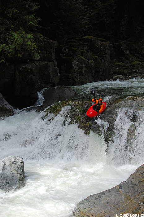
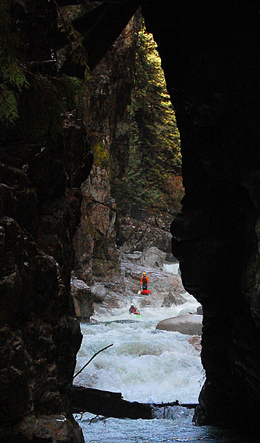
The first walled in section is easy to scout from the left - there is no good portage option. It has a notoriously sticky hole at the bottom - the line is obvious. This rapid is the high water limiting factor. Below this is some more action as you near the second of the walled out rapids.
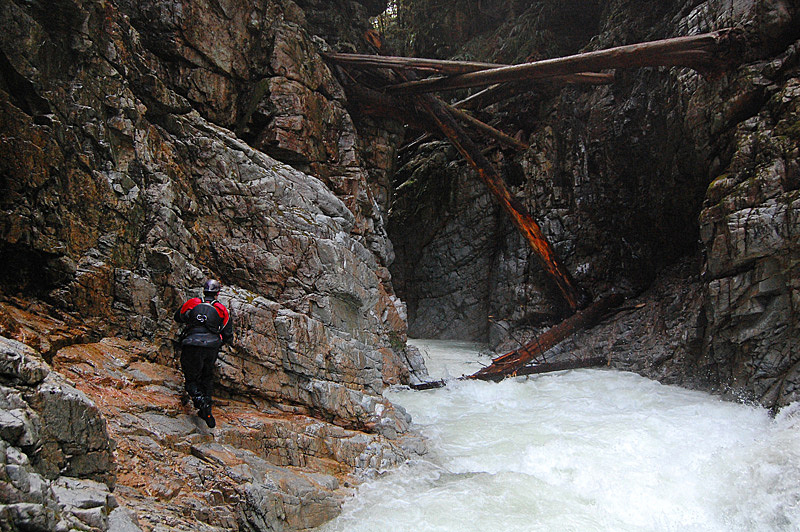
This section is signified by a long straight stretch of river surrounded by canyon walls with an obvious pinch at the bottom - there are several large trees wedged in the walls 20 or 30 feet off the water. There is some wood here at water level that can usually be paddled around - if not you can execute a difficult portage along the left wall.
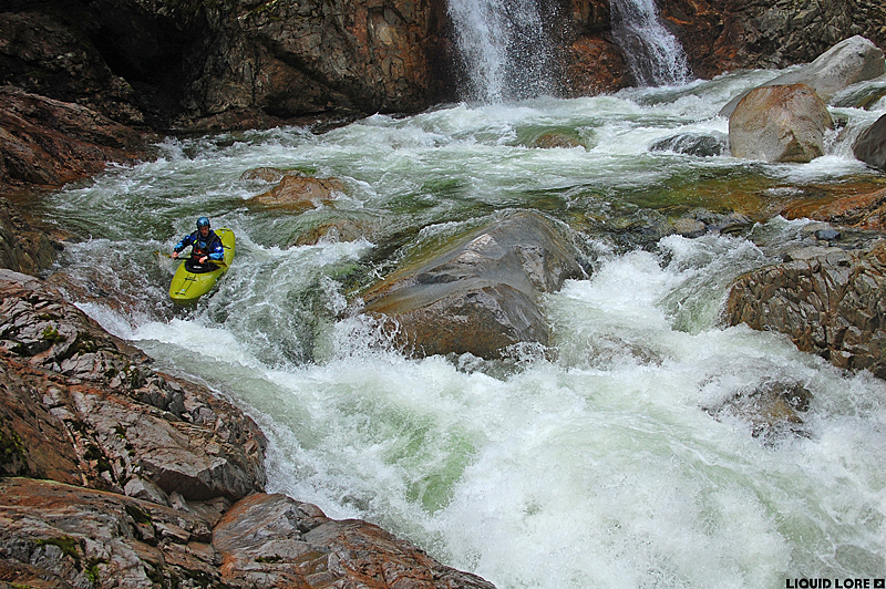
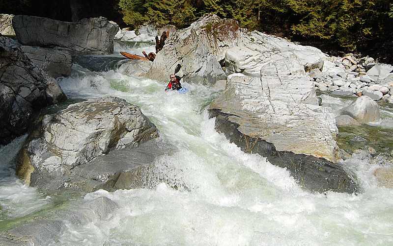
The river below this pinch lets up noticeably until the take out, with the exception of one rapid that is easy to spot from above. It is a fun class IV drop with a cool squeeze between two boulders at the bottom. This rapid is the end of the Norrish - the river valley opens up into some wide braided channels for a few kilometers that quickly bring you to the take out. Enjoy this Fraser Valley gem!