Contributed by Ali Marshall
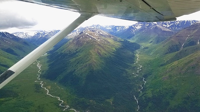
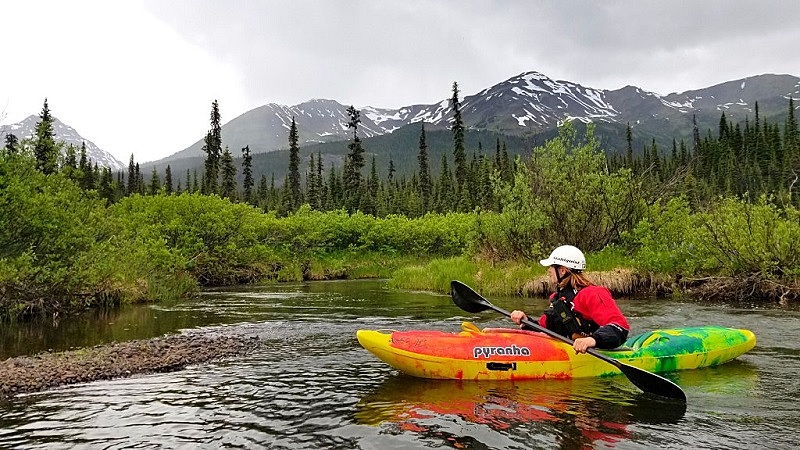
The Nass is born on the Spatsizi Plateau, in the interior of Northern BC. Sometimes called 'The Sacred Headwaters', this pristine wilderness is the source of the Northwest's three greatest salmon rivers: the Stikine, the Nass and the Skeena. It flows for 380km through Tahltan and Nisga'a territory before reaching the Pacific. Unlike the Stikine, the Nass has a very even gradient with 6-7+ days of whitewater.
Flow Windows
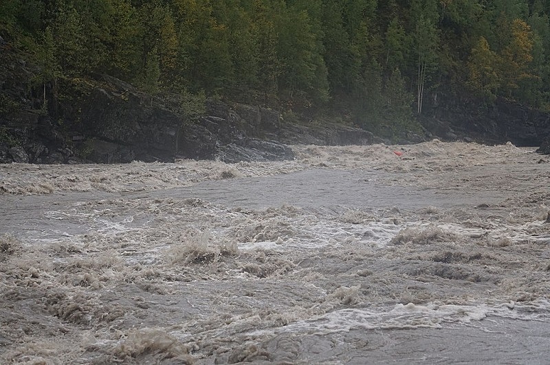
The Upper Nass should be paddled at the tail end of the spring freshet. If you're an experienced kayaker, high water is recommended (June/July rather than August/September). The online gauge is located near the take out of the Lower section and it does not give an accurate representation of flows on the Upper. The Upper can be paddled at low water but the quality of the rapids decreases. There is no official cut off for the Middle Nass. Above 1800cms there are some LARGE whirlpools and swims are not recommended. This section doesn't get too low. It's not recommended to paddle the Lower Nass over 1800cms. The river pushes through some constrictions, generating large boils and whirlpools at high water.
Upper Nass
Fly In
Drive to Tatogga Lake on Highway 37, 386 km north of Kitwanga Junction. Alpine Lakes Air fly into Nass Lake (the source).
Hike In
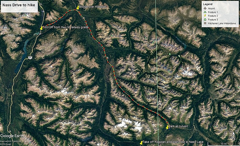
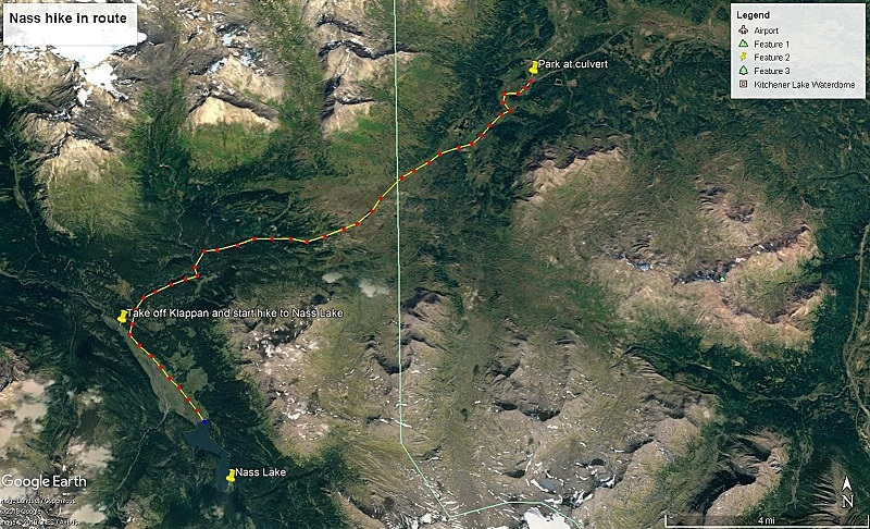
Drive North on Hwy 37. 1.6 km past Tatogga Lake Lodge, take a right onto Ealue Lake Rd. Drive roughly 25 km down the dirt road until you reach the bridge over the Klappan River. Hang a right onto the old railway grade. Drive roughly 90 km down the railway grade until you reach the second airstrip followed by a large 180 degree bend to the left (see attached map). Park at the culverts passing under the road.
This road is prone to wash out. If in doubt, contact the Tahltan Band office for current conditions. It helps to say that you are not a hunting party.
Hike southwest up the creek, follow the second small tributary that enters from the river left. Follow until creek dries out. Continue southwest across the plateau. The horizon dips to the right and left. Both lead to tributaries that eventually flow into the Klappan. Follow your nose and eventually you will end up at the river. The Klappan has some class 3 and 4 rapids. Paddle for roughly 4 km until a large marsh appears on the left. Hike across the marsh/grassland on a southeast heading. In 4 km you will reach Nass Lake.
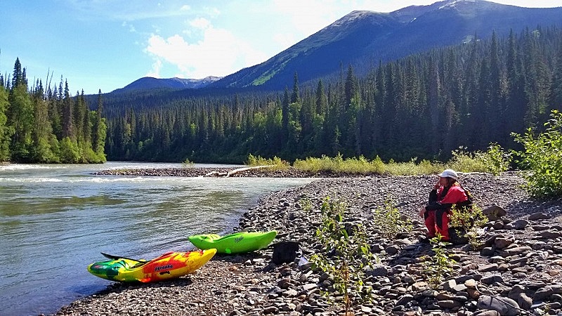
Take Out
Park at the Meziadin Hwy bridge rest area. Hike your boats up and out of the river. Or 4.2 km south of the bridge, by Elsworth Culvert, there is a small turn off that provides truck access down to the river. It can also be used as a put in for the middle and lower sections. This access point is unmaintained and may be in poor condition.
Description
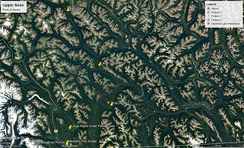
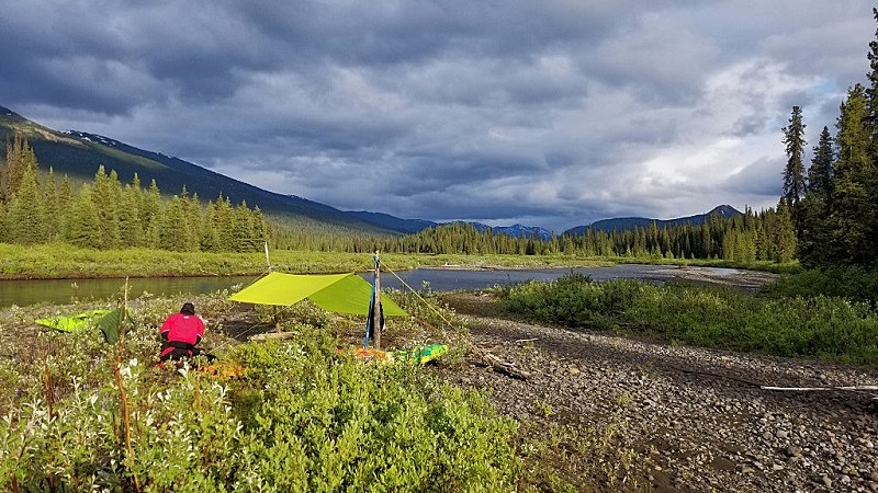
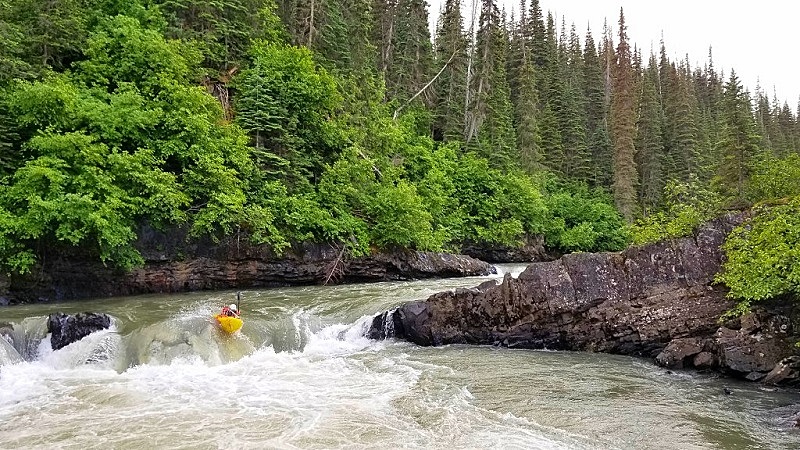
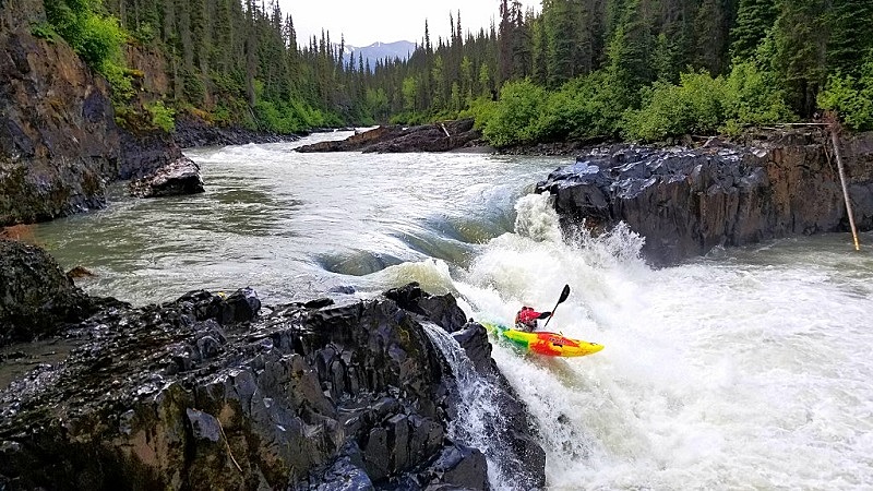
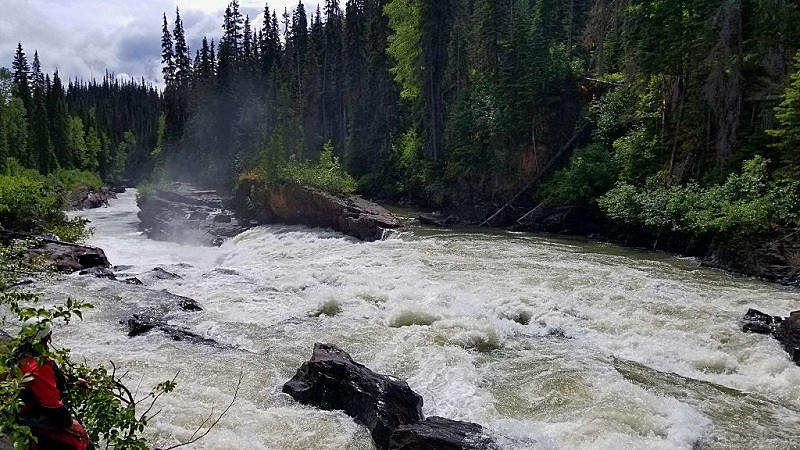
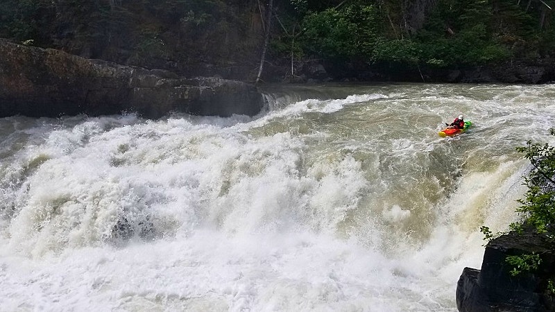
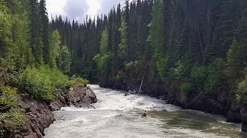
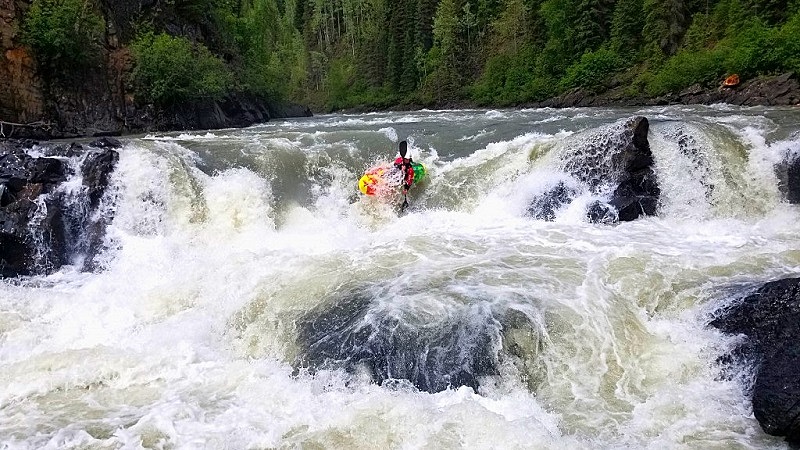
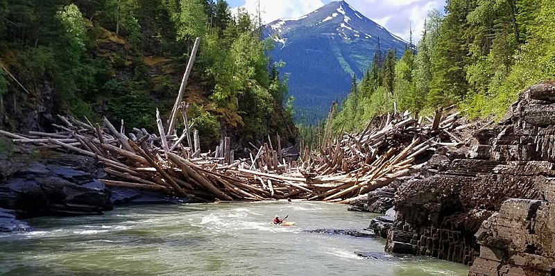
Leaving Nass lake, the river slowly meanders for 6 km until a few tributaries bump up the flow. It's not uncommon for crews to drag this section during low water. 10 km downstream, the whitewater begins. For the first few days, the rapids are ledge drop in nature. The largest can be found on day three. A powerful approach with a 15 ft falls at the bottom. Scout or portage on river left. On day 4, you will come across two of the biggest log jams you have ever seen, just a few hundred meters apart from one another. If the logs are dry, portage straight over the top. If wet and slippery, the safest option is to portage both on river right. Downstream from the log jams, down to the Bell Irving River confluence, is some fantastic big volume class 3-4. Keep an eye out for transmission lines crossing the river. Under them is a large rapid that gets powerful at high water. Scout on river left.
Take out at the highway bridge or continue down to enjoy the middle and lower sections.
This is an extremely remote section of river. Be prepared. Hiking out for much of the run is not an option. Bug and bear spay is a good idea.
Middle Nass (Day/Play Run)
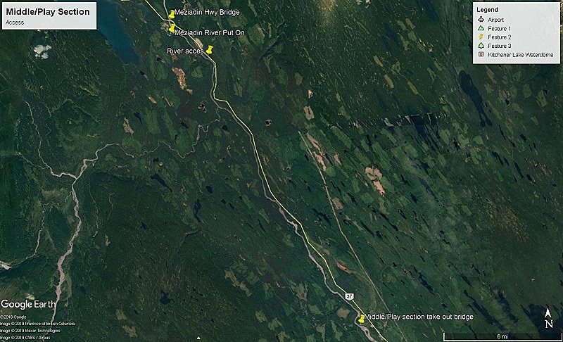
Put In
There are several access points for putting on this section.
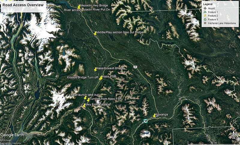
1: Park in the rest area at the Meziadin Hwy bridge and scramble down to the river. The bridge is 137 km north of Kitwanga Junction on Hwy 37.
2: 4.2 km south of the Hwy bridge, by the Elsworth Culvert, is truck access to the river. The road is unmaintained. This is the most convenient put in, but you miss the first rapid.
3: Heading north, take the first left after the Meziadin Hwy bridge. Drive through what looks like a gravel pit, keep going straight. You will pass a fish ladder and Nisga'a fisheries. Park at the end of the road and paddle the Meziadin River into the Nass. Please act respectfully if use this access point.
Take Out
31 km south of the Meziadin Bridge, on the west side of the Hwy, is the Arbor FSR. Drive 1 km down this road until you reach the bridge. There is a trail that leads down to the Nass, river left of the bridge.
Description
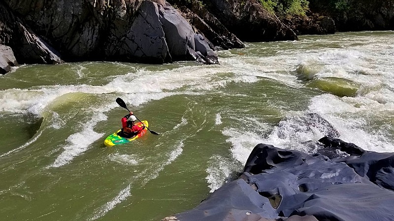
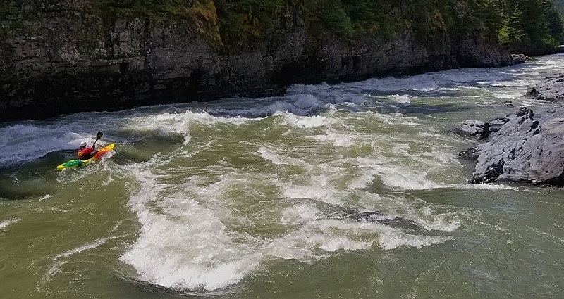
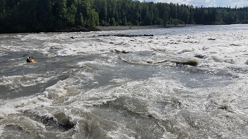
This is a straightforward section to navigate. The whitewater is comprised of large standing waves and boils. Keep your eyes peeled for the occasional large hole and whirlpool.
Lower Nass
Put In
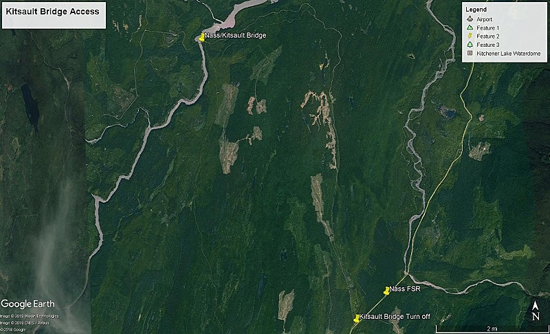
Use the take out of the Play section (bridge on the Arbor FSR) to access the Lower. Most people will put on upstream, paddling the Bell Irving River and Middle/Play section first. There is another bridge halfway down this section. Get to this Nass/Kitsault bridge from New Aiyanch. Drive through New Aiyanch towards Nass Camp on the Nass FSR. After 33 km turn north towards Kitsault, drive 14 km north along the Nass/Kinskuch FSR until you hit the bridge.
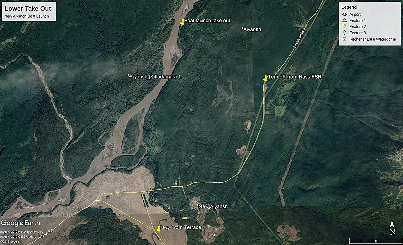
Take Out
Take out at the boat launch, near New Aiyansh on river left. To get to the boat launch from Terrace drive north up the Nisga'a Hwy. After driving through the lava fields the road hits a T junction. Hang a right towards New Aiyanch (Gitlaxt'aamiks). After you drive over the Tseax River bridge, continue for 6.5 km. Take a left onto Irene Meadows Rd. There is a 'No Thru Rd' sign. Follow for 4 km until you hit the river. Park so you are not in the way.
Description
Below the Arbour FSR bridge is a nice class 3+ canyon. After a few hours of flatwater the class 3+ Squish Rapid appears. Just below is the Nass/Kitsault bridge. Next is Moose Carcass Canyon, a class 3+/ 4 freight train with a couple of holes to dodge. The Tchitin river enters from river right, signaling the end of Moose Carcass. The river remains in a canyon but eases to class 2 for a couple of hours. When the river exits the canyon you have an hour or two of flatwater until you reach the boat launch / take out.
More Information
Many groups choose to put on at the Bell Irving River to access the Nass. This adds an extra day of class 3-4 paddling upstream of the Meziadin Hwy Bridge/Middle Nass. To access this section drive 46 km north from the Meziadin bridge until you cross the Bell 1 Bridge. Put in here.