The Middle Memekay River is a nice long intermediate canyon run, a good North Island option when it is raining enough. The run starts with a downhill bushwhack into the small Middle Memekay River and finishes at major FSR bridge over the Memekay River. Both rivers have very scenic canyons with a lot of corners, which often contain riverwide wood (hopefully duckable). The combined experience is a little like running Lynn Creek into the Capilano River, if that were possible. Even though the surrounding area has been heavily logged, the forest in the river corridor is mostly intact old growth. As long as you can catch it with enough water this is a great run, and don't forget to check out the other Sayward highlights while you're in the area: White (III-V) and Adam (III+). Check out more details on these runs and others in an upcoming guidebook produced by the Vancouver Island Whitewater Paddling Society.
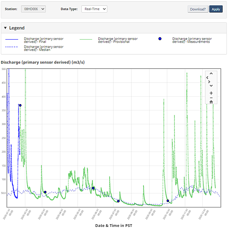
The Middle Memekay River is fairly small, and levels rapidly flash up and down. Since the gauges are downstream, by the time online flow readings are falling, the Middle Memekay could already be dropping out. The run will only hold water for the day it is raining, the day after, and maybe two days from a really big rain. To target a low-medium flow, try for 150cms on the SALMON RIVER NEAR SAYWARD (08HD006), or 50cms on the SALMON RIVER ABOVE MEMEKAY RIVER (08HD007). The actual flow in the Middle Memekay is only a small fraction of these values. Expert kayakers will enjoy this river at double these flows, but the run will be harder than class III-IV. In the spring, you'll need less water on the online gauge, as more water comes from snowmelt high in the drainage. However, snowmelt is rarely adequate for enjoyable flows without additional rain, and a springtime level of 50cms at Sayward was brutally low. Visual levels at the put in and take out can be hard to judge, but you don't want it too look scrapey, especially at the takeout.
2020 hydrograph and median flows for SALMON RIVER NEAR SAYWARD (08HD006). To target a low-medium flow aim for 150cms on this gauge, less in spring.
The run is less than an hour north of Campbell River on Highway 19 and logging roads, but finding it will be a struggle without a map (e.g. Backroads Mapbook). The takeout is located where the Salmon River Main crosses the Memekay River, near the Memekay Horse Camp Recreation Site. To get to the put in, head east (on river right) and make a series of right turns onto Big Tree Main, Memekay Main, and Memekay West Main to park at branch W300 near a corner at the top of a hill. You will have crossed the upper Memekay River enroute, which doesn't look that great for paddling. Walk northwest down the overgrown W300 for ~400m until there is old growth forest on your right, before the road starts climbing again. If you pick the right spot to enter the bush, there will be a walkable forested spur right down to water level, with steep gullies to the sides.
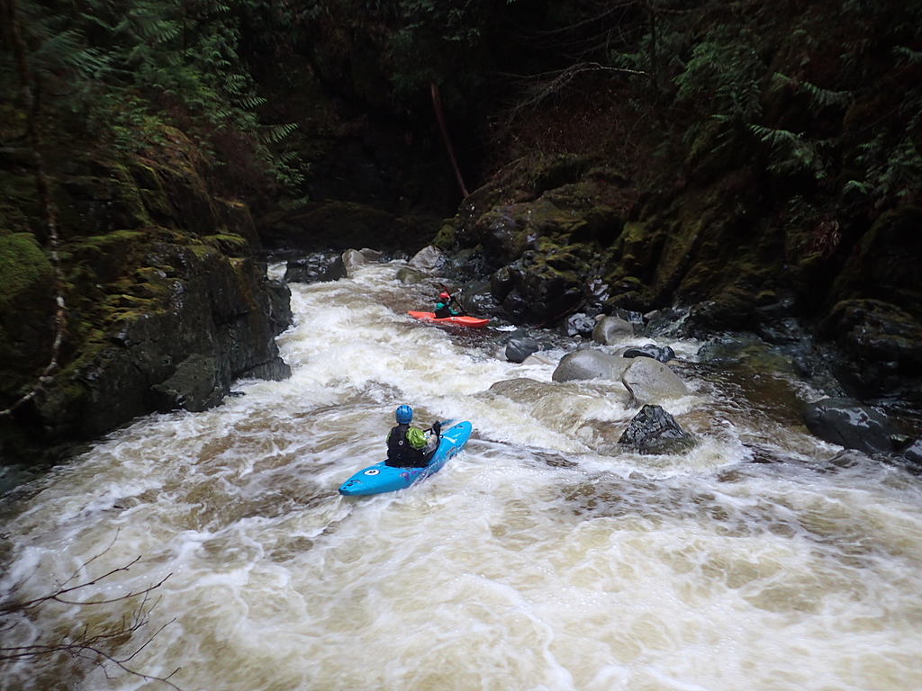
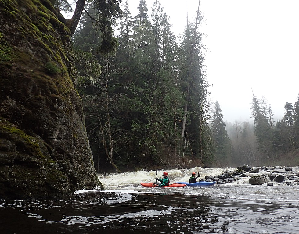
The Middle Memekay River starts with a couple boulder gardens, but is mostly narrow twisting class III+ canyons which can contain wood. Once you pass a bedrock island, get ready to scout and/or portage the crux class IV rapid. After the confluence, the Memekay River is a bit easier class III but with slightly bigger canyons.
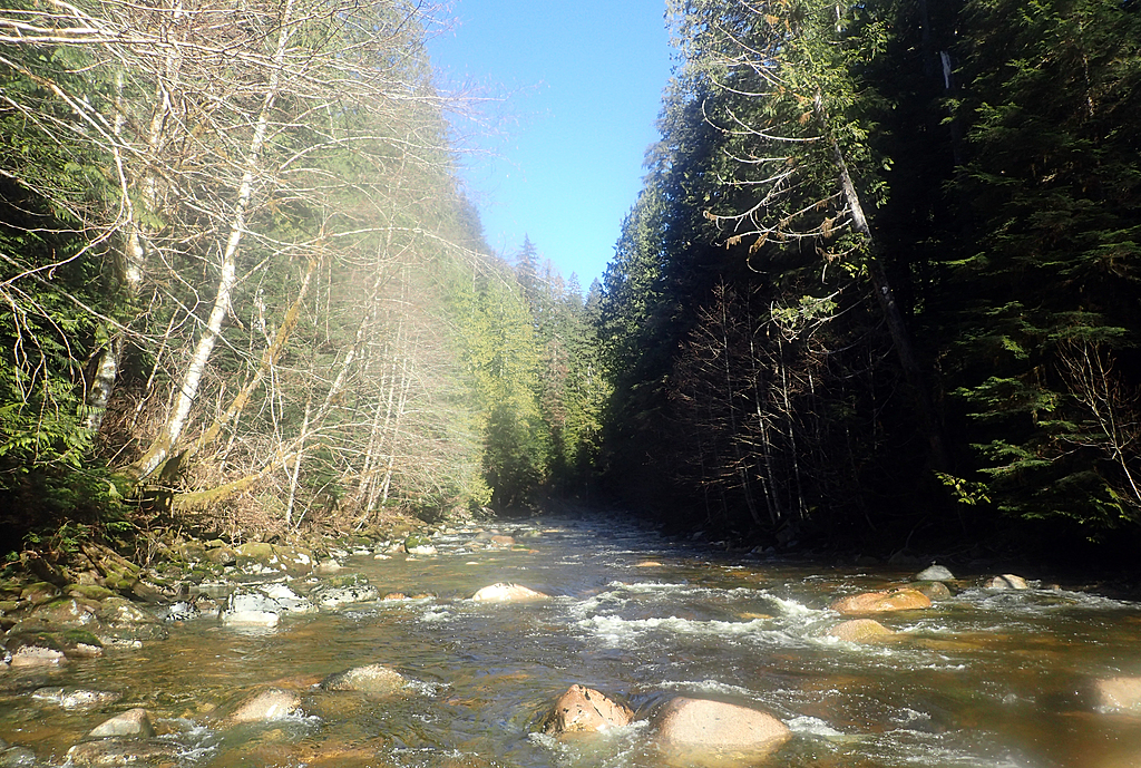
Looking upstream at the put in for the Middle Memekay at a brutally low flow of 50cms on the SALMON RIVER NEAR SAYWARD (08HD006) gauge. For a medium low flow, you should be able to maneuver through these rocks without scraping too much. If the rocks aren't showing, flows are going to be high.
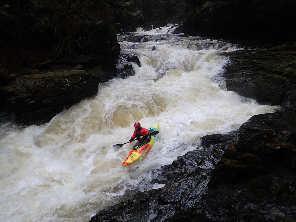
The class IV rapid on the Middle Memekay at a medium-low flow.