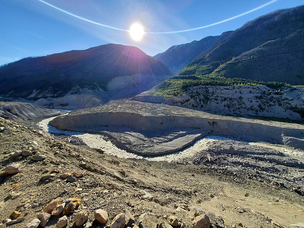
In 2010, one of Canada's biggest recorded landslides descended off the glaciated volcano Mt. Meager, ripped down Capricorn Creek, and buried much of the Meager and upper Lillooet valleys in debris. Several bridges were destroyed, and a lake formed temporarily behind the debris dam, potentially threatening Pemberton. Fortunately, Meager Creek established a new riverbed, and once new logging access was built on river right, it wasn't long before kayakers came to have a look. Although seeing the landslide in person may be the most interesting part of the trip, the whitewater is actually a pretty fun continuous section that is possibly worth the sweaty hike in. Meager Creek Hotsprings are just a short hike further upstream from the put in.
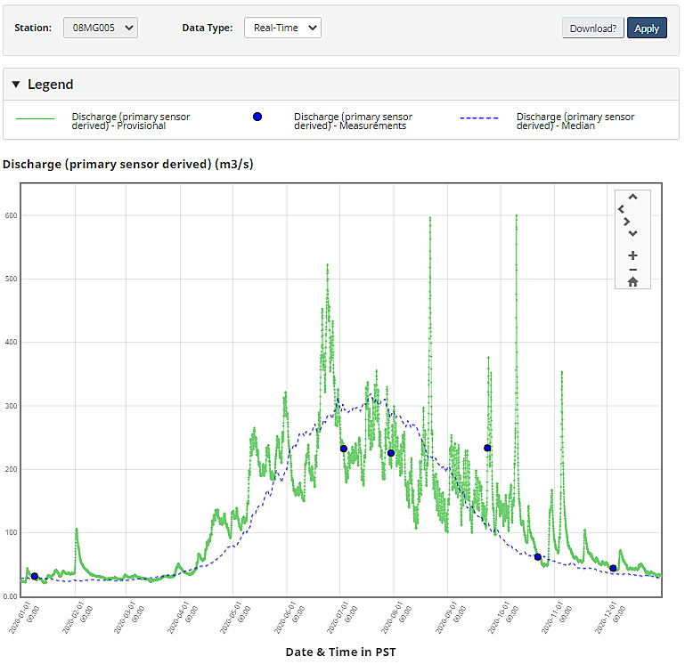
A proxy gauge is LILLOOET RIVER NEAR PEMBERTON (08MG005), and a flow of 200cms on that gauge in July was a nice padded medium on Meager Creek, which contributes only an estimated 10-20% to that flow. Flows can peak higher during very hot weather and heavy rain, but this is when the landslide risk is greatest and visiting is not advised. The BC government has a protocol for shutting down the area during these high risk windows.
2020 hydrograph and median for LILLOOET RIVER NEAR PEMBERTON (08MG005).
Meager Creek is an hour drive northwest of Pemberton. The best access is on the Lillooet South FSR to the gate at ~24km. The gate is a short bushwhack from a take out at the confluence of Perkins Creek and the Lillooet River. To get to the put in, hike a further ~6km up the FSR. There is about 300m of vertical gain, and the best put in is where the road drops back down to river level. An alternate takeout option is located on the Lillooet River FSR across from the Meager confluence, but using this option is unlikely to save any time because of the ferrying and bushwhacking involved.
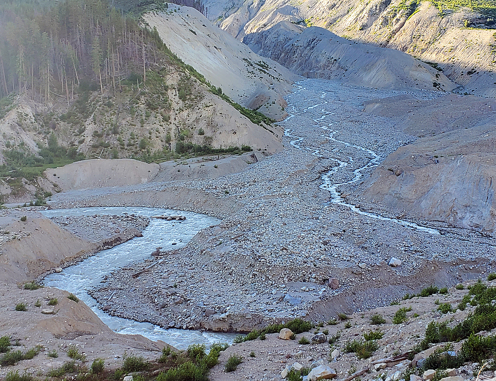
The river is very continuous class 4(+) boulders with very few eddies, at least in the first portion, and is similar to but a bit easier than the Lower Ryan. The entire run can be scouted on the hike in, but from ~100m above river level, leaving it hard to judge the true size of river features. Multiple groups have put on expecting full on class V, only to find manageable class IV. But, it is entirely possible the opposite could happen at a higher flow. Also, it is certain that the river morphology, gradient, and difficulty will evolve over time.
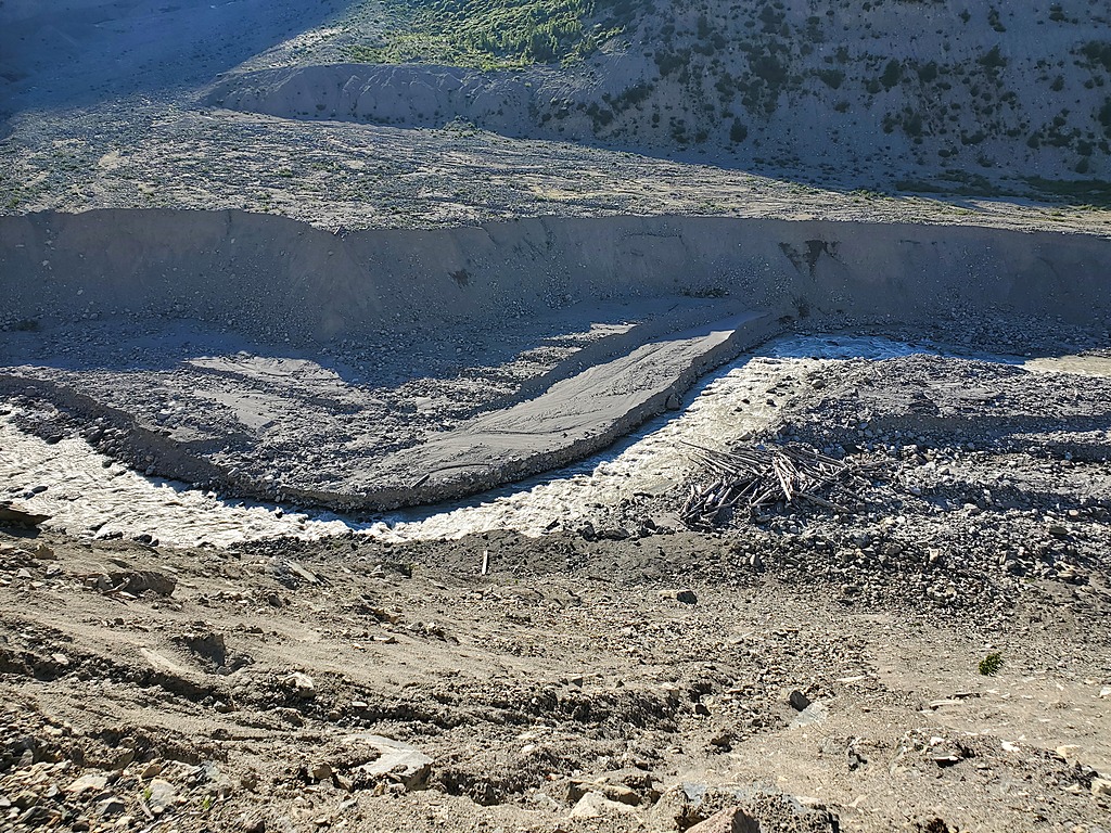
Part of the crux section where Meager Creek cuts through the debris dam left by the Capricorn Creek landslide.
Meager and Capricorn Creeks
There's plenty of time on the hike in to argue about how big the whitewater is.