Lynn Creek sits squarely in both location and difficulty between the two other popular North Vancouver rivers - the Capilano and the Seymour Canyon. The Lynn is a small drainage with crystal clear water, fun rapids that cater to a wide range of boaters and even an optional waterfall at the put in to fire up. It is surprisingly high quality urban class III-IV fun.
A map of North Vancouver is all you need to find the Lynn. The take out is at Bridgeman Park just south of the Keith Road bridge. The put in is at Lynn Canyon Park. Being in an urban area there are many routes between the two. Get to the water by following the signs for the Twin Falls bridge found at the south (downstream) end of the park. It is a 5-10 minute walk from the parking lot to the water. Above Twin Falls is a serious section of whitewater of dubious runnability.
The Lynn has a visual staff gauge found at the take out bolted to a tree growing out of the river bed. The visual gauge has two parts: upper and lower colored gauges with green, orange and red bands. Lower green is bare minimum and good for low water runs of Twin Falls. Lower orange has a nice class III feel and lower red means the rocks are fewer and it is maybe no longer appropriate for intermediate or tentative boaters. You can run the river all the way up to the top of the gauge and beyond, but once you get into the orange marker on the upper gauge it's getting high and while not crazy difficult everything is moving very fast and being able to stop in the event of a swim or because of wood is a real issue to consider. On the Lynn, appropriate water levels will vary greatly with who is here to paddle.
Because the Lynn is a small drainage it flashes up and down quickly, and it needs a lot of rain to get going. Typically the Cap and Seymour are high or too high when the Lynn runs. It has a propensity to collect wood so be vigilant, especially if you're going in at higher levels.
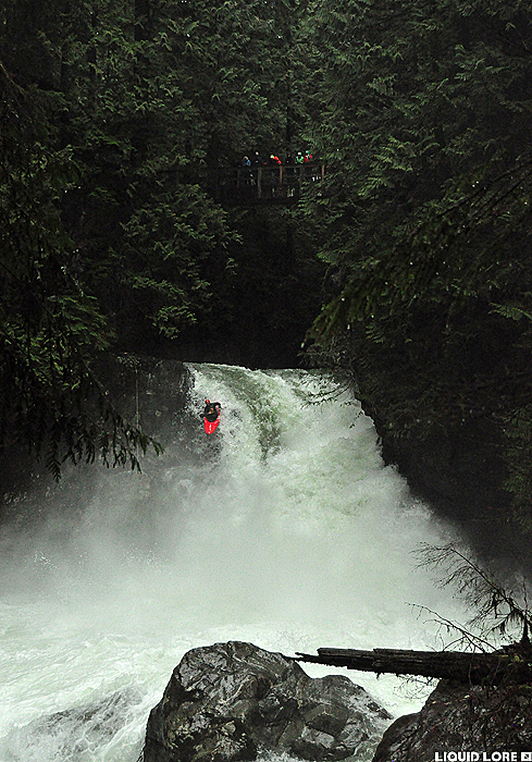
Twin Falls is the optional put in waterfall - it's found under the Twin Falls bridge. It's an intimidating drop that is usually run at lower levels with a bad rapid in the immediate run out. To run the falls seal launch in above it, otherwise the trail continues downstream on river left to an easy put in below the falls.
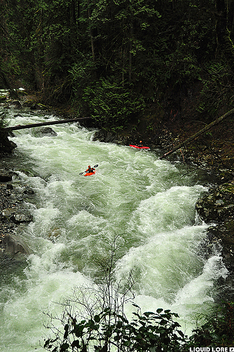
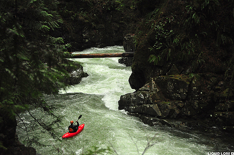
Below the falls are some open rapids. The canyon starts at the first sharp bend to the right with some fun warm up drops. Some of the rapids are difficult to portage, but you can almost always bail out up to a hiking trail on river left. The end of the canyon comes after a short but noticeable narrowing of the canyon walls.
Below the canyon are a few kms of open gravel bed rapids to the take out. Take out on the right immediately after passing under the highway 1 and Keith Road bridges where it is just a short walk up to the cars. The gauge is found here at the take out. Enjoy!