The Coal River is a tributary to the Liard, and drains from headwaters in the Selwyn Mountains in the Yukon. By the time the Coal crosses into BC, the landscape is a more subdued forested limestone plateau. Even though the takeout is on the Alaska Highway, this is a remote corner of BC, and the put in is less than 100km from Nahanni National Park. The section Coal River described here (Lower Coal) can be accessed off the paved Alaska Highway and a reasonable hike in, for a total trip length of ~120km, almost entirely in pristine wilderness. The guidebook Paddling in Yukon also describes a fly-in trip to the Upper Coal, which is above this section. After the trip, you can check out the big water class IV rapids on the Liard River, as well as the nearby hot springs.
Flows
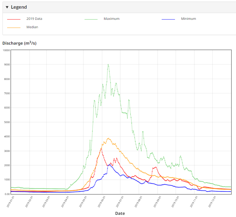
There is no gauge on the Coal River, but you can get a general idea of flows from nearby gauges (Liard, Hyland, Nahanni). Flows generally rise high off snowpack melt into May and June, before gradually dropping through the rest of the summer. An early July trip (LIARD RIVER AT LOWER CROSSING @ 4000cms) was a fun medium high flow for kayaking. The guidebook Paddling in Yukon also describes this as a great August or September trip, including for decked canoes (LIARD RIVER AT LOWER CROSSING median flow 1100-1700cms). The actual flow in the Lower Coal reach will only be an estimated ~5-10% of these values.
Daily Discharge Graph for LIARD RIVER AT LOWER CROSSING (10BE001).
Directions
Not exactly conveniently located, the Coal River is about 6 hours drive east of Whitehorse or Dease Lake on the Alaska Highway (BC97), or about 24 hours drive north of Vancouver. Once you are in this zone, however, logistics are about as easy as they get for northern rivers. The takeout is next to the paved Alaska Highway, just east of the bridge over the Coal River at km823, across from the gas station.
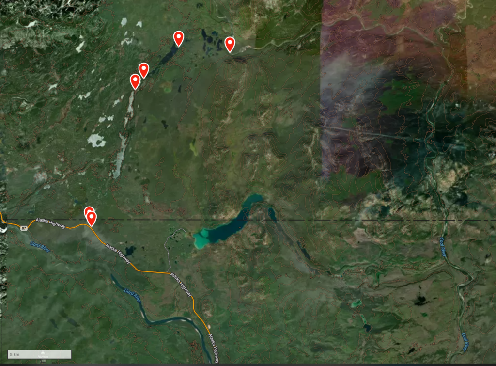
The crux of a trip on the Lower Coal may be finding the correct turn off the Alaska Highway to the put in. From the takeout at the Coal River bridge, drive west ~77km to a small bit of the old Alaska Highway on the north side of the new highway, around km900 (59.99509N, 127.60981W). This turnoff point is about 10km east of Contact Creek gas station, and 7km east of Contact Creek itself. Once on the old highway bed, quickly turn right (north) onto a dirt road. Follow this road ~15km NNE, ending at a nondescript turnaround near Pike Lake (60.09681N, 127.53799W). Early on in this drive, stay straight at a T junction; later, stay right at a Y. It's possible to get lucky and drive right to the trailhead, but a GPS, saw and 4x4 certainly can't hurt.
Route from the Alaska Highway to the lower Coal River via a dirt road, lakes, and portage trails.
River Description
The Lower Coal River is more of an adventure trip than a whitewater trip. The breakdown is roughly 10km portaging along a lake chain, 90km of flatwater, 10km of whitewater, and another 10km of flat ending at the Alaska Highway.
From the end of the 4x4 access road, hike ~200m north to the southern end of Pike Lake. From this point starting in the Coal watershed, it's about 10km or 5 hours of travel to the Coal River itself. However, the connecting creeks are mostly too small to paddle, so a combination of lake paddling and portaging is required. The portage route is on the north (river left) side of the Pike Lake outlet. Initially you can follow the lake/marsh, but then for the biggest portage the trail is up and out of the creekbed, and it's in bad shape (2022) with a lot of burned forest and blowdown. Look for sawed log ends to try stay on the trail. This tiring portage ends at a chain of five or more picturesque lakes. From this point it's best to paddle and drag your way down the creeks joining the lakes and the Coal River (60.11560N, 127.41788W). A map will be helpful in this section.
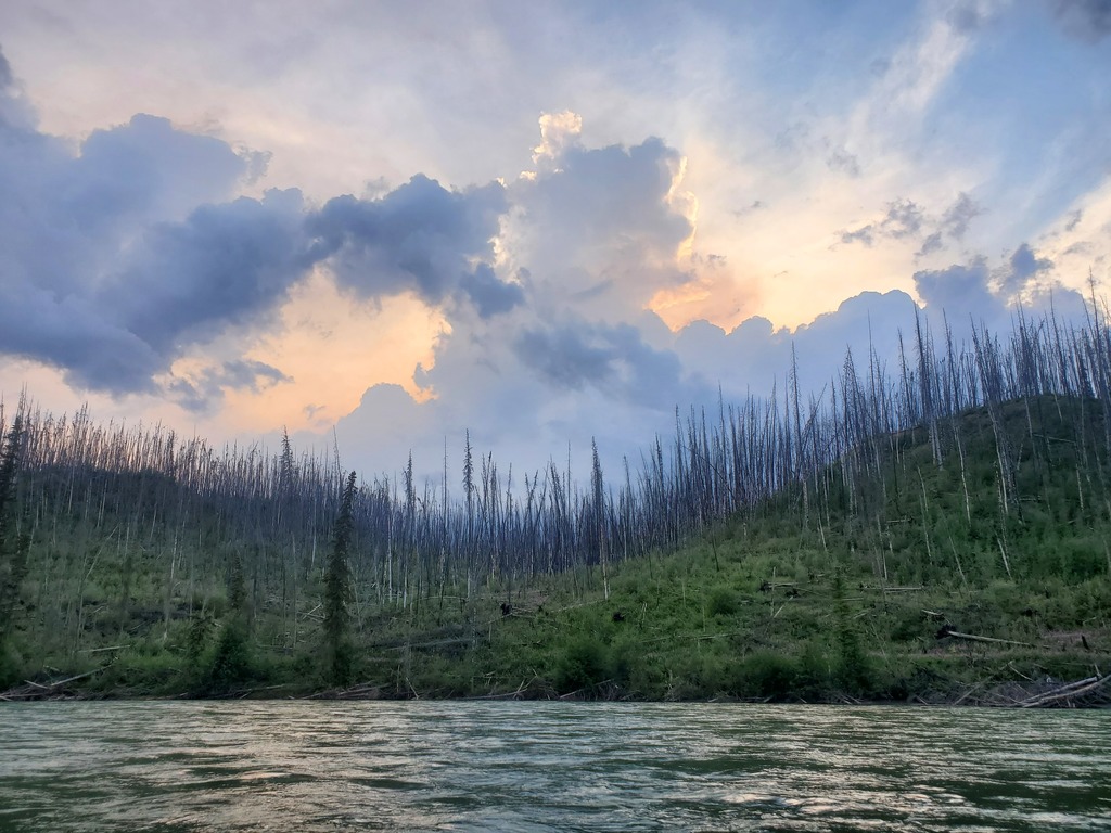
On the Coal River itself, the first couple days are FLAT, like read a book flat. Camping options are limited at high water but do exist, low water should have more sandbar options. A lot of this section has been completely burned.
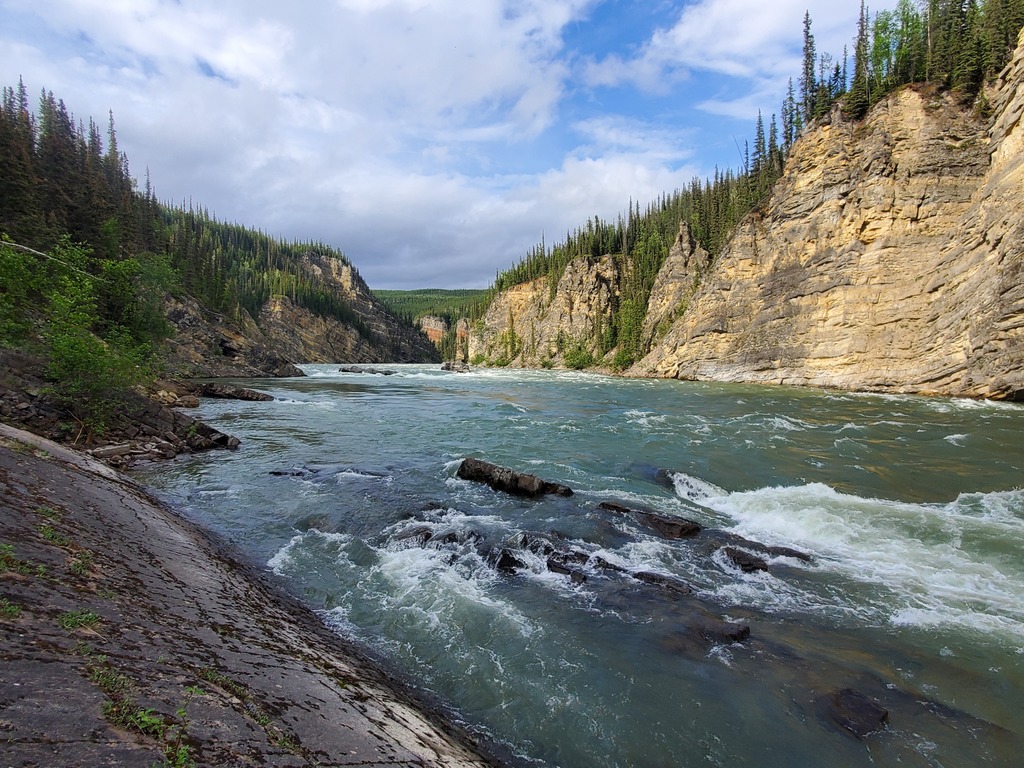
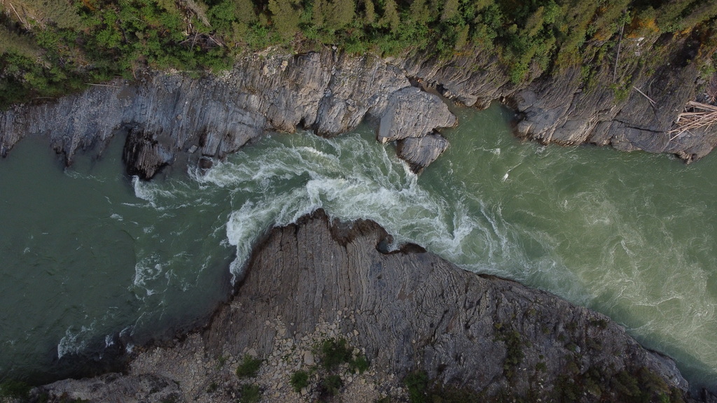
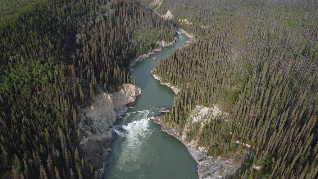
Eventually, after a few sweeping river bends, the canyon entrance appears to the east. Starting at a tufa spring, several class II-III rapids continue for about 10km. The nature of the whitewater is mostly ledges and separated channels, formed by layered sedimentary rock. Some rapids are quite long, and portaging would not be practical. As the river bends back to the west, there is a constriction rapid (IV) that can be portaged on the left. Shortly after is the final ledge (IV), which can also be portaged on the left with a bit of sketchy rope work.
There's a great camping spot at the end of the canyon and then a quick float out to the highway. Or continue into the Liard to run the Portage Brule Rapids (IV).
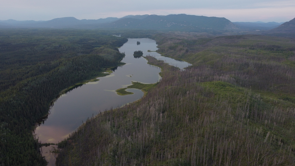
Pike Lake at the start of the portage route into the lower Coal River.
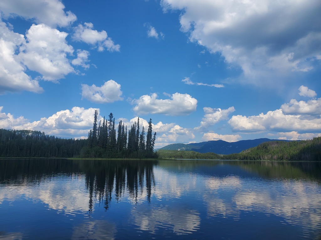
Pike Lake.
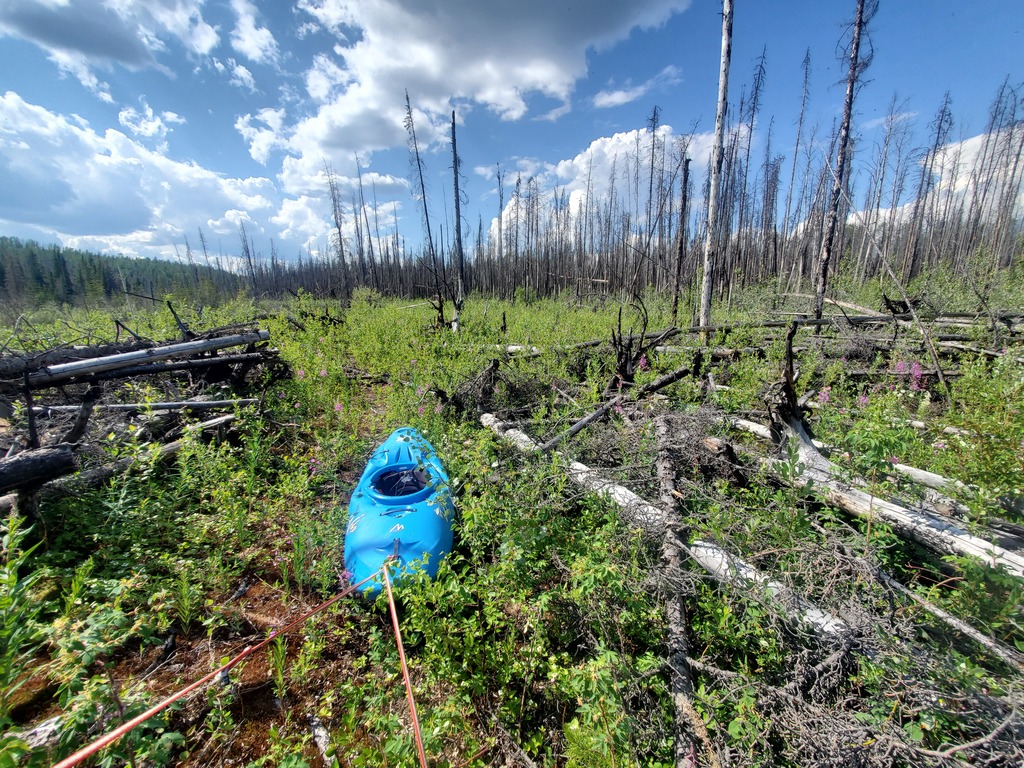
Crappy bits of the portage route.
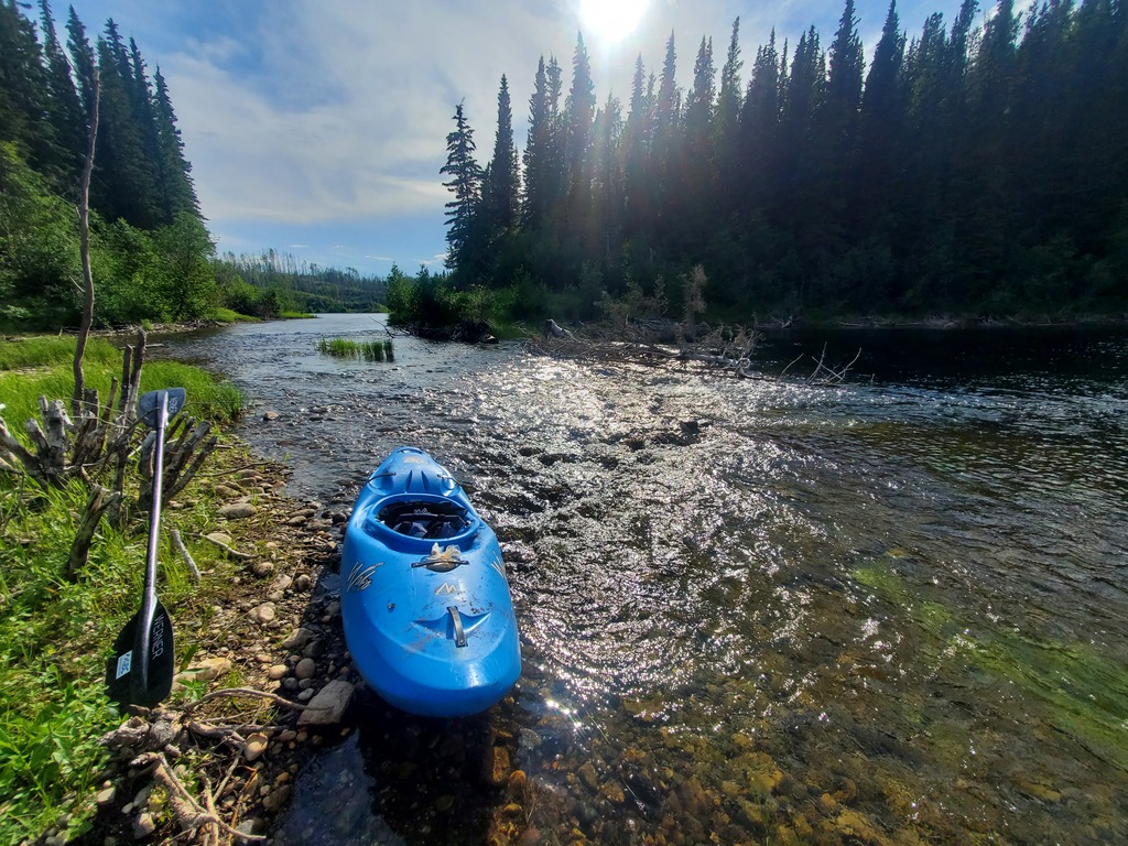
Scenic bits of the portage route.
Onto the Coal River itself.
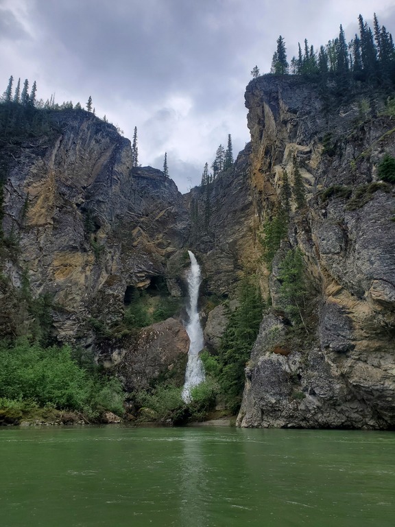
A waterfall partway through the flatwater section.
Tufa spring at the start of the whitewater canyon.
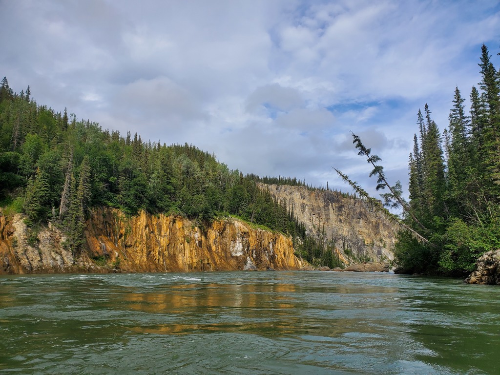
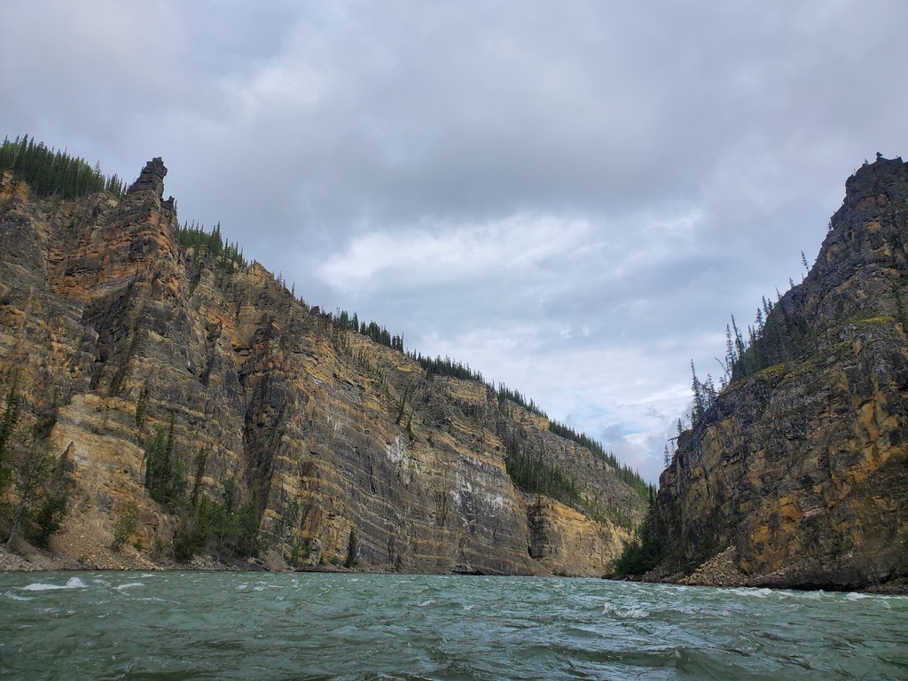
Lower Coal Canyon.
Lower Coal Canyon.
Constriction rapid (IV) near the end of the canyon.
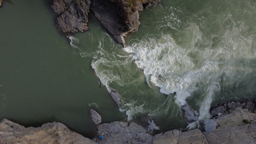
Final ledge (IV) at the end of the canyon. Kayak onshore for scale.
Looking back up at the exit of the Lower Coal Canyon.