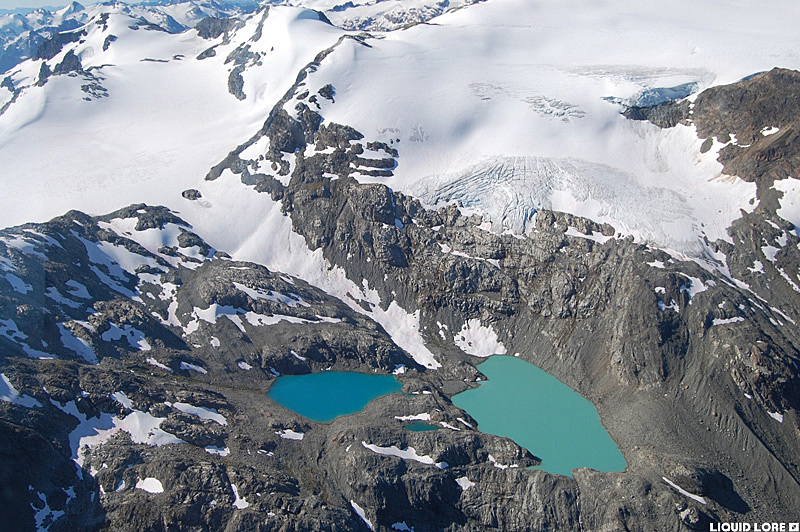
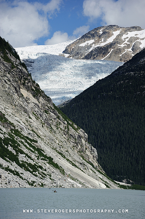
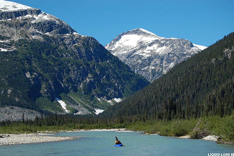
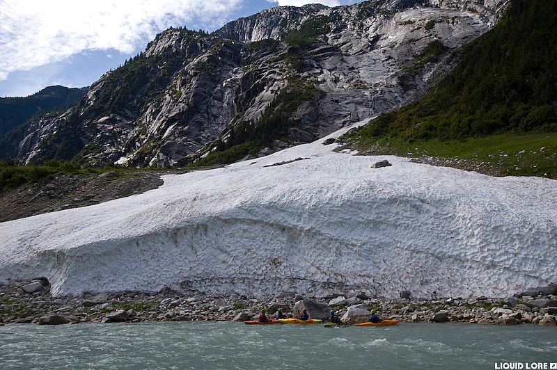
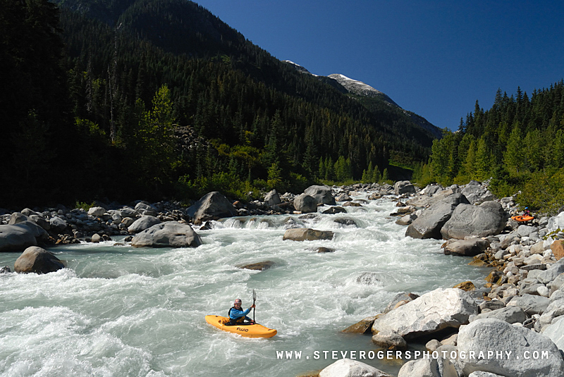
The Clendinning is one of the premiere overnight kayaking trips in Squamish-Whistler zone. This river is a great 2 day run that can be accomplished easily in a normal weekend, and though it doesn't have the hardest or the best whitewater in the area, the high mountain scenery is in a class of its own. The trip can be extended by taking an extra half day to paddle over to the receding Clendinning Glacier where you can hike up, over and around the true source of the river.
Flows on the Clendinning are easy to determine by using the Elaho gauge - the Clendinning is a major tributary of the Elaho. The normal season is in late summer and early fall - it is too high for much of the summer and the put in lake likely remains iced over when it's still low enough in the spring. 60-70 cms on the Elaho is minimal - there will be a lot of rocks, particularly on the first day. Optimal medium range flows are 80-150 cms. High water trips have been run with minimal portaging but the difficulty increases accordingly - expect a class V trip as levels approach 200 cms - it is unreasonable much above this level. This river tends to cause epics - don't underestimate it.
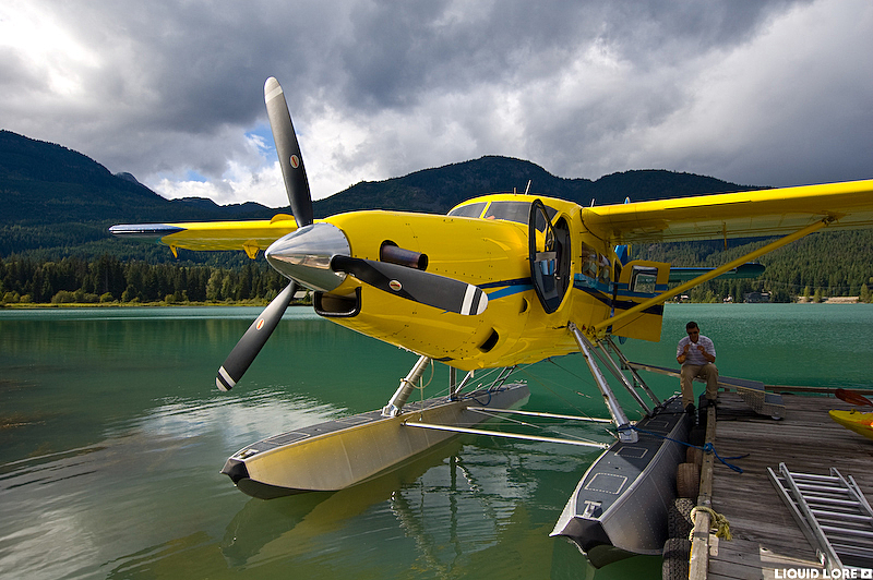
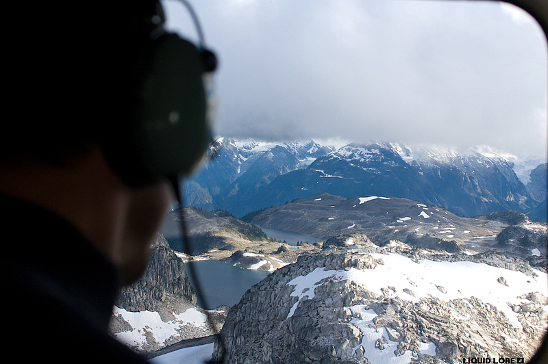
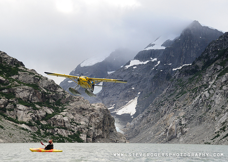
Getting to the put in is not as simple as it used to be before Whistler Air changed ownership. You have to fly in to Clendinning Lake, but the obvious choice Whistler Air/Harbour Air usually won't do the flight any more. Reports say that flying with Tyax Adventures currently presents the most affordable/only possible option, but do some research for other providers. The shuttle to the take out is long, especially if you have to return to Whistler for vehicle recovery. The take out is somewhere along the Elaho FSR, far up the Squamish and then the Elaho valley, where the road is close to the river. The Clendinning/Elaho confluence is around the mile 60 marker - the road is far from the river at the confluence so you'll have to find a spot somewhere lower down to park your vehicles - there are several options. It is at least 2 hours from the take out to Squamish.
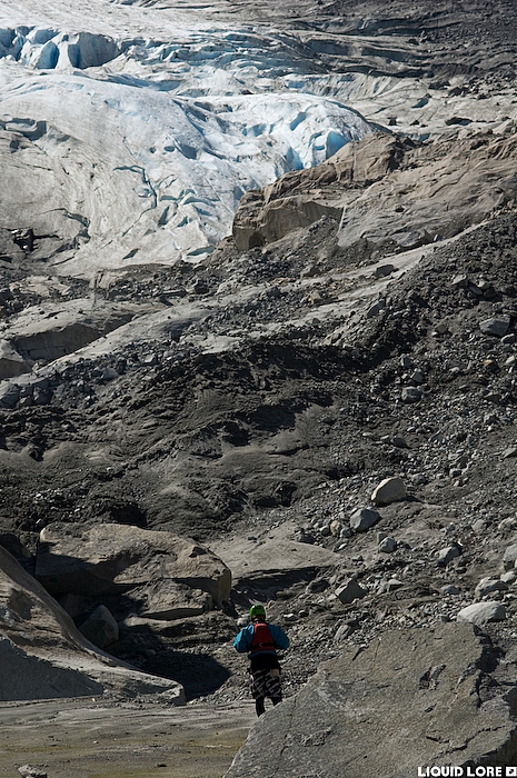
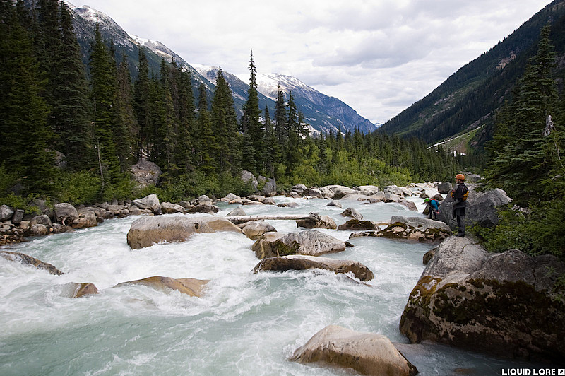
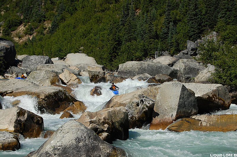
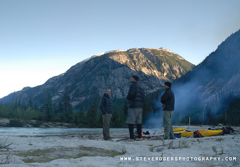
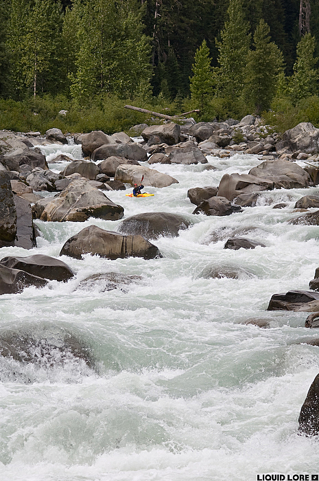
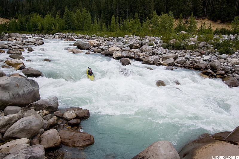
When you fly in, give yourself enough time to paddle over to the Clendinning Glacier to do some hiking. There is nice camping on Clendinning Lake and the mountain scenery is great. Out of the lake the river is small (and manky if it's low) until the first major tributary. The whitewater ramps up slowly - you will eventually reach the first steep section that starts with a burly 6 foot ledge. Run it or portage on the left and immediately go over to river right. The next 100 meters is a manky boulder choker that can be snuck down the right side - a quick lift over the most choked out portion of the section gets you back on the water with almost no portaging. Some groups have spent hours portaging this whole section.
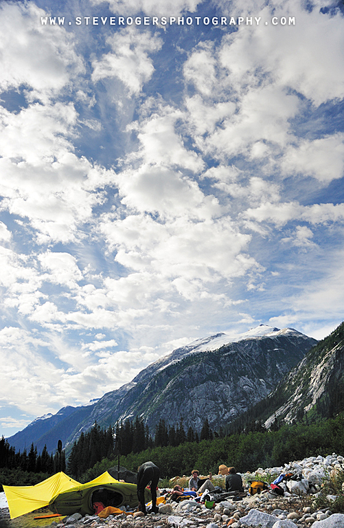
The whitewater continues for another few kilometers, eventually giving way to flatwater - this flatwater is the obvious spot to break for the night and there is ample good camping. Giving yourself 3 to 5 hours should be more than enough time to get through day 1.
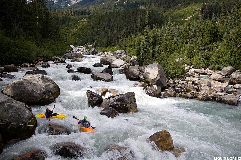
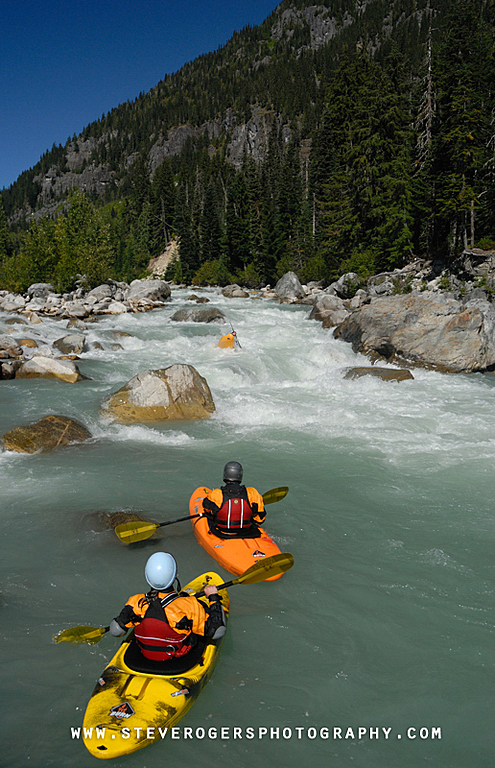
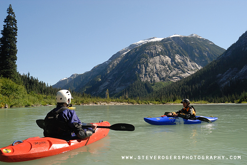
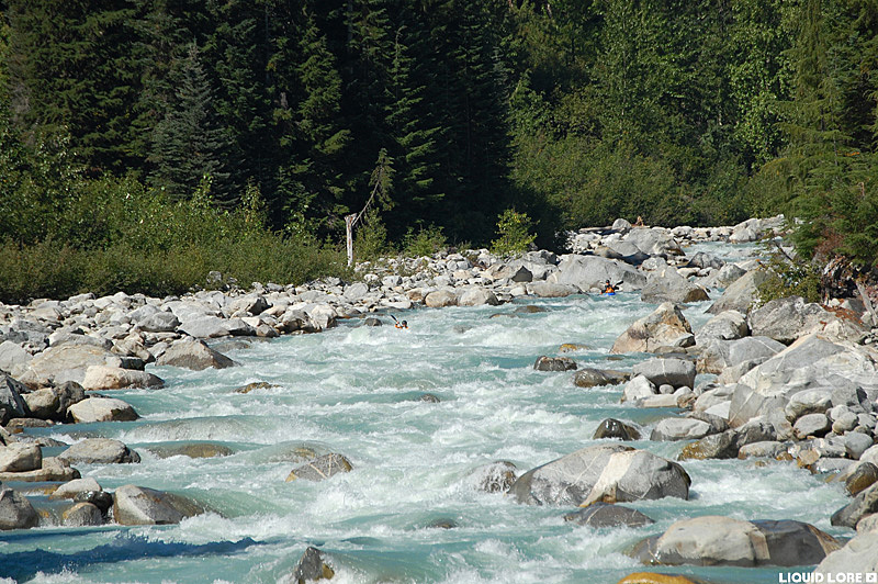
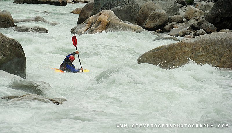
Starting slowly, the whitewater on the second day is much better than the first. Things are generally very continuous boulder rapids that build in difficulty until the river suddenly flattens out to easy busy water and finally flat water down to the confluence with the Elaho - expect 3 to 6 hours to get through day 2. The volume doubles once you get on the Elaho and fast current will quickly bring you through the wide valley down to wherever you parked the cars and the inevitable bumpy drive back to civilization.