Mostly scoutable and portageable with some work, except for the lead in to the crux rapid.
Time
4-6 hours including scouting
When to Go
Rainfall October-March, snowmelt April-June
The Upper Chehalis offers a full day of adventure boating, all within striking distance for a day trip from Vancouver. A series of class III-IV canyons is punctuated by powerful class IV-V ledge holes and one steep class V boulder rapid which is tricky to portage. The whitewater may be a little inconsistent, but that is made up for by the beautiful rainforest canyon scenery and several unique rapids.
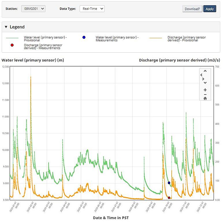
The Chehalis River is a free flowing, low to moderate elevation watershed that is buffered by the respectably sized Chehalis Lake. While there is a modest snowmelt season from April to June, it is during the fall and winter that big rainstorms and atmospheric river events truly bring this watershed to life. At the peak of a rain event the Upper Chehalis will likely be too high to paddle, but it should drop in during the following days. With a tolerance for low water, it's possible that this is one of the last sections to drop out in the Fraser Valley, since most of the water comes from the lake at low flows. A recommended medium level is 9.7m on the staff gauge. The run has been paddled at 9.3m and reported to be more manageable. A level of 10.0m was medium-high for the first bit out of the lake, and would likely be doable for the remainder below the bridge, if you are willing to deal with the commitment issues of the crux rapid. Keep in mind that Statlu Creek confluences between this section and the gauge.
2020 hydrograph showing the dynamic nature of the Chehalis watershed.
Access is often possible year round, although some years the logging roads on the shuttle may be snowed in. The put in is only at 250m elevation, and the highest point on the shuttle is just below 400m. To get to the recommended take out from Vancouver, follow Highway 7 east to Harrison Mills, turn left at the Sasquatch Inn onto the paved Morris Valley Road, and follow to the Chehalis River Recreation Site on the left just before a bridge over the river. If you have enough daylight, it's better just to combine your paddle with the classic Lower Chehalis (III) and take out here on river right near the gauge. Total driving time from Vancouver to the takeout is 1.5-2 hours. To get to the put in, backtrack to just before Highway 7 and turn right (North) onto the Chehalis FSR. After ~15km you will cross a bridge over Statlu Creek, stay right after the bridge. After climbing a small hill, the first logging spur on the right ends at a trail that can be used as an alternate take out for the Upper Chehalis; however, it is difficult to spot from the river and not really worth the steep carry out. Carrying along the Chehalis FSR to ~20km, stay right at a Y to follow the Chehalis-Fleetwood FSR (unsigned?) down to a bridge over the river. Take a quick look upstream here to scout a natural weir hole. After the bridge, stay left onto Chehalis South FSR (unsigned?), up a steep hill, and down the first branch to the left to a neglected campground near the lake. The shuttle should take about 1 hour each way.
Paddling out of the lake, a short section of class II quickly leads to one of the optional class V rapids. It's a tricky entrance into a steep ramp ending at a boxed in hole. Many people will portage this drop, so while scouting on river left leave your boats on a gravel bar ~50m above the drop, across from a small creek river right. To portage, follow this creek up through some devils club, looking for an opening to the left into a crack, down which you can lower boats back to river level. The first small ledge after putting back in has a bit of commitment factor, but it usually goes much better than it looks. Downstream is a beautiful class III-IV canyon, most of which can be boat scouted while being mindful for wood. After ~2km, get ready to run the weir hole that you scouted from the bridge. Swimmers and gear often float out into the large pool below the bridge, which makes a good bail point if you've had enough. Continuing below the bridge, the river progressively builds from class II to III to IV over the next ~4km. At some point, the gradient will markedly increase into the crux rapid of the run. This steep class V boulder rapid can be portaged over boulders on the right; unfortunately, there is no obvious way to scout or access the start of the portage without first running part of the rapid. One option is to do a short carry on river left past the entrance, and complete a pushy ferry through boulders to the right side. There is also a report of this rapid being portaged somewhere high on the right side. At this point you are in a >100m deep forested canyon, and while not totally boxed in, the commitment factor is not trivial. Immediately below the steep boulder rapid, get out on river left to take a look at an easily portageable, sweet 3m water boof into a pocket hole. Mellow water leads to the last big rapid on the run, a nice class IV boulder garden. At this point, either look for the upper takeout that you would need to have scouted beforehand, or preferably just paddle out through the classic Lower Chehalis (III). In total you will have paddled ~16km: Chehalis Lake to bridge (~2km), bridge to Statlu confluence (~6km), and Statlu to take out (~8km).
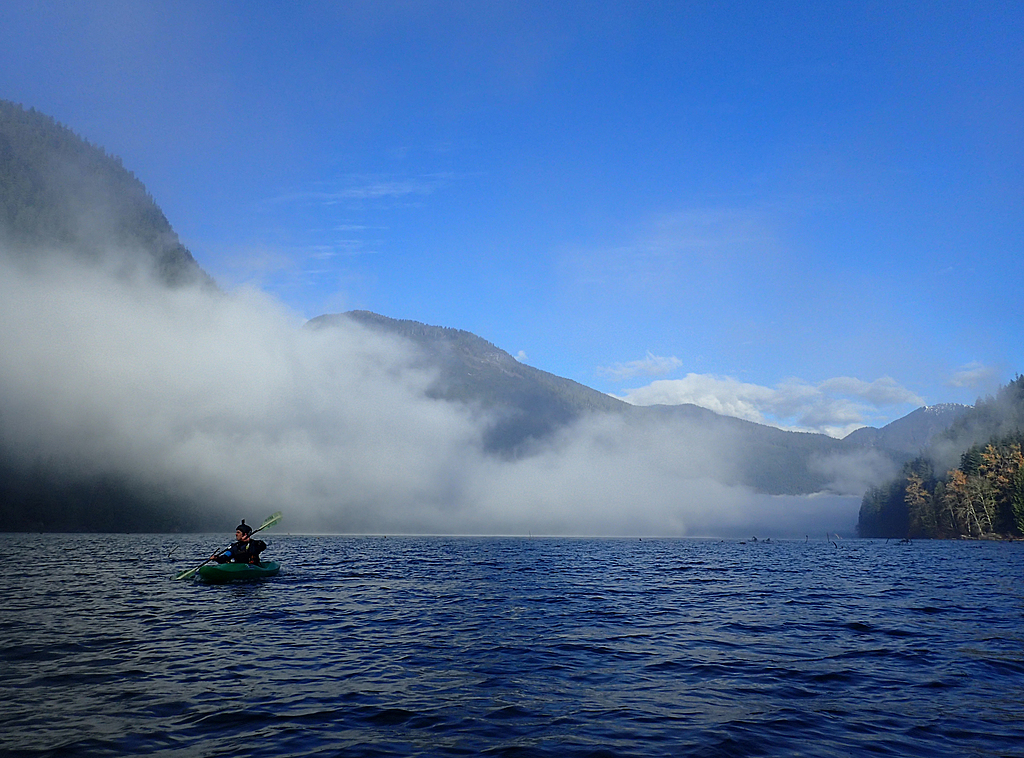
Put in on Chehalis Lake
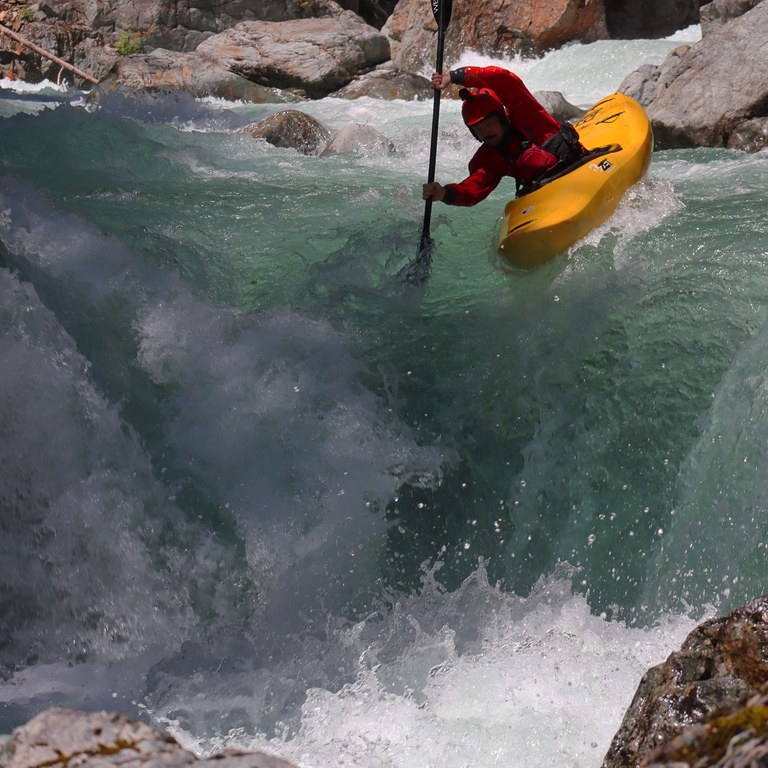
"Holy Roller," an optional class V chute immediately below the lake. Photo Adam Frey
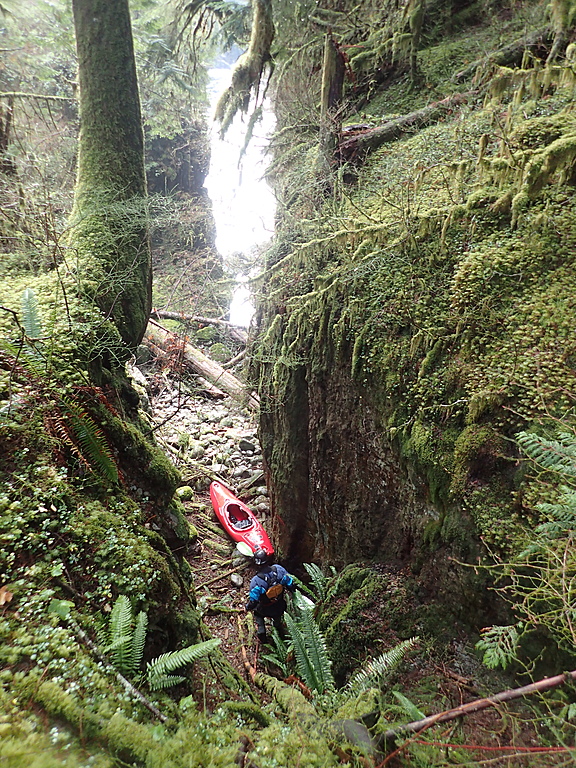
Portaging the first rapid down a crack on river right.
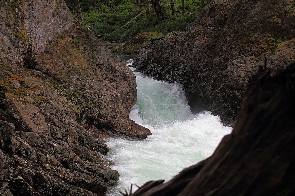
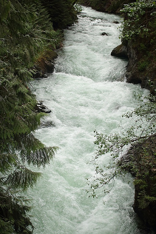
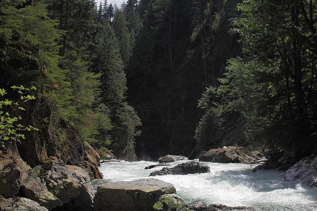
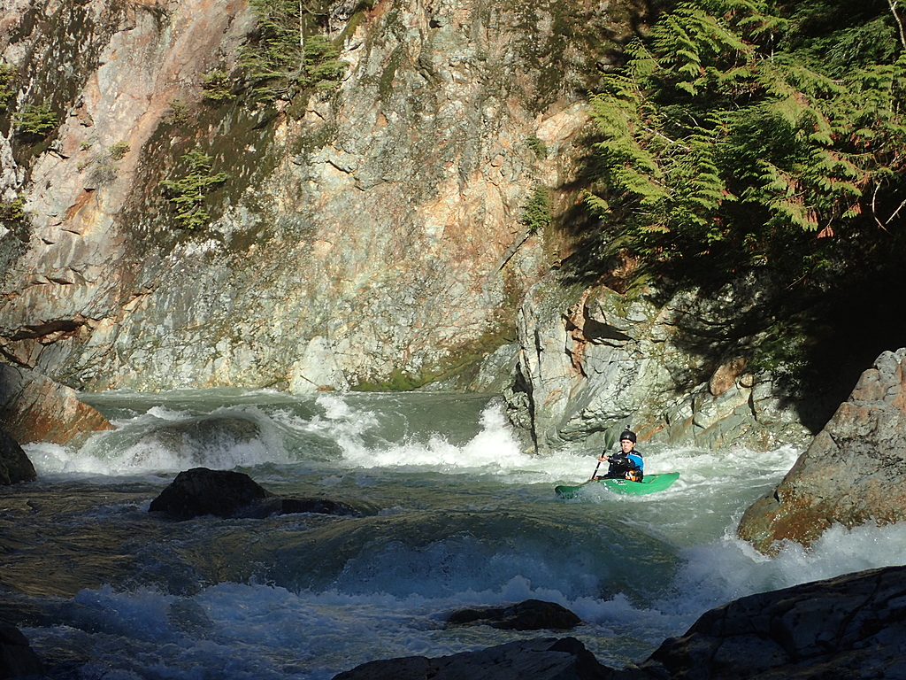
Scenic class III-IV canyons above the bridge.
The natural weir hole just above the bridge. Photo Adam Frey
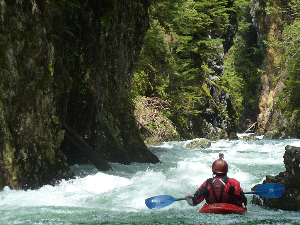
The hairy ferry (left to right) above the crux rapid, a steep class V boulder garden. Photo Adam Frey
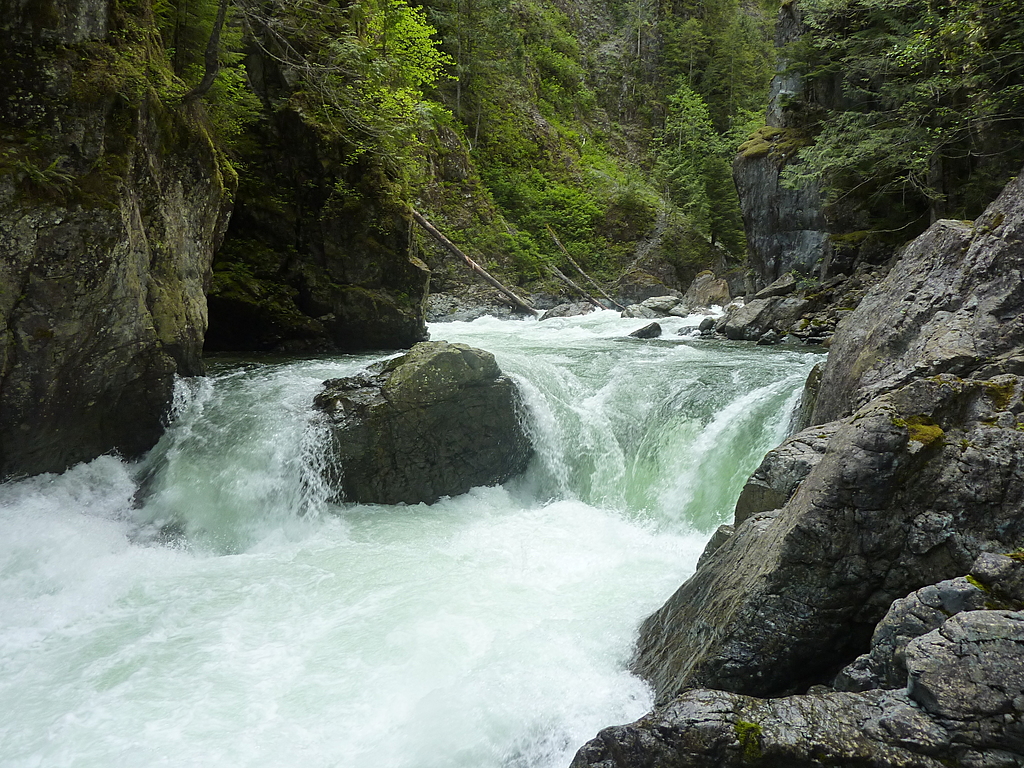
"Chehalis Falls," a nice 3m water boof immediately below the crux rapid.
Chehalis Falls
Part of the nice class IV boulder garden.
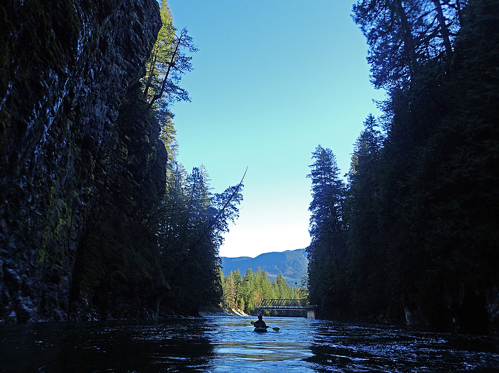
Exiting from the Lower Chehalis into the Fraser Valley.