The best intermediate run in the Fraser Valley, down a wilderness canyon
Class
III-IV-
Scouting / Portaging
The IV- rapids can be scouted and portaged at low water
Time
1 hour at high water; 4 hours at low water with scouting
When to Go
During or after rainfall October-March, snowmelt April-June
The Chehalis River is arguably the best intermediate section in the Fraser Valley. While the Chilliwack may be better for skills progression and easy laps, the Chehalis offers a scenic wilderness canyon experience runnable at a wide range of flows and seasons, outside of the dry summer months. Uncertainty about flows used to make the drive out here a gamble, but with the gauge now online hopefully the river gets enjoyed more than ever before.
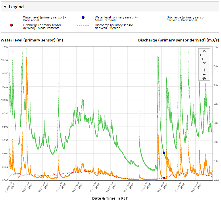
The Chehalis River is a free flowing, low to moderate elevation watershed that is buffered by the respectably sized Chehalis Lake. There is a modest snowmelt season from April to June, but later in the spring Statlu Creek will dry up and the alternate put in on the Chehalis River will be the better option. There is a report of using this put in at a very low level of 9.08m (~15cms). A better entry level low-medium flow is around 9.5m (~35cms). At this level the Chehalis is class III with one IV- rapid; III+/IV- if starting on Statlu Creek. Above 10.0m (~90cms), the run transforms into excellent read and run bigwater class IV, where boat recovery could be very challenging. At 10.5m (~160cms), the boils will be getting bigger but expert boaters will still be having fun. As flows approach 11.0m (~300cms), the river remains runnable but is essentially in flood with the associated serious hazards. It is during the fall and winter that big rainstorms and atmospheric river events truly bring this watershed to life; you'll need a big warm winter rain for flows to bump above 10.0m. The water colour at the takeout can suggest which branch is providing more water: Chehalis (clear green), and Statlu (brown tea).
2020 hydrograph and median for CHEHALIS RIVER NEAR HARRISON MILLS (08MG001)
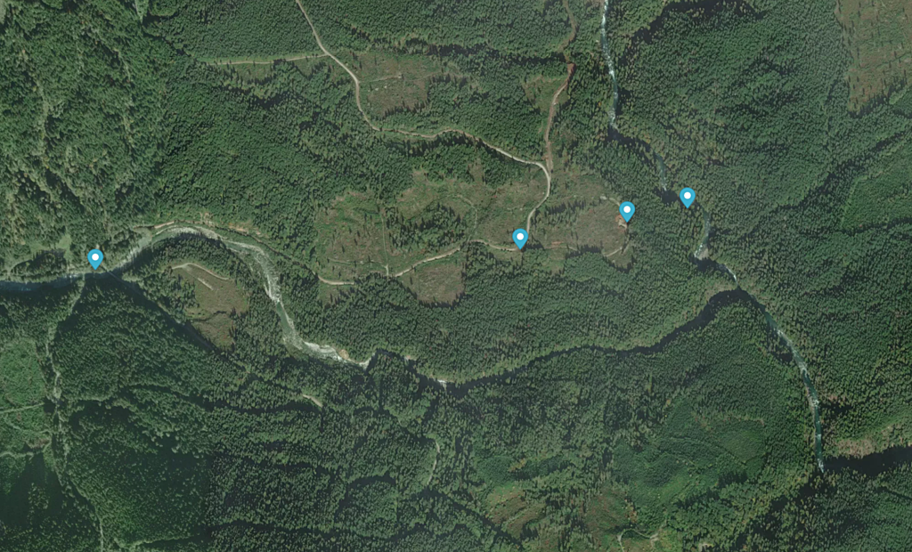
Access is often possible year round, although some years the logging roads on the shuttle may be snowed in. The put in is only at 150m elevation, and the highest point on the shuttle is just below 300m. To get to the take out from Vancouver, follow Highway 7 east to Harrison Mills, turn left at the Sasquatch Inn onto the paved Morris Valley Road, and follow to the Chehalis River Recreation Site on the left just before a bridge over the river. The usual take out is on river right just above the bridge; try to park out of the way as this is a heavily used area. The gauge is just a short walk upstream. Total driving time from Vancouver to the takeout is 1.5-2 hours. To get to the put in, backtrack to just before Highway 7 and turn right (North) onto the Chehalis FSR. After ~15km you will cross a bridge over Statlu Creek, where the most common put in is upstream of the bridge on river left. To get to the alternate put in on the Chehalis River, stay right after the bridge, drive up a a small hill for ~1.6km, turn right on the first logging spur and follow ~400m to a small gravel pit, where a steep trail leads down to the river. The shuttle should take about a half hour each way.
Close up of the put in options: Statlu Creek from the west, and the Chehalis River from the north.
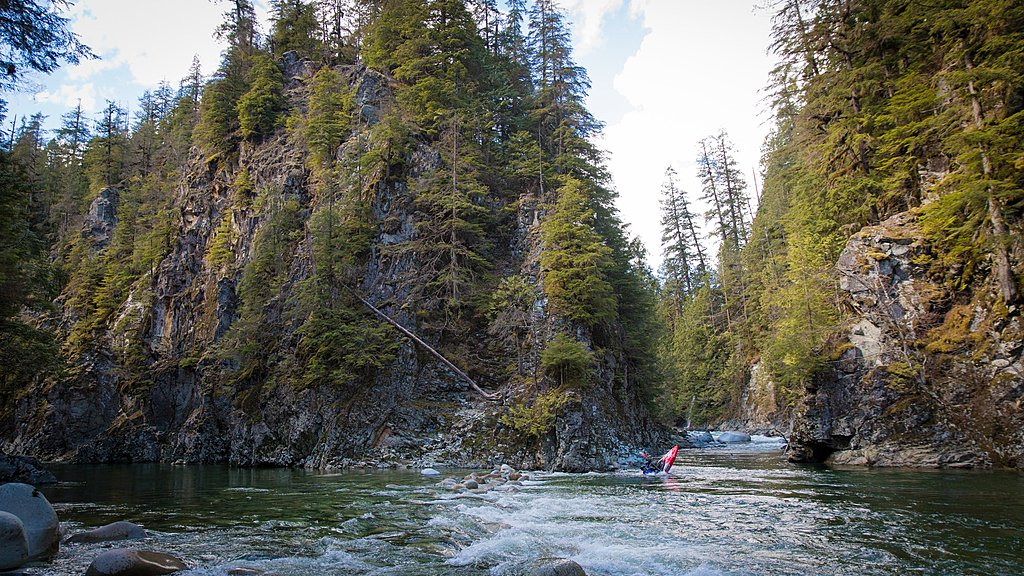
At the Statlu Creek put in bridge, the rapid just upstream is indicative of the difficulty down to the confluence: moderately steep boulder bars with the occasional hole to dodge. Further downstream there are some canyon walls in play, but no bedrock rapids. There is one long rapid confusingly also known as 'landslide' (there's one on the Chehalis too), which is often a site of carnage but usually fairly easy to collect gear at the bottom.
If Statlu is too hard for your group (III+/IV-), or flows are too low, the alternate put in on the Chehalis River is a good option with only a couple class III rapids to reach the confluence . Below the confluence, the river is predominantly class III pool drop, on the first major left bend beware a nasty pour-over in the middle of the river, it's hard to read from above so we suggest sticking to the outside of the bend and taking eddies to the right.
Below this after a right bend there is the old landslide rapid, this changes frequently and after a few years of having a crux move in it, the rapid changed in a big flood and is now read and run, it's also not really possible to portage this rapid unless you eddy out half way down it now, by which point you can see the rest of the rapid anyway.
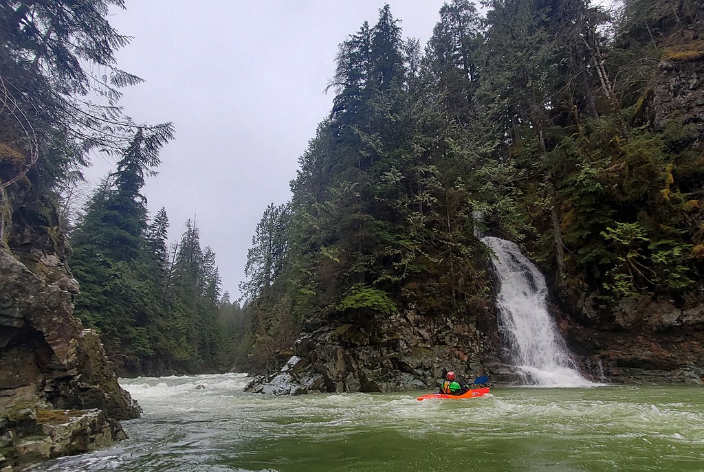
One of the later rapids named Grayhound has a very large hole on river left at the bottom but is easily avoidable.
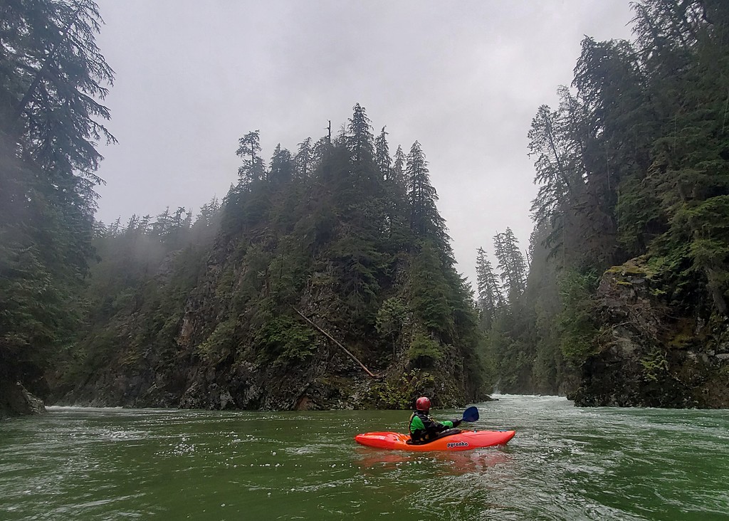
At high water (over 10.0m), the whole run turns into a quality fast and boily class IV(+) section with the occasional monster hole to dodge; scouting and portaging are often not practical. The main hazards are boily pocket eddies against headwalls, especially the one river right at the base of the landslide rapid. The run is perhaps best at 9.8m as above this many features also wash-out.
No matter the flow, most of the run is far from the road with limited hike out options. Non shuttle drivers will often want to stay warm with dry clothes and a pint at the Sasquatch Inn after the run.
Pushing low water limits on Statlu Creek. Photo Dave Wortley.
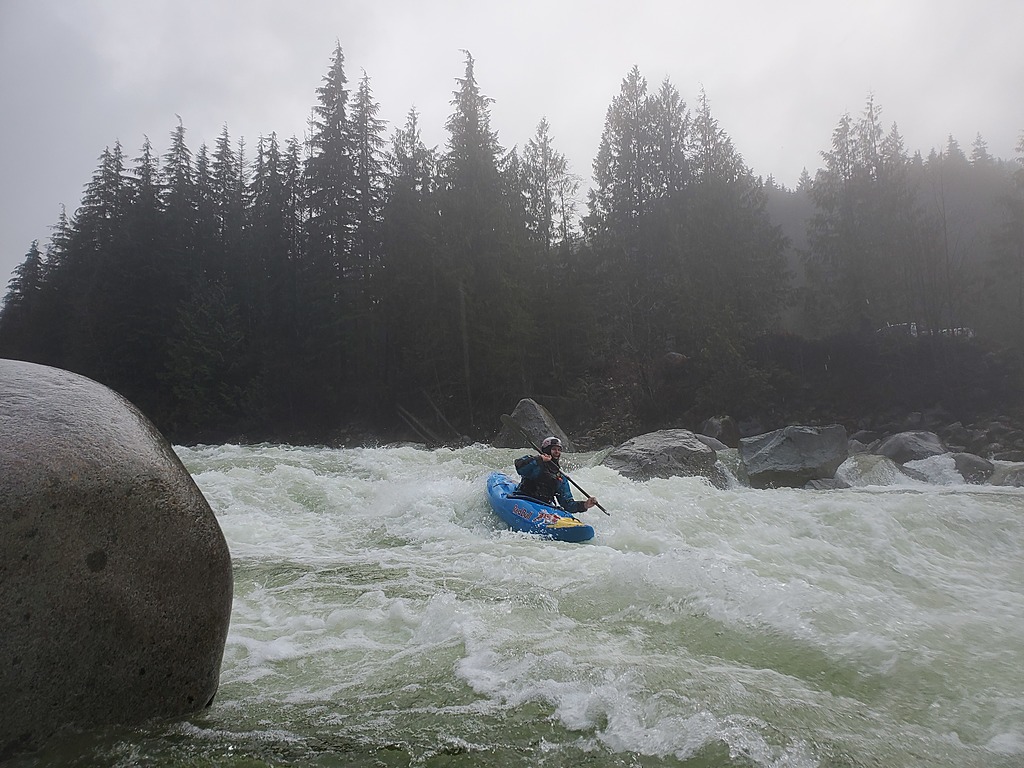
The put in rapid on Statlu Creek at a medium high flow.
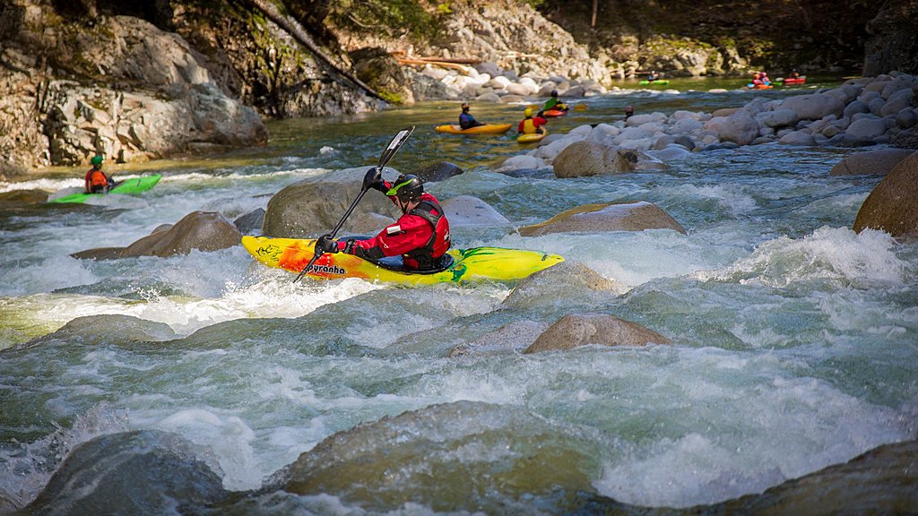
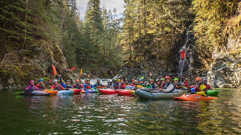
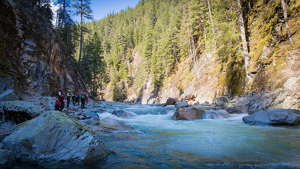
The Chehalis River is a popular choice for the Vancouver Whitewater Club. Photo Dave Wortley.
Statlu Creek at a medium high flow.
Statlu-Chehalis confluence at very low water. Photo Dave Wortley.
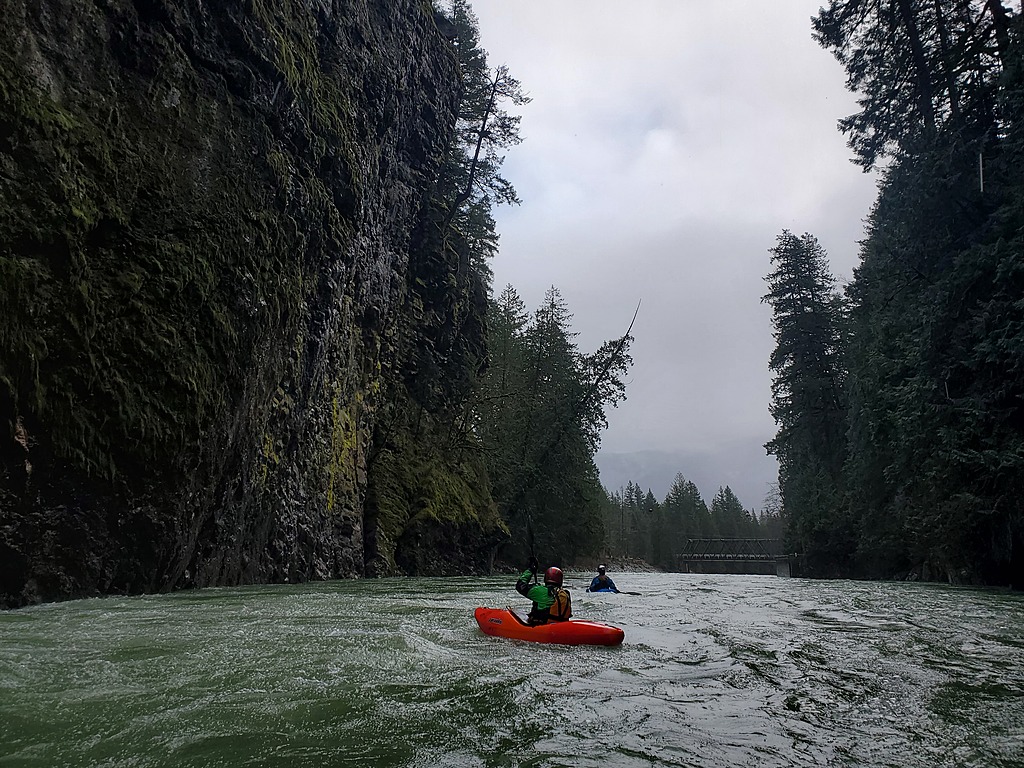
Statlu-Chehalis confluence at medium high flow.
The old (now dramatically different and easier) Landslide Rapid. Scouting the crux landslide rapid at low water. Photo Dave Wortley.