Gauge info: if you have previous experience on the Cheak, note that the gauge changed sometime before the 2015 season and now reads about 0.1 m lower than it used to. Levels are adjusted appropriately on this page.
The Cheakamus River is synonymous with Whistler kayaking, largely because of the ultra-classic Upper Cheak section near Function Junction. Unbeknownst to many and maybe avoided by others because of tales of epic log jams and the Whistler waste water treatment plant, there is an equally fun and perhaps more adventurous stretch that departs from the Upper Cheak take out and ends at the confluence with Callaghan Creek. It's a little bit harder, a little bit more committing, it has a great waterfall for those so inclined and there is a lot more wood in the river. You can run it as a stand-alone section of whitewater if you want something short, but it's best combined with the Upper Cheak to make a great hour or two of river running.
The Cheak has an online gauge. The gauging station is at the junction between the Upper and Balls sections and it is accurate. Alternatively, you can physically look at the gauge. Low water is 2.1 m, and the upper limit is whatever you're comfortable with. Prior to 2013 this section was not runnable at high water because of a log jam that couldn't be paddled under, but it washed away, opening the run to all water levels.
Access is straightforward. The put in is the same as the take out for the Upper Cheak (it's best to combine it with the upper). West of Whistler, turn south at the Function Junction exit off highway 99. Follow the river left logging road (Cheakamus Lake Road). After you cross the river to the left take a left turn in to a large parking area/trailhead and the gauge site (down the trail). The take out is west down highway 99 from Function - just before you cross over Callaghan Creek, the Daisy Lake FSR turns off to the left. Follow the signs for Whistler Bungee. You can take out at the bridge over the Cheak, or at the Cal-Cheak North camp site.
On the water there is not much to speak of at the start. Splashy water floats you past the Whistler waste water treatment plant (think sewage) - although the water quality does drop when you get past here it is still much better than many places that people have been known to go kayaking.
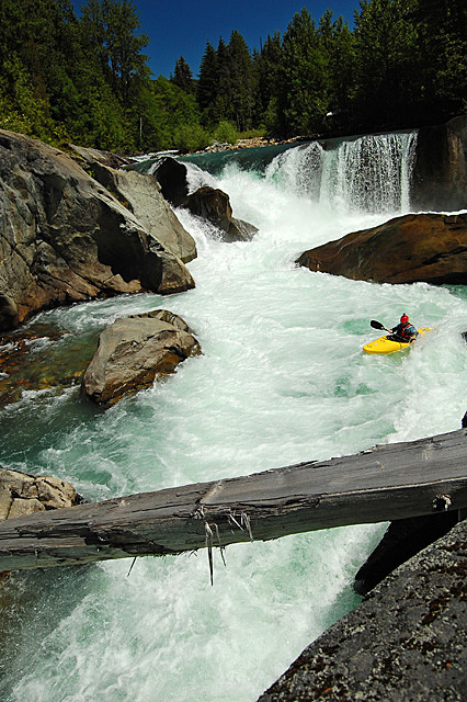
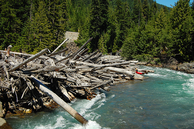
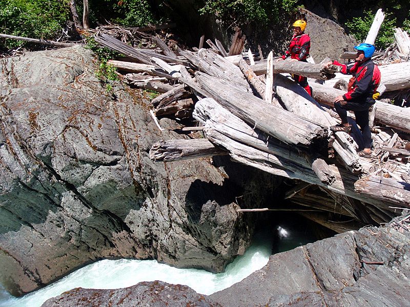
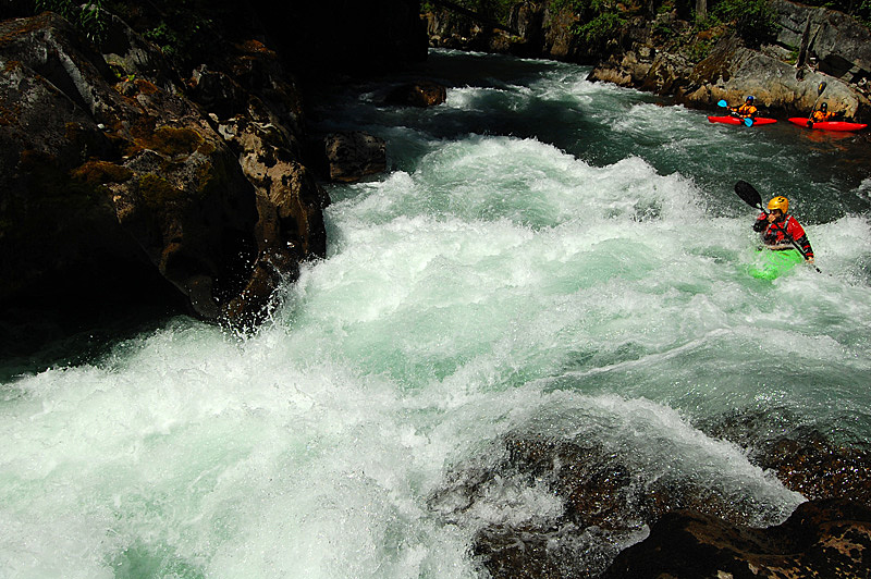
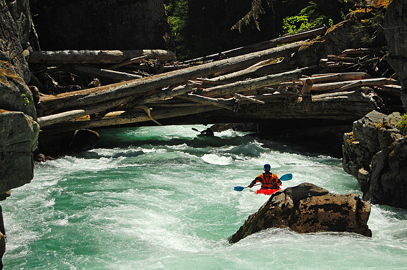
More easy river leads into the first rapid - Balls To The Wall. It's a sweet, easy waterfall with a tricky run out through a boily mini canyon that has a very dangerous pocket on the right wall at higher flow. After this great warm up, a few bends in the river brings you to the first major log jams - right now there are big log piles on either side of the river - the first rapid, squeezed between the wood, is runnable but is pretty high consequence as the next rapid is fully (and maybe permanently) clogged with wood. Portaging is easiest on the right, and it has a tricky put in.
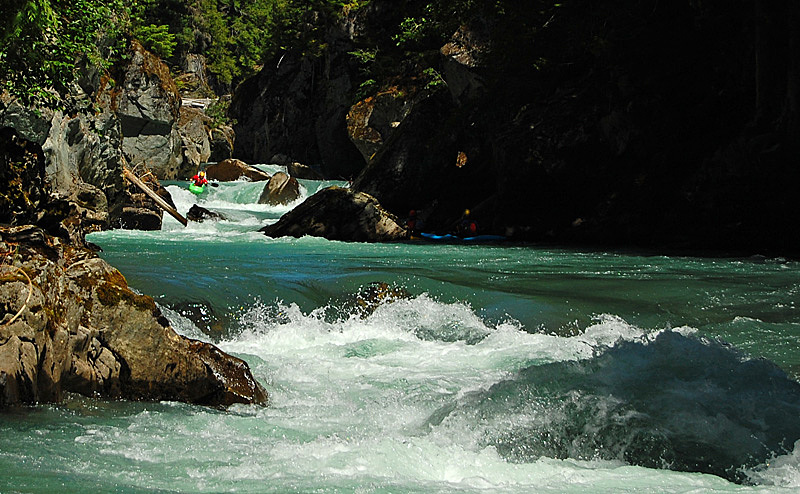
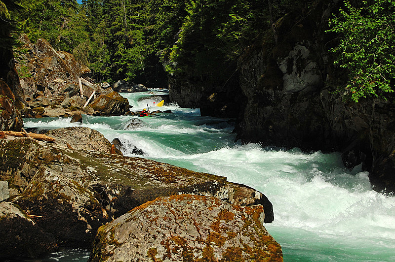
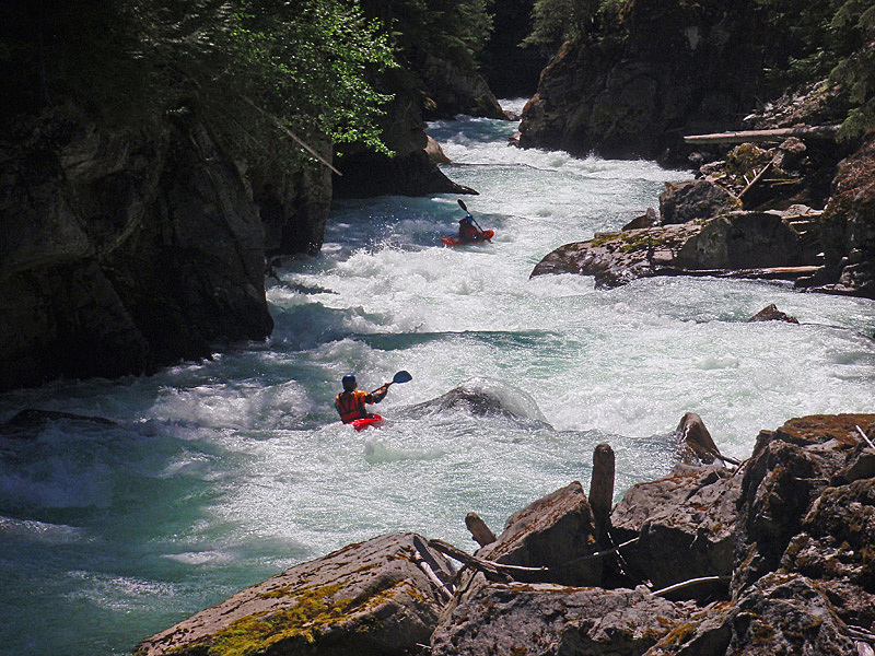
Shortly below the portage is boogie that leads past the site of the old log jam. After a strong boof over a fairly big hole, the walls fall away and the river eases to class II for a short distance. When the walls close up again get ready for the big finale rapid, and a tedious paddle out through a braided section that collects wood.