The Bowser River is all about getting up close to some huge glaciers. Think of it as a budget Alsek trip, located just off the highway with no flight or permit required. There is not much whitewater, and the price of admission is a 25km paddle out across Bowser Lake. Also, while the mountains and glaciers surrounding the river are some of the most dramatic in BC, the wilderness feel is reduced by ever present mining access roads and powerlines. This trip should be extended by continuing into the classic Bell Irving-Nass (III-IV).
The Bowser River flows directly out of several large glaciers and icefields, and at many times of year is likely the largest tributary to the Nass River. The Nass gauge will give an indication of levels, but these readings will be buffered by Bowser Lake. If the Nass is above 800cms, there should be enough water to get through the braids in the upper river. On hot summer days, the upper Bowser probably has a massive diurnal spike. This section should remain runnable at high water, although the crux rapid will be pretty exciting. The water is frigid, pogies are recommended.
The Bowser River is located near Meziadan Junction, BC, about 3 hours drive north of Terrace on Highway 37. Pick a takeout at either the Meziadan Bridge on the Nass River, or the Bell 1 Bridge on the Bell-Irving River. For the put in, take Highway 37A west to Stewart, and continue into Hyder, Alaska. There is no US Customs presence, but there is Canada Customs to re-enter Canada. From Hyder, the Granduc Road continues across another unmarked crossing back into Canada, past the Salmon Glacier, and ends near the abandoned Granduc Mine. This is a public road, but there may be active mining operations in the area to avoid. At the Granduc Mine, find a way down the old mine dumps to the lake to put in. To do this route, you will need to clear it in advance with Canada Customs. If this doesn't work out, it's a short heli from Stewart to the put in. The entire river trip is in BC, it's only about 20km of the shuttle that is in Alaska.
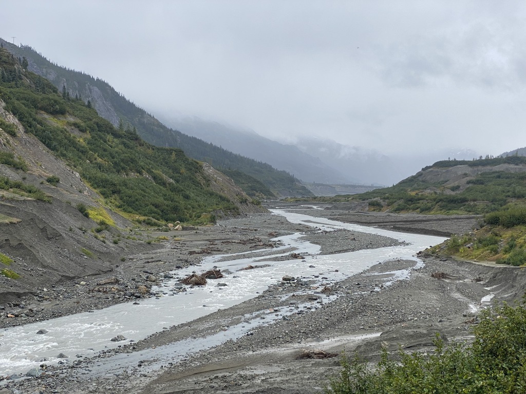
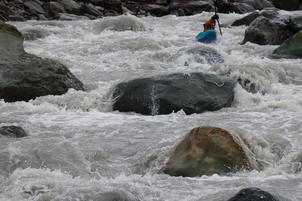
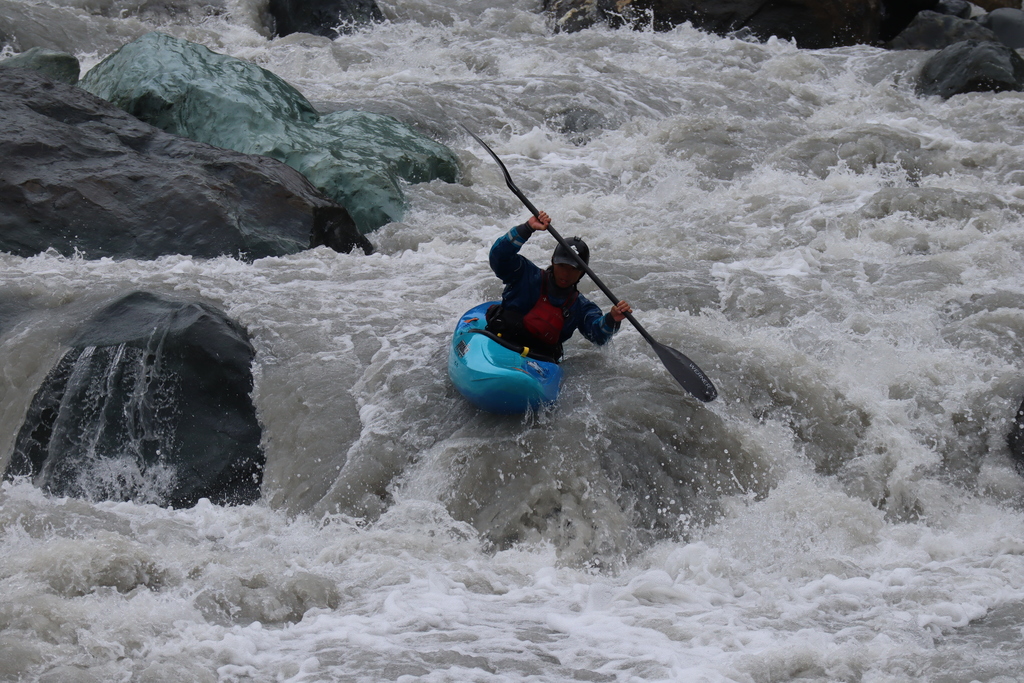
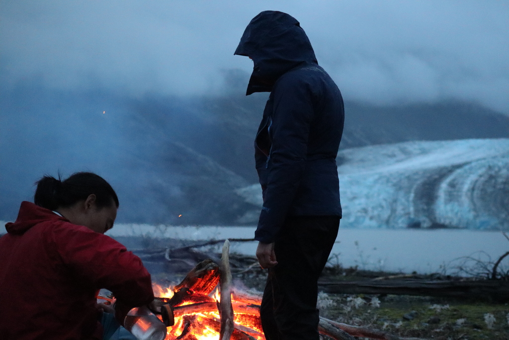
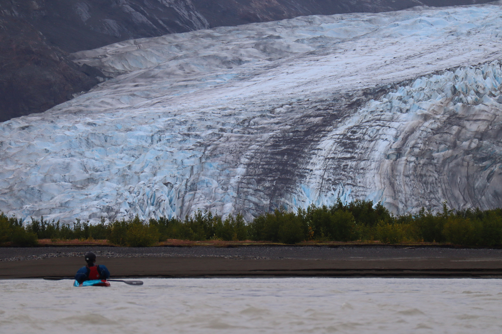
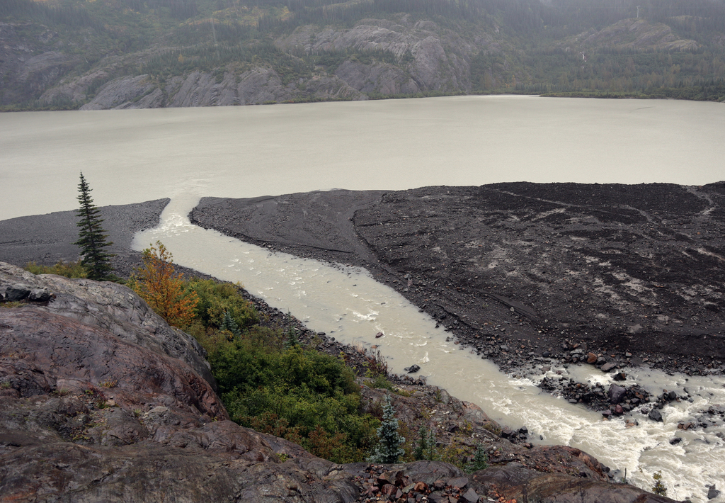
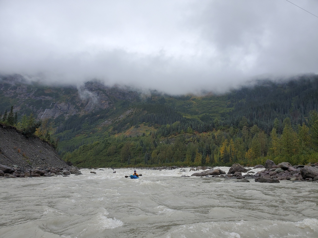
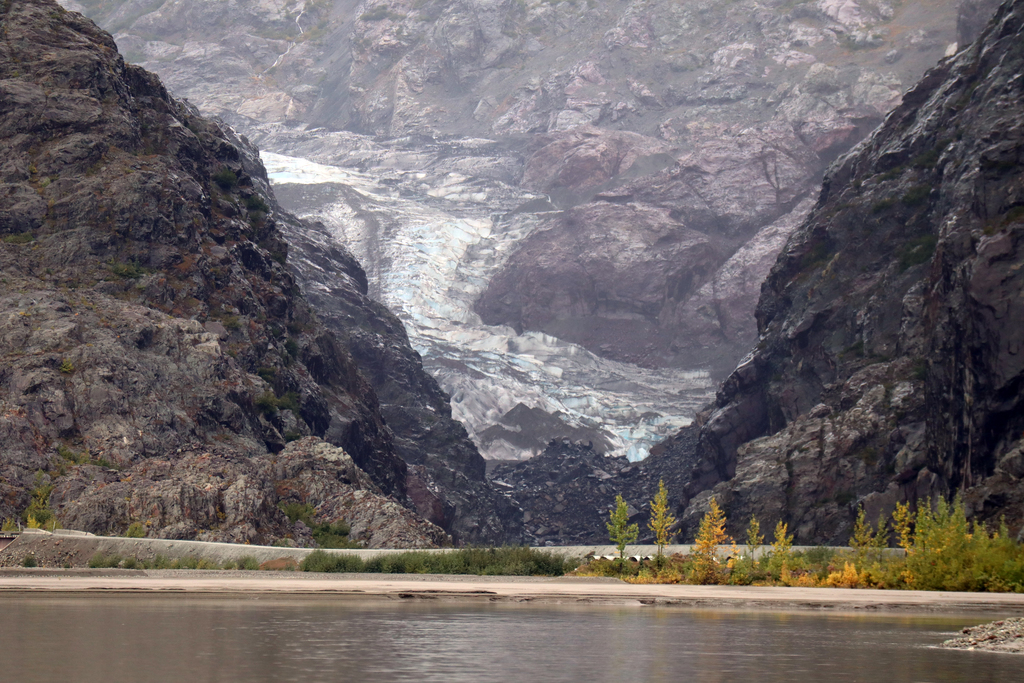
Aside from 1 km of steeper class IV+, the whitewater is mostly read and run boulder gardens and braided class II-III between a chain of five glacial lakes. As of 2021, almost every one of these lakes has a glacier either reaching the lake or within walking distance, although these are retreating quickly. This is a very active glacial subalpine environment, so expect unstable ground and changes to the landscape. Paddling out of the first lake, the river may be bony until some tributaries join in. After about 7km on this initial section, the crux rapid comes at a sharp left bend. It is a ~1km section of bumpy class IV-IV+ boulder gardens. At low water it can be scouted and portaged at river level on the left. At high water, portaging up the steep muddy banks would be annoying and possibly hazardous. There is nice camping at the second lake, and the glacier here adds a lot of flow. After an uneventful third lake, at the fourth lake is the site of an enormous landslide, which occurred in 2021 and covered most of the Canoe Glacier. Near the fifth lake is a non-public mining road, and from here down the river eases up to class II. There are a couple decent campsites away from the road just before Bowser Lake. Bowser Lake is 25 km of flatwater and will take most of a day in calm conditions, maybe longer if common mountain winds pick up. Rare landing spots, marginal campsites, and no road access make the Bowser Lake crossing a bit committing. From the lake outlet to the first take out at Bell 1 Bridge on Highway 37 is a short section of class II+ with a couple camping options. But, why take out here when you could continue downstream into the classic Bell Irving-Nass trip (class III-IV, 3-6 days).
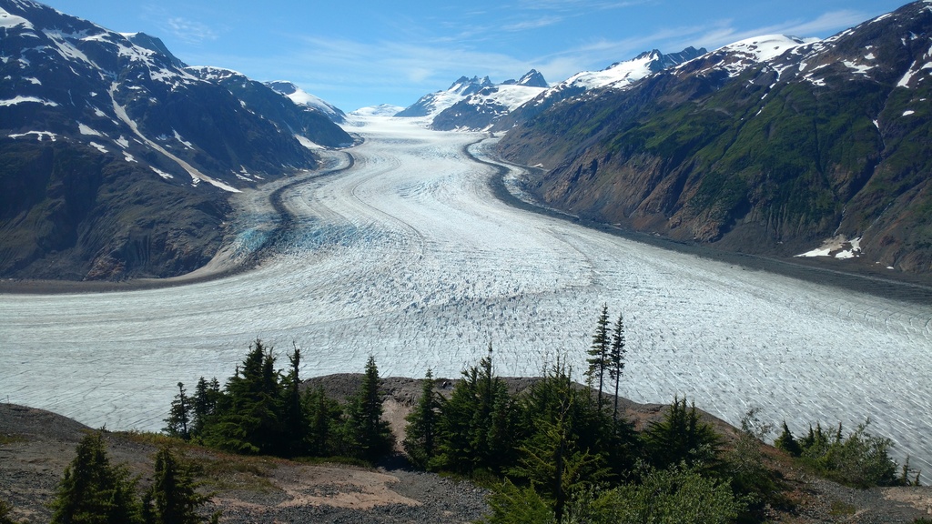
The view of the Salmon Glacier while driving to the put in on the Granduc Road.
An alternate route to the put in without crossing the border.
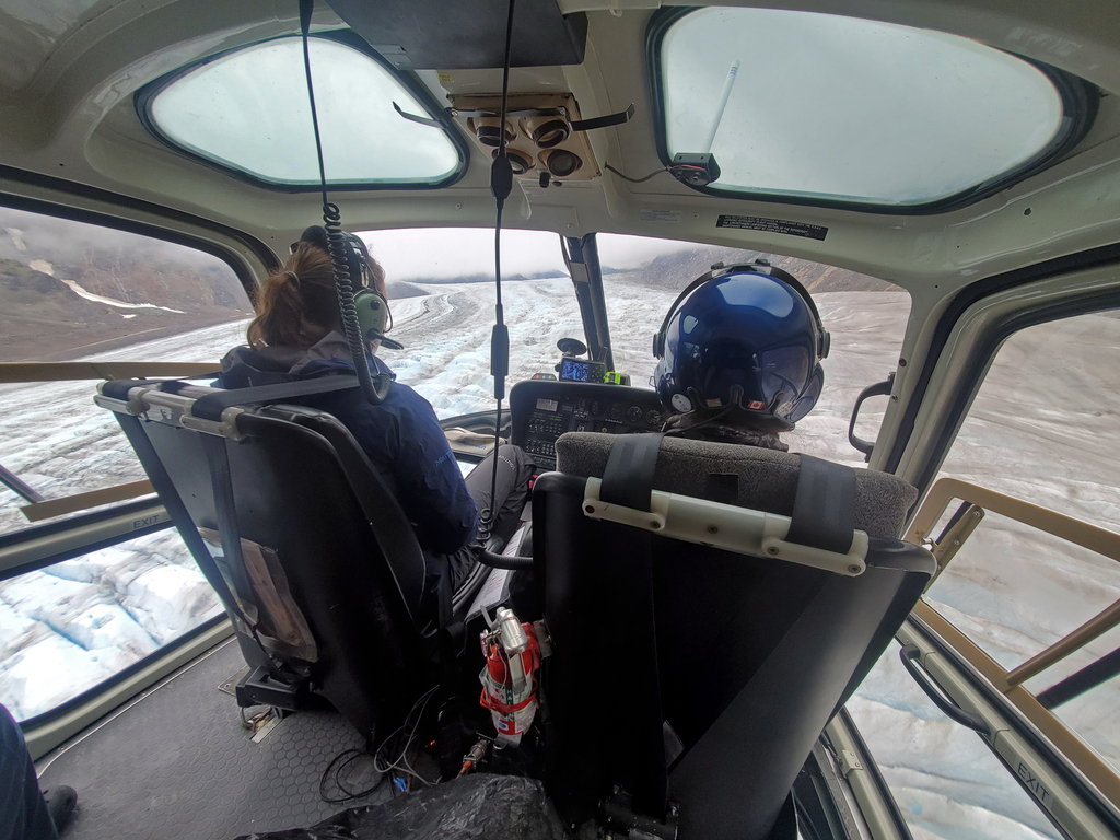
Flying in to land at the source of the Bowser River.
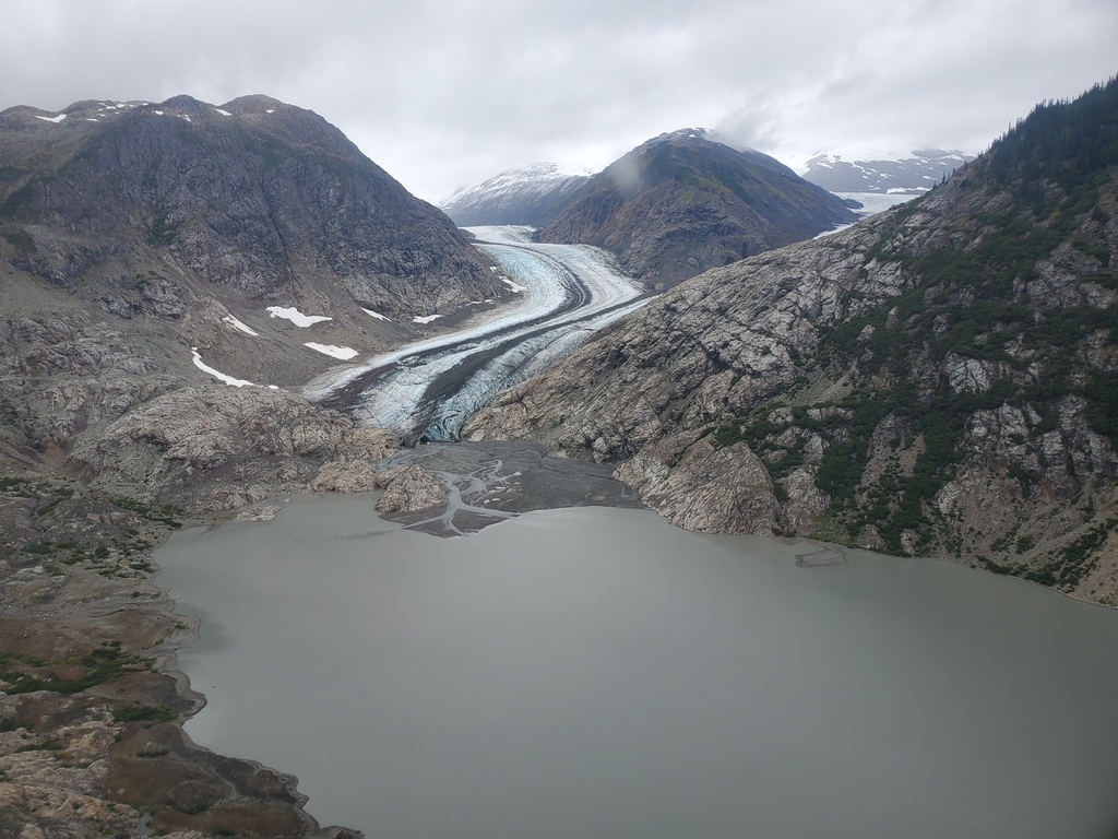
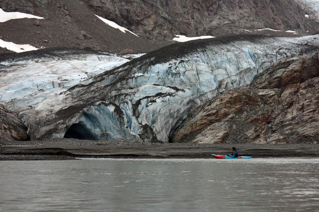
Berendon Glacier. Photo Greg Lee.
Another view from the first lake.
A view upstream just above the crux section.
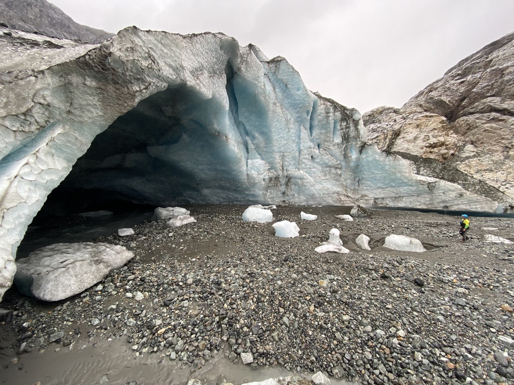
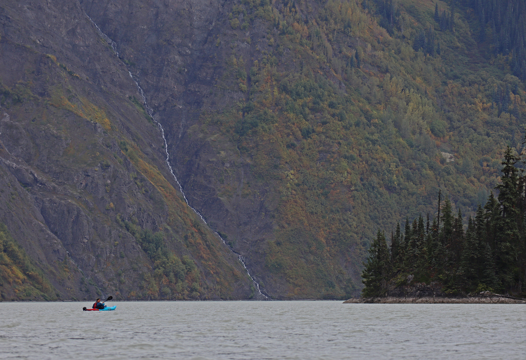
A small part of the crux class IV+ boulder garden on a cool September day, Nass gauge at 800cms.
Another shot of the crux section.
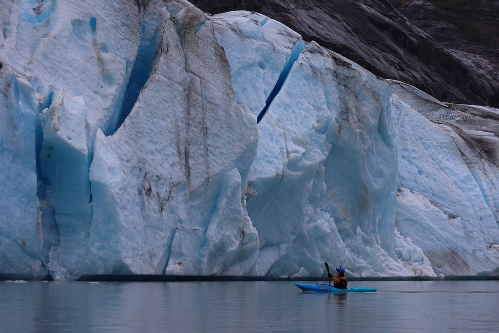
Frank Mackie Glacier at the second lake.
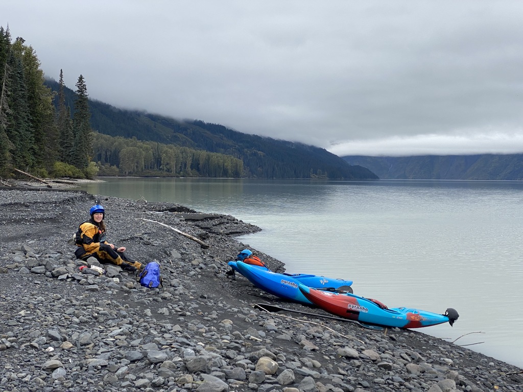
Great camping at the second lake.
Looking back upstream from the third lake.
The Canoe Glacier covered in landslide debris at the fourth lake.
The Canoe Creek debris fan into the fourth lake.
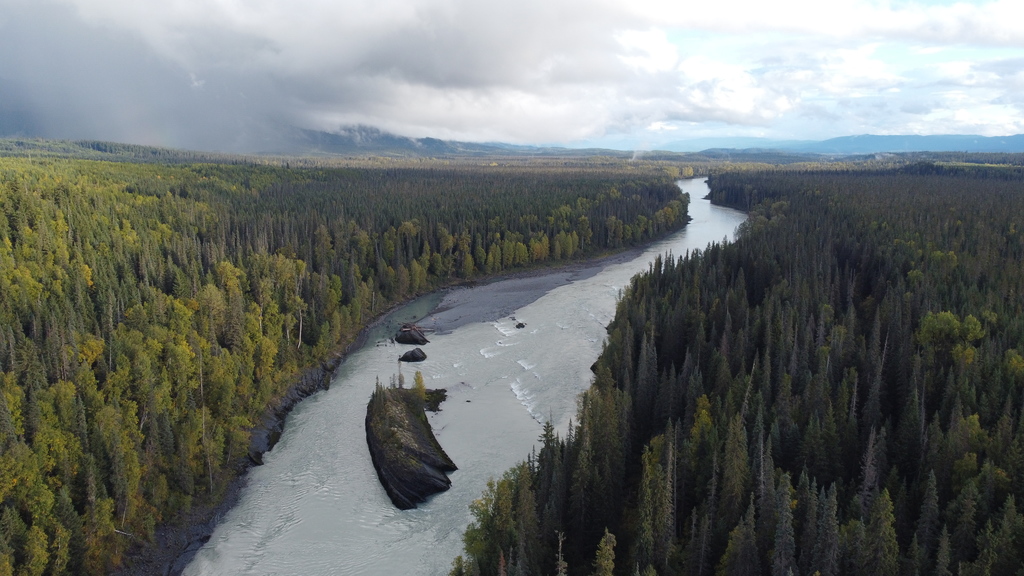
Random class III boulder rapids between the lakes.
The Knipple Glacier and a non-public mining road near the fifth lake.
Camping at the Todd Creek confluence just upstream of Bowser Lake.