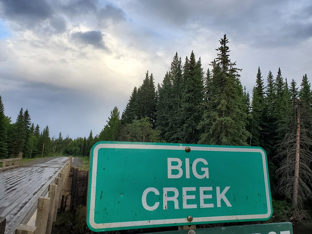
Big Creek starts high in the South Chilcotin Mountains at Lorna Lake, then meanders gently through the ranchlands, forests, and small canyons of the Chilcotin Plateau. In the Lower Big Creek section described here, below Farwell Canyon Road, the river drops off the edge of the volcanic plateau through a dramatic, unrunnable canyon. Below the canyon, ~15km of steep, scrappy, continuous, bouldery, and sometimes dangerous whitewater follows down to the confluence with the Chilcotin River. The whitewater is not classic, but this rarely visited semi-arid canyon is unusual for BC. Picture the Ashnola River, but with lower quality whitewater and difficult access, or maybe the unloved sibling of the Hurley River. The reason to come here is for a bite sized 50km mission off the beaten path. If Big Creek is running, it is likely that the nearby class III-IV classics on the Chilko, Taseko, and Chilcotin rivers will be running at excellent high water levels.
Flows
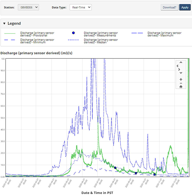
In most years the thin alpine snowpack melts off early during May and June, possibly extending into July. While there are small glaciers in the alpine headwaters, they are not big enough to sustain runnable flows through the summer. In some years (e.g. 2019), major summer thunderstorms can hit the Chilcotin Plateau, and the large area of this plateau can lead to flooding, but in most years this run will be done by July. The information here is from a descent at 12cms in July 2020 (BIG CREEK ABOVE GROUNDHOG CREEK (08MB006)), which was a low runnable flow. Below 10cms is not recommended, and while flows up to 20cms may improve the quality of some of the whitewater, the added push may put some of the canyons into the V+ range. Keep in mind that the gauge is upstream of several diversions for agriculture and wetlands, which may influence the actual flow in this reach.
2020 hydrograph for and historical averages for Big Creek. 10-20cms probably represents the runnable flow window.
Shuttle
Access to the take out is one hour out of Williams Lake, by following Highway 20 west for 46km, turning left onto the Farwell Canyon Road (unpaved), and following this 22km down into the Chilcotin River canyon. There are several take out options near the Farwell Canyon bridge, a common one being near the old cabin on river right. To get to the put in, continue along Farwell Canyon Road up and out of the canyon for another 34km, staying right at the Y, until reaching the Erickson Bridge over Big Creek. Much of the land near the put in is private property outside of the road right of way. There are alternate put in options downstream of this bridge which cut out flatwater, but these involve route finding and 4x4 driving in sticky mud. It should be possible to evacuate to Farwell Canyon Road on river right from any point during the run, as it is never further than 5km away cross country to the SE, but this would be a last resort.
On the water
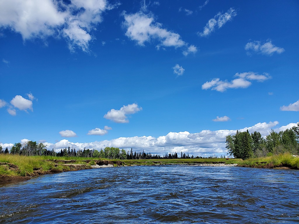
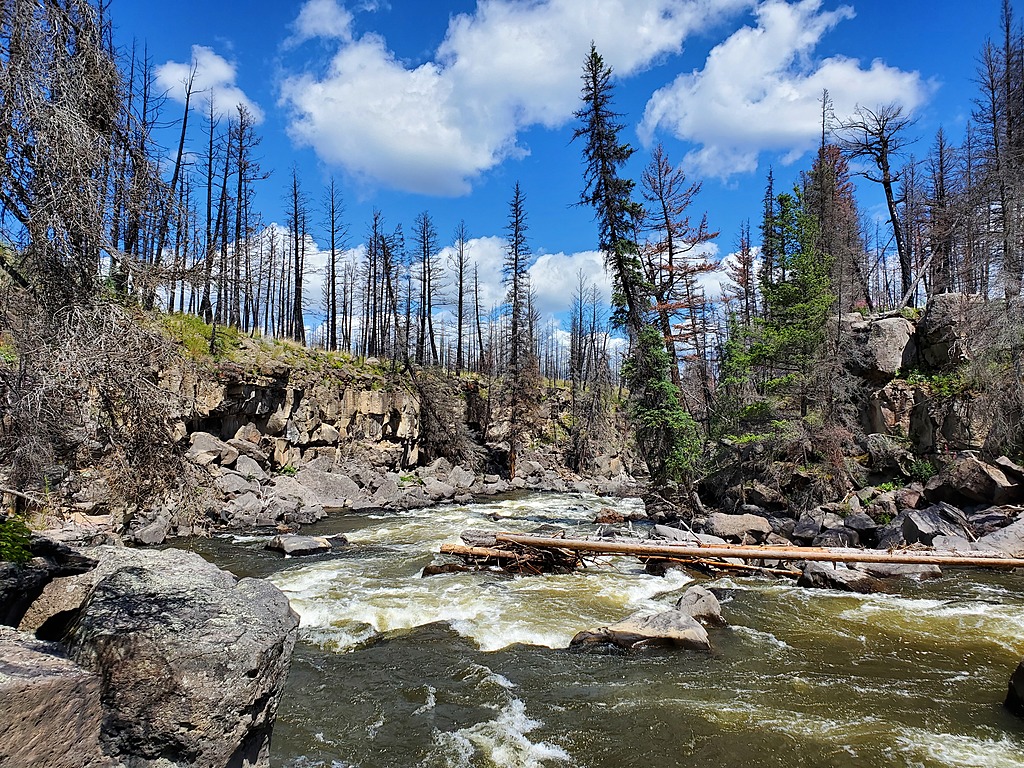
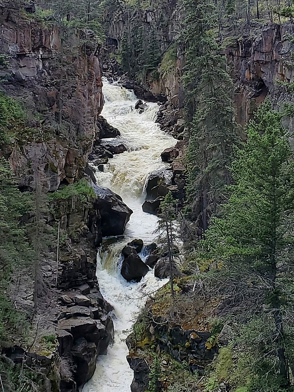
From the bridge, the first ~20km is mellow class II-III whitewater traversing the fields and small forests of the Chilcotin Plateau. There are some logjams and small canyons, but with some luck you shouldn't have to get out of your boat. IMPORTANT - At some point (approximately 51.78594, -122.77957), you need to get out for a mandatory portage around a huge, unrunnable canyon. In the next section the creek drops over 100m in less than 1km, and is totally boxed in with vertical volcanic rock walls. The start of this canyon is not obvious, and looks very similar to the other small runnable canyons upstream. It is recommended to get out on river left when the walls are only ~5m high. The portage itself is about 1km long, and is relatively easy along the river left canyon rim, through grassy meadows and open burned forest. Take an occasional peek into the impressive canyon below, then follow a manageable scree slope back down to river level at the end of the canyon. Make sure to walk over and take a look back up into the exit of the canyon. Below this portage is the bulk of the runnable whitewater in this section, ~15km of steep bouldery class IV-V whitewater that never really gets quality. There are no notable rapids, but the crux may be a middle section where the river passes through a series of winding, unstable canyons. Many scouts and portages are on very unstable and dangerous landslide material and large loose blocks. Wood is in play, including around blind corners and in steep class V rapids. At some points, portaging up and out of the inner canyon becomes a tempting option. Just when you think it's pointless, the last ~4km clean up into a fast, technical, and fun read and run class IV section down into the Chilcotin River, which then dumps you straight into Big Creek Rapid, a long class III wave train and one of the fastest rapids out there. There are reports of paddlers on a Chilcotin trip stopping to camp at Big Creek, hiking upstream from the confluence and paddling this lower read and run section, which is the only good part of the creek anyhow. This lowermost read and run class IV section could handle more water than the rest of the creek. The ~15km on the Chilcotin River down to the takeout at Farwell Canyon should take less than an hour.
Don't say you're not at least a little bit curious.
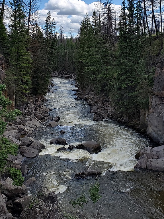
Mellow floating across the Chilcotin Plateau
At the start of the portage along the river left canyon rim. Take out early.
With prior scouting for an exit point, you might be able to run some of this lead in to the unrunnable canyon. Do not proceed past a known exit point.
About a third of the unrunnable cataract.
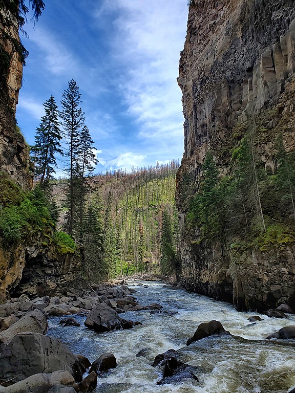
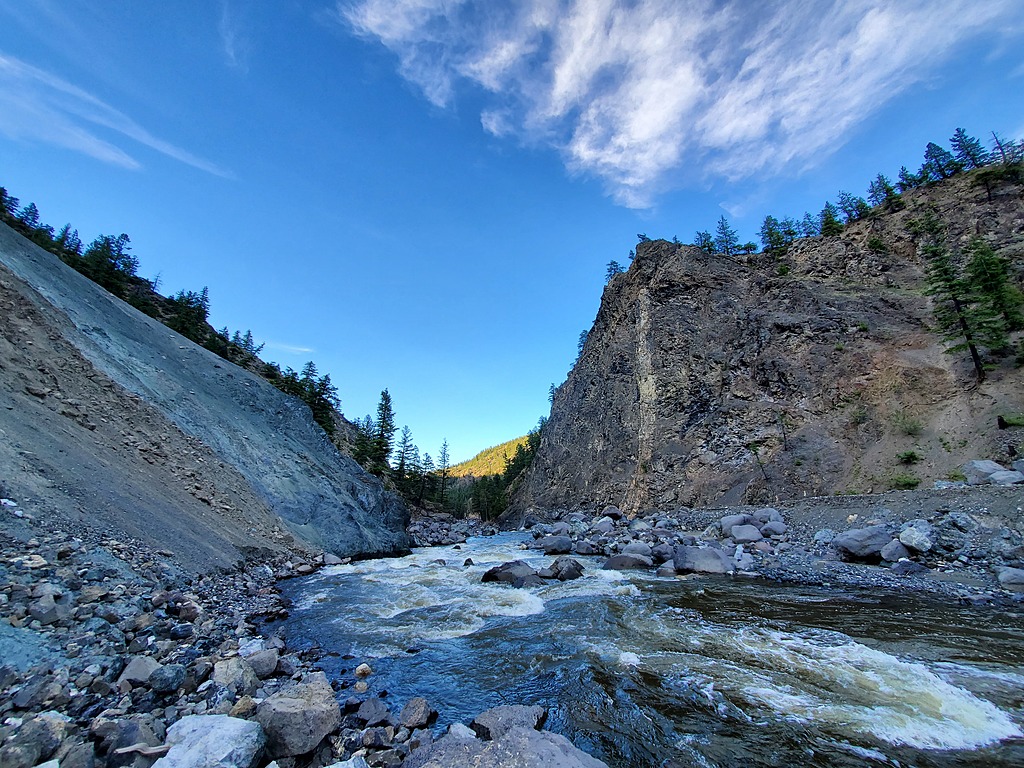
The end of the unrunnable canyon.
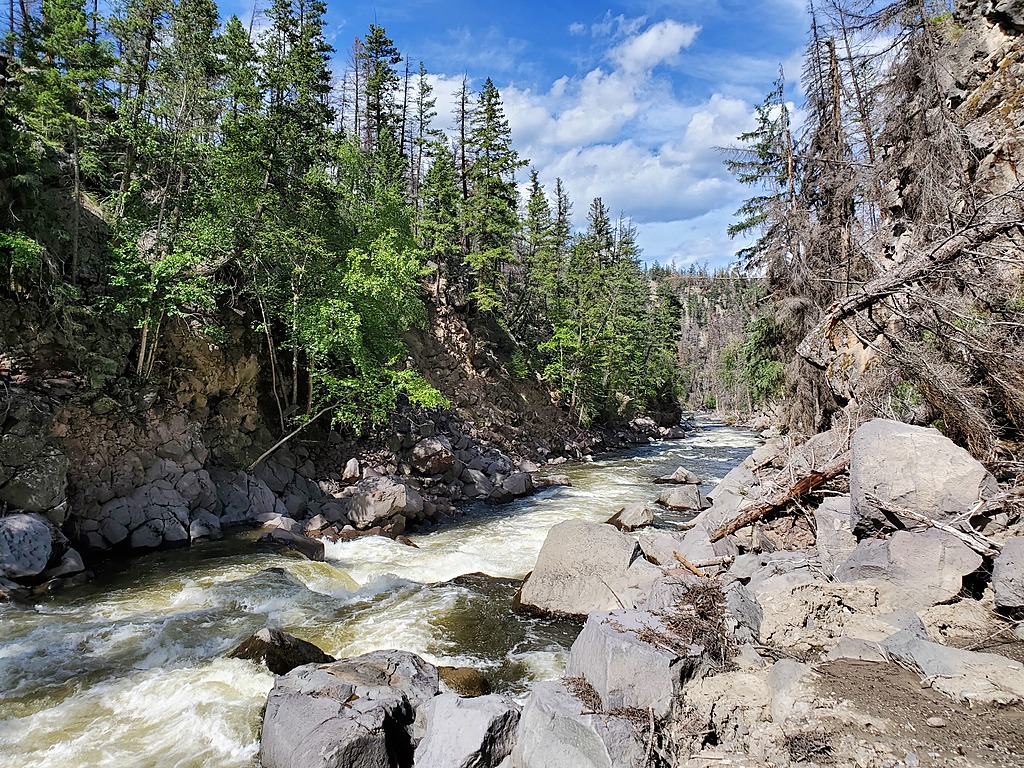
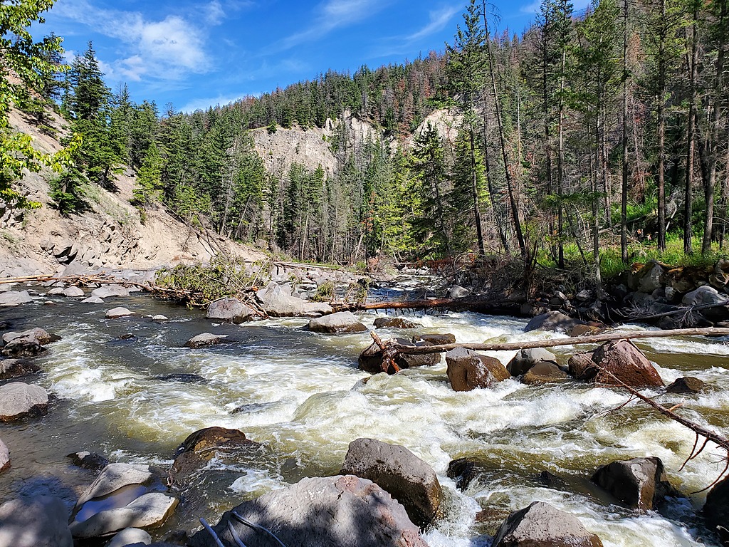
Decent class IV whitewater below the canyon.
Ugh.
Dangerous, loose, class V boulder mank. It gets worse than this.
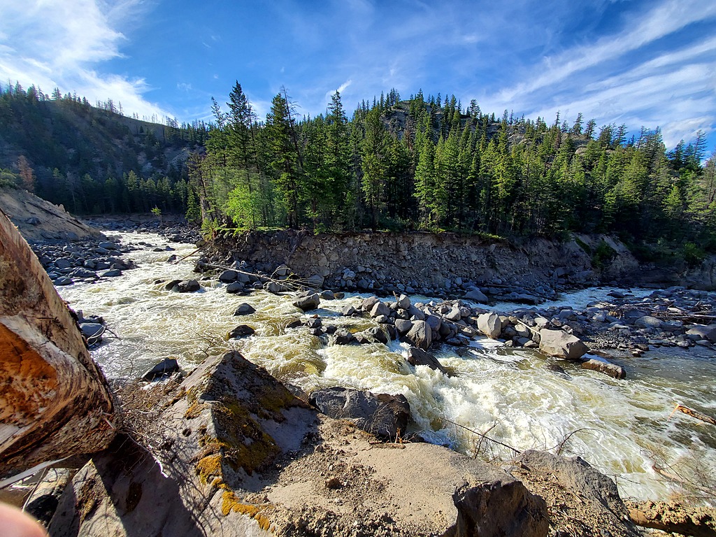
Eventually, the final ~4km cleans up into read and run class IV.
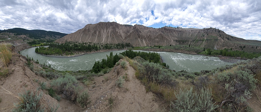
Takeout river right near Farwell Canyon on the Chilcotin River