The Adam River is a quality intermediate run that is great for laps, if you have enough energy for the bushwhack at the take out. The tannin-rich brown water will carry you through old growth cedars into a very clean and fun granite canyon. While you're in the area, don't forget to check out the other Sayward highlights: White (III-V) and Middle Memekay (III+). Check out more details on these runs and others in an upcoming guidebook produced by the Vancouver Island Whitewater Paddling Society.
The Adam is a separate watershed, but the nearby gauge on the SALMON RIVER NEAR SAYWARD (08HD006) may give an idea of what is happening in the area. If you are making a trip to Sayward, this is one of the more flexible runs in terms of levels. To target a medium low flow, aim for 100cms on this gauge, less in the spring. The run accommodates water well and will be runnable at flows below and above this value, although it does turn into class IV at some point. The pool under the put in bridge can be deceptively calm even at good flows.
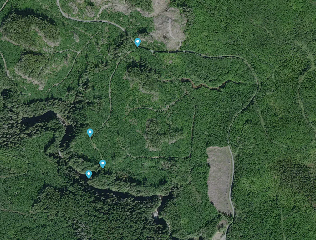
The Adam is just over an hour drive north of Campbell River on Highway 19. After crossing the Adam River highway bridge, turn right and follow Kim Creek Main and Rooney Main downstream on river left for ~4km to the put in bridge on your right. The takeout is ~7.5km further down Lower Adam Main, found by crossing the bridge, turning left, and heading downstream on river right. After passing through several clearcuts, look for two old logging spurs on your left just before a small creek. Turn left onto the second one, and drive ~1km through alders and small ditches to near the end of the spur. Hunt around here for a very rough trail that leads down to river level. The takeout eddy is very large and usually has many flood logs onshore up around the high water line.
Close up map of the take out area.
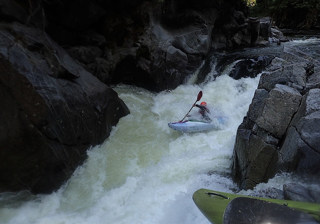
Paddling down from the put in, the run starts out slowly with a flatwater warmup into class II-III gravel bars and boulder gardens. About halfway through the run, it canyons up and the action remains fairly stacked class III+ boulder gardens and bedrock ledges right to the take out. Most rapids can be boat scouted, aside from the crux ledge (V-), which is an easy scout and portage on the left at an obvious horizon line. At high flows, it may be necessary to run a sneak line through the portage area. After paddling or seal launching into the runout of the crux rapid, a bit more whitewater quickly brings you to the takeout, a large eddy on the right that you should have scouted ahead of time. Continuing downstream to the confluence with the Eve River is not recommended due to a reportedly unrunnable falls.
Skipping out of the crux ledge.
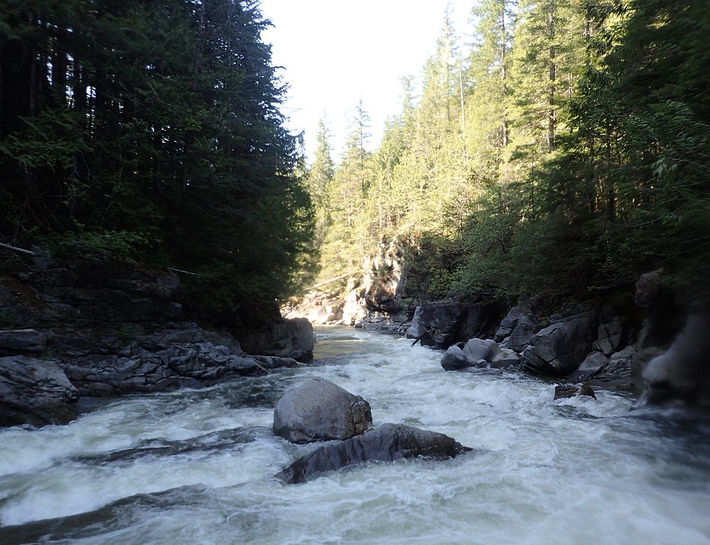
The runout of the crux ledge, which is representative of the difficulty of the rest of the run.